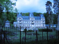
On the edge of the Eu Forest at Millebosc

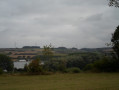
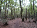
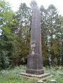
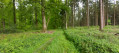
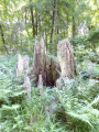
On this walk starting from Millebosc, you’ll stroll through the Eu Forest via the Bois de Longroy. In the forest, you’ll discover the Adélaïde memorial.
This circular walk follows much of the yellow-marked Route 12.

Details

1397283
Creation:
Last update:
Last review:
  • Walking
    Activity: Walking
  • ↔
    Distance: 7.10 mi
  • ◔
    Average duration: 3h 40 
  • ▲
    Difficulty: Moderate

  • ⚐
    Back to start: Yes
  • ↗
    Ascent: + 430 ft
  • ↘
    Descent: - 413 ft

  • ▲
    Highest point: 535 ft
  • ▼
    Lowest point: 121 ft
  • ⚐ Country: France
  • ⚐ City: Millebosc (76260)
  • ⚑
    Start/End: N 49.974712° / E 1.490922°
  • ❏
    IGN map(s): Ref. 2108OT
  • Hour-by-hour weather

Photos

Description of the walk

Park next to the church in Millebosc, opposite the town hall.

(S/E) With your back to the church, turn right onto Rue de la Forêt and follow it to the junction with Rue de Nemours.
At the junction, turn right onto Rue de Nemours. Continue along this street until you reach the junction with Rue du Curé.
Turn right to walk alongside the cemetery. Follow this street until you reach the junction with Rue Adélaïde.

(1) Cross Rue Adélaïde and take the path opposite, at the Croix du Père Antime. Continue along this path until you reach the junction with the D126 at the calvary.

(2) Take the D126 on your left. Continue along this road and take the first path on the left. Follow this path straight ahead across the fields towards the Forêt d’Eu.

(3) Enter the forest and carry on straight ahead, staying on the same track, which, at the end, turns left and leads to the hamlet of La Tuilerie (Longroy).

(4) Once you reach the hamlet of La Tuilerie, continue along the Allée des Tilleuls until you reach the junction with the Route de la Forêt. Cross over and take the path opposite, which bends to the right.

(5) Take the first wide, flat path on your left. This path then becomes a narrow and very steep track. Keep going straight on. At the bottom of the path, you’ll arrive in the village of Longroy, on Chemin du Petit Mont.

(6) Walk down to the junction with Rue Jean Jaurès. Cross Rue Jean Jaurès with care (there’s a bend) and walk along it on your left. Then take Chemin Vide Bouteille on your right, which is opposite the entrance to the town hall.
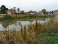
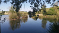
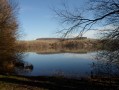
Follow this path along the edge of the Bois de Longroy, which offers a lovely view of the ponds.

(7) Turn left. Carry on until you reach the junction with another path. At the junction, turn left.
Carry on straight ahead along this forest track, which climbs gently, ignoring the tracks to the right and left, until you reach the Route Forestière Adélaïde.

(8) Carry on to the left along the Route Adélaïde until you reach an inverted Fork in the road.

(9) Carry on straight ahead along the forest road, which curves to the left before reaching another Fork in the road. Then take the left-hand branch until you reach the Adélaïde memorial.

(10) Turn round and retrace your steps to the Fork in the road. Then continue slightly to the left until you reach the edge of the Bois de Longroy, where you’ll come to a junction with a tarmac road.
Take the road on your right across the plain and head for the village of Millebosc at the junction of Rue du Curé and Rue Adélaïde.

(1) Carry on straight along Rue Adélaïde until you reach the junction with Rue des Canadiens.
Turn right onto Rue des Canadiens. Follow this road until you reach the junction with Rue de la Forêt.
Turn right and you’ll be back at your starting point (S/E).


Waypoints

  1. S/E : mi 0 - alt. 456 ft - Parking next to the church in Millebosc
  2. 1 : mi 0.42 - alt. 466 ft - Junction of Rue du Curé and Rue Adélaïde
  3. 2 : mi 0.87 - alt. 512 ft - Turn left onto the D126
  4. 3 : mi 2.01 - alt. 469 ft - Entry to the forest
  5. 4 : mi 3.04 - alt. 404 ft - Allée des Tilleuls in La Tuilerie
  6. 5 : mi 3.28 - alt. 387 ft - Path on the left
  7. 6 : mi 3.71 - alt. 141 ft - Chemin du Petit Mont in Longroy
  8. 7 : mi 4.23 - alt. 197 ft - Turn left at the fork
  9. 8 : mi 4.53 - alt. 171 ft - Forest track on the left
  10. 9 : mi 5.22 - alt. 285 ft - Adélaïde Forest Road
  11. 10 : mi 5.85 - alt. 436 ft - The Adélaïde Stele
  12. S/E : mi 7.1 - alt. 456 ft - Parking next to the church in Millebosc

Notes

Check the ONF website for hunting days in the Eu Forest.

Worth a visit

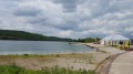
The Longroy-Gamaches ponds with their water sports centre.

In the Eu Forest:
* The Roman ruins at Bois l’Abbé.
* La Pierre Bise.

Reviews and comments

4.5 / 5
Based on 2 reviews

Reliability of the description
4.5 / 5
Ease of following the route
5 / 5
Route interest
4 / 5
benoitrando
benoitrando

Overall rating : 4.3 / 5

Date of your route : Oct 24, 2021
Reliability of the description : ★★★★☆ Good
Ease of following the route : ★★★★★ Very good
Route interest : ★★★★☆ Good
Very busy route : No

A lovely route.

Hello Lannel, there’s a discrepancy between your description and the route on the map.
Point 5: you arrive directly at Longroy Town Hall.
Point 6: The route on the map suggests turning left at the bottom of the path to go round the town hall and then take the Chemin Vide Bouteille. At no point does it go down to the junction with Rue Jean Jaurès, so a small amendment is needed.

Thank you, Lannel, for this route.

Machine-translated

Javanaise_80
Javanaise_80

Overall rating : 4.7 / 5

Date of your route : Oct 17, 2018
Reliability of the description : ★★★★★ Very good
Ease of following the route : ★★★★★ Very good
Route interest : ★★★★☆ Good

The EU forest is magnificent in its autumn colours.

.

Machine-translated

Other walks in the area

For more walks, use our search engine .

The GPS track and description are the property of this route's author. Please do not copy them without permission.