Baudinard Gorges and Montpezat Lake

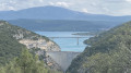
This easy hike runs along the top of the Baudinard Gorges, offering several views of the gorges and their clear waters.
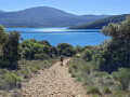
Halfway along the route, there is a descent to a small beach where you can take a well-deserved break and cool off in the waters of Lake Montpezat.
After several reviews and having done this route in the opposite direction, I think it's better to do it this way. This allows you to start with the least interesting part and descend with a view of the lake and the goal of swimming in it. So it's good for morale! And on the way back, the climb along the gorges is punctuated by views that make you forget the effort.

Details

1270152
Creation:
Last update:
  • Walking
    Activity: Walking
  • ↔
    Distance: 4.30 mi
  • ◔
    Average duration: 2h 35 
  • ▲
    Difficulty: Easy

  • ⚐
    Back to start: Yes
  • ↗
    Ascent: + 741 ft
  • ↘
    Descent: - 725 ft

  • ▲
    Highest point: 1,982 ft
  • ▼
    Lowest point: 1,319 ft

Photos

Description of the walk

Park at the side of the D71 at a place called Saint-Jaume (where you will see charcoal kilns and a cistern).

(S/E) Follow the road and you will soon reach a fork in the path.

(1) Continue straight ahead on a path that climbs slightly. Ignore the path on the right. You will come to a crossroads.

(2) Take the path that branches off to the right, heading north, until you overlook the Gorges de Baudinard. Continue to reach the first viewpoint. Ignore all adjacent paths.

(3) Follow the cliff and reach the second viewpoint.
These two viewpoints offer views of these smaller and quieter gorges than the lower Gorges du Verdon.

(4) Continue above the Verdon until you reach a fork in the path in a cove of the Lac de Montpezat.

(5) At this fork, take the path on the right that descends to a small stone beach where you can swim.

(6) Go back up to the fork

(5) Take the path opposite that leads to the Basse Eouvière forest and continue to the next fork.

(7) At this junction, take the path on the left, heading east. Follow the bottom of the valley and you will reach the crossroads you passed on the way up, via a gradual climb. Ignore all the adjacent paths.

(2) Head straight ahead. Follow the same route as on the way there to return to the car park (S/E).


Waypoints

  1. S/E : mi 0 - alt. 1,886 ft - Edge of the D71 at a place called Saint-Jaume
  2. 1 : mi 0.04 - alt. 1,903 ft - Fork in the road.
  3. 2 : mi 0.3 - alt. 1,955 ft - Crossroads, turn right on the way there.
  4. 3 : mi 1.33 - alt. 1,722 ft - View
  5. 4 : mi 1.7 - alt. 1,594 ft - View
  6. 5 : mi 2.51 - alt. 1,375 ft - Fork in the road. Beach on the right.
  7. 6 : mi 2.57 - alt. 1,319 ft - Small beach
  8. 7 : mi 2.86 - alt. 1,539 ft - Fork
  9. S/E : mi 4.3 - alt. 1,890 ft - Parking

Notes

(S/E) From the car park, you can see old charcoal kilns that were once used to make charcoal.
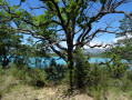
The first part of this hike is in the shade of a forest, but it can still get very hot, so bring water.
This hike is a loop, so it can easily be done in the opposite direction.

Worth a visit

Depending on the season, you may be able to see fields of lavender and sunflowers opposite.

Reviews and comments

4.4 / 5
Based on 81 reviews

Reliability of the description
4.3 / 5
Ease of following the route
4.4 / 5
Route interest
4.4 / 5
mayrima
mayrima
• Edited:

Overall rating : 3 / 5

Date of your route : Jun 20, 2025
Reliability of the description : ★★★☆☆ Average
Ease of following the route : ★★★☆☆ Average
Route interest : ★★★☆☆ Average
Very busy route : No

The start of the hike is not well signposted. There are viewpoints along the gorge, which are not recommended for families with very young children. The return journey in the heat is uninteresting.

Machine-translated

cotin
cotin
• Edited:

Overall rating : 5 / 5

Date of your route : Jun 06, 2025
Reliability of the description : ★★★★★ Very good
Ease of following the route : ★★★★★ Very good
Route interest : ★★★★★ Very good
Very busy route : Yes

Not a very difficult walk, but a good part of it is not shaded (34°C this afternoon). The return on a long track can be tricky. Water is essential.
However, the scenery is sublime.

Machine-translated

le gobi
le gobi
• Edited:

Overall rating : 5 / 5

Date of your route : May 26, 2025
Reliability of the description : ★★★★★ Very good
Ease of following the route : ★★★★★ Very good
Route interest : ★★★★★ Very good
Very busy route : Yes

A very pleasant hike, easy to do with superb scenery over the lower gorges of the Verdon.
Avoid the hot seasons or the hottest times of day, as much of the route is not shaded.

Machine-translated

Bmrando
Bmrando
• Edited:

Overall rating : 4.7 / 5

Date of your route : Dec 09, 2024
Reliability of the description : ★★★★★ Very good
Ease of following the route : ★★★★☆ Good
Route interest : ★★★★★ Very good
Very busy route : No

Hike done in beautiful weather with stunning scenery.
The description in the "details" tab accurately reflects the reality.
The difficulty level indicated by the app accurately reflects the actual difficulty.
A lovely walk. Swimming is possible in summer!

Machine-translated

Jérôme Var 83
Jérôme Var 83
• Edited:

Overall rating : 4.3 / 5

Date of your route : Sep 23, 2024
Reliability of the description : ★★★★★ Very good
Ease of following the route : ★★★★☆ Good
Route interest : ★★★★☆ Good
Very busy route : No

Tour completed in September... very peaceful!
Beautiful scenery, lunch by the lake with the ducks.

Machine-translated

nelcoi
nelcoi
• Edited:

Overall rating : 4 / 5

Date of your route : Aug 25, 2024
Reliability of the description : ★★★★☆ Good
Ease of following the route : ★★★★★ Very good
Route interest : ★★★☆☆ Average
Very busy route : No

Nice hike, but a little disappointed with the second part... not very interesting and in full ☀️.
Avoid in very hot weather.

Machine-translated

Ratus84
Ratus84
• Edited:

Overall rating : 5 / 5

Date of your route : Aug 13, 2024
Reliability of the description : ★★★★★ Very good
Ease of following the route : ★★★★★ Very good
Route interest : ★★★★★ Very good
Very busy route : Yes

The first part is magnificent. The return trip was a bit long, but we left late and were therefore in the full sun. There were quite a few people at the lake, but that's normal in August. I recommend it.

Machine-translated

Athanase103
Athanase103
• Edited:

Overall rating : 5 / 5

Date of your route : Aug 05, 2024
Reliability of the description : ★★★★★ Very good
Ease of following the route : ★★★★★ Very good
Route interest : ★★★★★ Very good
Very busy route : No

Well-described route.

Despite a late start (10:30 a.m.) on a hot day (35 degrees), the OUTWARD journey was very pleasant, as it was shaded and followed only trails and paths.
The stopover point by the lake is very pleasant and refreshing for a well-deserved picnic.
The return journey was less pleasant as it included a long stretch of tarmac in the second half, although the road was not very busy.
Our advice: do the route as described on Visorando, and not the other way around, as some reviews mention.

Machine-translated

Dom59112
Dom59112
• Edited:

Overall rating : 4.3 / 5

Date of your route : Aug 02, 2024
Reliability of the description : ★★★★☆ Good
Ease of following the route : ★★★★★ Very good
Route interest : ★★★★☆ Good
Very busy route : Yes

Good route. Difficult to find the starting point, but OK after that.

Machine-translated

nicolenelson
nicolenelson
• Edited:

Overall rating : 4.3 / 5

Date of your route : Jun 12, 2024
Reliability of the description : ★★★★☆ Good
Ease of following the route : ★★★★★ Very good
Route interest : ★★★★☆ Good
Very busy route : No

Nice route. We followed the yellow signposts without any problems.
Beautiful views of the gorges, the dam and the Ste Croix bridge, as well as Lake Montpezat.
Well shaded.

Machine-translated

bernard coulomb
bernard coulomb
• Edited:

Overall rating : 5 / 5

Date of your route : Mar 14, 2024
Reliability of the description : Not used / Not applicable
Ease of following the route : ★★★★★ Very good
Route interest : ★★★★★ Very good
Very busy route : No

One of the hikes to do in the area.
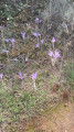
In spring, the area is covered with mini irises, tulips and wild daffodils.
No problems following the route with GPS.

Machine-translated

andrea_frra
andrea_frra
• Edited:

Overall rating : 5 / 5

Date of your route : May 11, 2024
Reliability of the description : ★★★★★ Very good
Ease of following the route : ★★★★★ Very good
Route interest : ★★★★★ Very good
Very busy route : No

A very interesting hike, well suited for beginners and those who are not very athletic. I recommend it.

Machine-translated

marenghi
marenghi
• Edited:

Overall rating : 4.3 / 5

Date of your route : May 06, 2024
Reliability of the description : ★★★★☆ Good
Ease of following the route : ★★★★★ Very good
Route interest : ★★★★☆ Good
Very busy route : Yes

Very beautiful hike, with views of the gorges, no tarmac

Machine-translated

User 12259938
• Edited:

Overall rating : 4.3 / 5

Date of your route : Apr 21, 2024
Reliability of the description : ★★★★★ Very good
Ease of following the route : ★★★★☆ Good
Route interest : ★★★★☆ Good
Very busy route : No

A pleasant hike with some beautiful views, suitable for occasional walkers. A slight disappointment on the way back, which isn't particularly interesting.
Glad I did it anyway...

Machine-translated

Laeti83
Laeti83
• Edited:

Overall rating : 4.3 / 5

Date of your route : Mar 22, 2024
Reliability of the description : ★★★★★ Very good
Ease of following the route : ★★★★☆ Good
Route interest : ★★★★☆ Good
Very busy route : Yes

A very beautiful hike with magnificent views. There is also a very pleasant access point to the lake.

Machine-translated

Other walks in the area

For more walks, use our search engine .

The GPS track and description are the property of this route's author. Please do not copy them without permission.