


Refine your search for walks in Génolhac
Génolhac walks


 Le Jardin du Tomple
 Local authority
 6.06 mi
 +1,020 ft
 -1,030 ft
 3h 40
3h 40
 Moderate
 Departure from Génolhac (Gard)
Starting from the village of Génolhac, the walk crosses the Col de l'Ancise and Col de la Banlève passes, heads towards the remarkable Tomple garden and crosses the Cévenol railway line, which still connects Clermont-Ferrand to Nîmes.
Chemin des Vignes in Génolhac
 Visorando Member
 4.39 mi
+420 ft
-413 ft
2h 25
4.39 mi
+420 ft
-413 ft
2h 25
 Easy
Departure from Génolhac (Gard)
Easy
Departure from Génolhac (Gard)
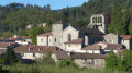
A circular loop without difficulty, with panoramic views to enjoy with the family. The Chemin des Vignes follows an old route that was once used for terraced farming and then for exploiting the pine forest to support the mining galleries. The vines disappeared in the 1960s.
Circular Rocher de Trenze starting from Génolhac
 7.71 mi
+2,664 ft
-2,635 ft
5h 50
7.71 mi
+2,664 ft
-2,635 ft
5h 50
 Difficult
Departure from Génolhac (Gard)
Difficult
Departure from Génolhac (Gard)
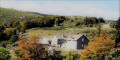
A very pretty walk, through trees at the bottom and broom at the top. Allow a good half day to a full day to complete the circuit. I recommend this walk to experienced walkers who are used to walking in the mountains.
Along the River Connes towards the Grotte des Baumes
 6.70 mi
+1,329 ft
-1,345 ft
4h 15
Moderate
Departure from Concoules (Gard)
6.70 mi
+1,329 ft
-1,345 ft
4h 15
Moderate
Departure from Concoules (Gard)
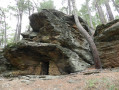
A gentle start along a straight, slightly downhill forest track, before climbing again and passing through some charming hamlets. Don’t hesitate to make a round trip to see the curious Grotte des Baumes. The path, which is steep in places, will take you to Besou, or you can easily reach the car park via the road.
Circular route from Concoules to Mas de la Barque and back via the Tour de Malmontet
 12.20 mi
+3,199 ft
-3,182 ft
8h 25
Difficult
Departure from Concoules (Gard)
12.20 mi
+3,199 ft
-3,182 ft
8h 25
Difficult
Departure from Concoules (Gard)
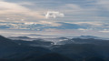
A walk starting from Concoules, with the option to park behind the pretty 12th-century church (small car park). This circular walk leads from Concoules to the Mas de la Barque via the Col de Rabusat and returns via the Tour de Malmontet. You’ll enjoy magnificent panoramic views of the Cévennes as you pass through beautiful forests of chestnut, beech and larch trees.
Pont de La Sale - Pont Rouge
 2.37 mi
+538 ft
-522 ft
1h 35
Moderate
Departure from Vialas (Lozère)
2.37 mi
+538 ft
-522 ft
1h 35
Moderate
Departure from Vialas (Lozère)
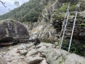
A short walk along the Luech, following an old irrigation canal.
Return via the road.
A few short steep sections mean that this walk is classified as moderate, despite the short distance.
Towards the Rochers de Trenze via Gourdouse to Vialas
 8.37 mi
+2,687 ft
-2,674 ft
6h 10
Difficult
Departure from Vialas (Lozère)
8.37 mi
+2,687 ft
-2,674 ft
6h 10
Difficult
Departure from Vialas (Lozère)
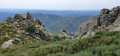
A magnificent hike amid broom and granite boulders.
Beautiful descent between the ridge and the village of Vialas.
Superb ridge trail along the impressive Trenze rock face.
Short circular loop starting from Aujac
4.80 mi
+663 ft
-659 ft
2h 45
Easy
Departure from Aujac (Gard) (Gard)
A short route, suitable for families, on decent paths with good signposting. A lovely apiary at Les Bouchets and superb views of the Monts de la Lozère. It’s (relatively) cool in the morning.You can enhance the walk with a meal at the little restaurant opposite the church (closed on Wednesdays).
Le gué d'Hiverne au départ d'Aujac
8.19 mi
+1,555 ft
-1,552 ft
5h 05
Difficult
Departure from Aujac (Gard) (Gard)
Une randonnée proposée par le Parc Naturel des Cévennes. Le sens de la randonnée a été inversé pour éviter une fin de parcours en forte côte, et très chaude.
The Chamborigaud viaduct
 4.62 mi
+459 ft
-476 ft
2h 30
Easy
Departure from Chamborigaud (Gard)
4.62 mi
+459 ft
-476 ft
2h 30
Easy
Departure from Chamborigaud (Gard)
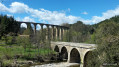
A short walk for a winter’s afternoon in the land of Jean-Pierre Chabrol. You pass under the magnificent Luech viaduct before climbing gently for a circular route through the Cévennes forests and returning to Chamborigaud.
Please note: On Monday 18 March 2024, the stone bridge spanning the Luech at the edge of the village collapsed. The start of the walk can be moved to Le Martinet: Chemin Jean-Pierre Chabrol.
Large circular loop around the Luech
 17.42 mi
+3,474 ft
-3,488 ft
11h 00
17.42 mi
+3,474 ft
-3,488 ft
11h 00
 Very difficult
Departure from Chamborigaud (Gard)
Very difficult
Departure from Chamborigaud (Gard)
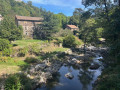
This is a challenging circular route with an elevation gain of over 1,000 metres, starting from Chamborigaud and climbing up to the Route des Crêtes, with superb views of the surrounding mountains, including the ruins of the old castle of Verfeuil, from the south of Mont Lozère to Mont Ventoux. There are various places between the points (7) and (15) that also offer beautiful views. From Vialas to Chamborigaud, you will come across numerous streams that flow into the Luech, which you will follow, with a superb spot that is ideal for a break or a swim, even if there are still 6 km to go to reach the starting point, with a steep hill to leave the Luech. But overall, it is a very beautiful route for lovers of good, challenging hikes.
From Chams en Hameaux via the Col de Peras
 11.52 mi
+2,851 ft
-2,851 ft
7h 45
Difficult
Departure from Aujac (Gard) (Gard)
11.52 mi
+2,851 ft
-2,851 ft
7h 45
Difficult
Departure from Aujac (Gard) (Gard)
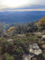
Les Chams de Bonneveau, Cassenade and Malbosquet, and the hamlets of Malbosquet and Les Escoussous as seen from the Col de Peras. Beautiful views of the Cévennes, the Alps, Mont Ventoux, the Tanargue Massif and, closer by, the Berrias Plain. Varied terrain on this fairly demanding hike.
The Étang du Serre d’Aubrias from the Col de Péras
 5.36 mi
+1,243 ft
-1,247 ft
3h 35
Moderate
Departure from Aujac (Gard) (Gard)
5.36 mi
+1,243 ft
-1,247 ft
3h 35
Moderate
Departure from Aujac (Gard) (Gard)
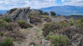
A round-trip hike, much of which follows the ridge, offering magnificent panoramic views of the peaks of the Cévennes in the Gard and the Monts d’Ardèche. Route along theGRP® Haute Vallée de la Cèze and the Cévenol.
Heathland, chestnut trees and old drovers' roads in Bonnevaux
 7.19 mi
+1,693 ft
-1,683 ft
4h 45
Difficult
Departure from Bonnevaux (Gard) (Gard)
7.19 mi
+1,693 ft
-1,683 ft
4h 45
Difficult
Departure from Bonnevaux (Gard) (Gard)
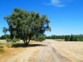
Set off to explore ancient drovers' roads (transhumance routes for herds) across arid, windswept plateaus. Chestnut trees (almost) everywhere, broom a little higher up, and then high-altitude moorland covered in heather and pine trees – that’s what this hike has in store! As well as magnificent views of the surrounding countryside. There are also quite a few stones on the ascents (up to the junction with theGRP® 4) and descents – take particular care between (8) and (9).
The forgotten drovers' roads in Bonnevaux
7.19 mi
+1,719 ft
-1,703 ft
4h 50
Moderate
Departure from Bonnevaux (Gard) (Gard)
Whilst roads have often been built along the valley floor, shepherds have chosen the ridge paths to lead their flocks to the lush pastures. This long circular walk offers breathtaking views.
From Sénéchas to the Tour d’Olivon via the Cèze dam reservoir
3.36 mi
+938 ft
-955 ft
2h 20
Moderate
Departure from Sénéchas (Gard)
Perched on a ridge between the steep-sided valleys of the Cèze and the Homol, the village of Sénéchas lies with its feet in the reservoir created by the dam that bears its name. The suggested route takes you down from the heights of the village to the shores of the lake, and on to an old medieval tower that stands watch over the lake’s meandering waters. Along the way, you’ll discover some marvels of the earthworks that once shaped this corner of the Cévennes.
Two bridges and a balcony at the start in Sénéchas
 11.22 mi
+2,326 ft
-2,346 ft
7h 10
Difficult
Departure from Sénéchas (Gard)
11.22 mi
+2,326 ft
-2,346 ft
7h 10
Difficult
Departure from Sénéchas (Gard)
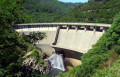
A challenging hike on often stony paths, but the scenery is well worth the effort and the signposting is excellent.
The two old bridges – one over the Cèze, the other over the Homol – are magnificent, and the path running along the cliff edge above the Luech is very pleasant.
Finally, there’s a climb for the fit, but it can be avoided.
Pont du Tarn Circular Route
10.39 mi
+502 ft
-499 ft
5h 15
Moderate
Departure from Le Pont-de-Montvert (Lozère)
Explore Mas Camargues and the Pont du Tarn, returning via the Bois du Commandeur.
Ventalon ridge via Soleyrols
 8.70 mi
+2,182 ft
-2,185 ft
5h 55
Moderate
Departure from Saint-Andéol-de-Clerguemort (Lozère)
8.70 mi
+2,182 ft
-2,185 ft
5h 55
Moderate
Departure from Saint-Andéol-de-Clerguemort (Lozère)
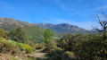
An easy walk consisting of a series of ascents and descents. The landscape is varied, with numerous stretches through chestnut groves, a few streams crossed twice via footbridges in excellent condition, and some beautiful views, particularly from the Ventalon ridge, not to mention some lovely hamlets restored in the typical Cévennes style.
Circular Pic de Cassini from the Mas de la Barque
6.52 mi
+830 ft
-830 ft
3h 45
Moderate
Departure from Le Pont-de-Montvert (Lozère)
In the heart of the Cévennes National Park, this beautiful circular walk starting from the Mas de la Barque takes you on a journey of discovery through superb high-altitude landscapes. The route alternates between shaded woodland and open stretches across the stubble fields, offering sweeping 360° panoramic views as you pass by the Pic de Cassini and the Col de l’Aigle. An ideal hike for enjoying the great outdoors and the magnificent Cévennes terrain.
Gourdouse circular loop
7.06 mi
+846 ft
-853 ft
4h 00
Moderate
Departure from Le Pont-de-Montvert (Lozère)
From the lodge of Mas de la Barque, take a trip to the hamlet of Gourdouse.
The old mine shaft at La Vernarède
 5.77 mi
+492 ft
-492 ft
3h 05
Moderate
Departure from La Vernarède (Gard)
5.77 mi
+492 ft
-492 ft
3h 05
Moderate
Departure from La Vernarède (Gard)
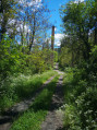
La Vernarède is a small mining village between Portes and Chamborigaud. It's a lovely, easy walk with plenty of water points for our furry friends to drink from, at least in spring (in summer this may not be the case).
The trail stretches under the pine trees and a few chestnut trees and runs alongside the Broussous stream. Numerous flowers dot the water sources, such as magnificent columbines and daisies.
Malons-et-Elze – Crète – Ponteils-et-Brésis – Bournaves
 11.53 mi
+2,336 ft
-2,339 ft
7h 20
Difficult
Departure from Malons-et-Elze (Gard)
11.53 mi
+2,336 ft
-2,339 ft
7h 20
Difficult
Departure from Malons-et-Elze (Gard)
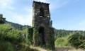
A fairly challenging route as the bulk of the climb comes at the end, and therefore in the heat. Walking along the old drovers' road is a real pleasure, as it is so unspoilt (apart from a few watchtowers...). From the point (11), the route is magnificent, with a succession of paths and the crossing of Bournaves, which has some lovely houses.
Crète, Ponteils-et-Brésis, Bournaves via the Col du Péras
13.67 mi
+2,982 ft
-2,989 ft
8h 55
Very difficult
Departure from Malons-et-Elze (Gard)
A circular loop starting from Malons-et-Elze with very little tarmac and a significant elevation gain. I’ve rated it as very difficult because the paths between (4) and (5) are very treacherous. What’s more, the route finishes with the climb up to Bournaves, and at the end of the walk, if it’s hot, it’s quite gruelling. But what a pleasure these walks are, out in the middle of nowhere!
The Paillère Valley
 13.35 mi
+2,667 ft
-2,667 ft
8h 30
Difficult
Departure from Villefort (Lozère) (Lozère)
13.35 mi
+2,667 ft
-2,667 ft
8h 30
Difficult
Departure from Villefort (Lozère) (Lozère)
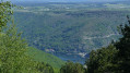
A long walk where you head up the Paillère valley through the woods before fording the stream. An easy climb then to reach the ridge at Col de Rabusat and return via the GR® trail, which offers beautiful views of the Paillère valley to the west and the Cèze valley to the east.Use of the app is strongly recommended.
The hamlets of Valouse and Cessenades as seen from Le Frontal
4.55 mi
+1,234 ft
-1,227 ft
3h 10
Moderate
Departure from Malons-et-Elze (Gard)
An easy walk that allows you to discover the isolated hamlets typical of this region of the Cévennes, as well as its vast chestnut groves.
 The Col du Pré la Dame in a circular fashion from Villefort
 29.04 mi
+3,527 ft
-3,504 ft
3 hrs
Very difficult
Departure from Villefort (Lozère) (Lozère)
29.04 mi
+3,527 ft
-3,504 ft
3 hrs
Very difficult
Departure from Villefort (Lozère) (Lozère)
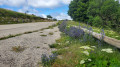
This is a must-see pass in the Cévennes, reached by a 15 km climb with an average gradient of 7%, followed by a beautiful descent to Génolhac. The return journey involves a short climb towards Concoules, followed by a much easier section to Villefort.
Portes Castle and Peyrerol Tower, or the mining history of the Cévennes
 4.86 mi
+308 ft
-305 ft
2h 30
Moderate
Departure from Portes (Gard) (Gard)
4.86 mi
+308 ft
-305 ft
2h 30
Moderate
Departure from Portes (Gard) (Gard)
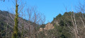
The Château de Portes is nicknamed the "ship of the Cévennes" as it overlooked the old Regordane Way, which pilgrims and crusaders used on their way to the Holy Land.
Through the woods, this hike will introduce you to another, more recent past of the Cévennes: the mines, with the discovery of the Peyrerol tower and its inclined plane.
09/10/2023 Moderator's message: the route has been modified and shortened to avoid private sections between (3) and Le Tour.
Loop in the south of the Cévennes, from the Col de Portes to the banks of the Luech
 15.78 mi
+2,756 ft
-2,776 ft
9h 40
Difficult
Departure from Portes (Gard) (Gard)
15.78 mi
+2,756 ft
-2,776 ft
9h 40
Difficult
Departure from Portes (Gard) (Gard)
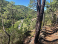
This challenging loop starts at Col de Portes and descends to Peyremale via the beautiful medieval village of Le Puech. After Peyremale and Saint-Herm, the route climbs back up to higher ground, offering superb views of the meandering Luech river below, which you eventually reach and follow along the beautiful hamlet of Chareneuve, which seems cut off from the world.Follow the Luech to Martinet Neuf after Chambon. Take a path that climbs steeply to Dieusses. Towards the end of the climb, you can clearly see the Château de Portes on the other side of the Luech, which you will have to reach. You are now about halfway there.Descend towards Chamborigaud, with beautiful views of the viaduct, which the path passes under. After the Chamborigaud bridge, take the GR®700, which climbs up to the Col de Portes. This is the thousand-year-old Régordane path. Although it stays close to the road, which you cross in a few places, this road, which starts off as a road but later becomes a path, is very pleasant.
Around Château de Portes
 1.37 mi
+135 ft
-105 ft
0h 45
Easy
Departure from Portes (Gard) (Gard)
1.37 mi
+135 ft
-105 ft
0h 45
Easy
Departure from Portes (Gard) (Gard)
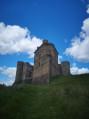
Short walk, about an hour, around Château de Portes.
It's not difficult, the route is easily accessible, you just have to climb a little to reach the château.
Lake Villefort on the Altier side
 6.42 mi
+2,047 ft
-2,047 ft
4h 45
Moderate
Departure from Villefort (Lozère) (Lozère)
6.42 mi
+2,047 ft
-2,047 ft
4h 45
Moderate
Departure from Villefort (Lozère) (Lozère)
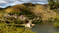
A challenging hike along the steepest section of Lake Villefort.
Circular tunnel loop starting from Combelouse
3.99 mi
+584 ft
-587 ft
2h 20
Easy
Departure from Saint-Privat-de-Vallongue (Lozère)
A circular route in the Cévennes that follows the old railway line between Alès and Florac and takes you through three tunnels. An easy, largely shaded route, suitable for families.
The heights of Saint-Privat
2.56 mi
+610 ft
-610 ft
1h 45
Easy
Departure from Saint-Privat-de-Vallongue (Lozère)
Circular loop in the forest above Saint-Privat. Magnificent old chestnut trees and a small viewpoint.
Soubrelargue Valley
 National Park
 6.43 mi
+1,650 ft
-1,644 ft
4h 25
Moderate
Departure from Saint-Privat-de-Vallongue (Lozère)
6.43 mi
+1,650 ft
-1,644 ft
4h 25
Moderate
Departure from Saint-Privat-de-Vallongue (Lozère)
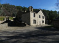
A lovely exploration of this valley via a ridge path, dominated by the Château de Bellegarde, now in ruins. Back in the deep valleys of the Cévennes, opened up in the early 18th century by the railway.
More walks in Génolhac
Select a point of interest below: