Genießerpfad – Menzenschwander Geißenpfad

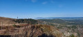
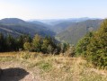
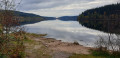
At the foot of the Feldberg, you’ll discover a valley through which the Menzenschwander Alb and the Krunkelbach flow. The pretty Menzenschwander Wasserfälle waterfalls are the highlight of this walk: they are illuminated in the evening (Wednesdays, Saturdays and Sundays) from May to October. Along the route, you’ll also see old farmhouses and superb panoramic views. The route climbs steadily at the start, with sections featuring cattle grids. Please note that there is a charge for parking at the starting point.

Details

n°47217118
Creation:
Last update:
Last review:
  • Walking
    Activity: Walking
  • ↔
    Distance: 6.25 mi
  • ◔
    Average duration: 3h 45 
  • ▲
    Difficulty: Moderate

  • ⚐
    Back to start: Yes
  • ↗
    Ascent: + 1,014 ft
  • ↘
    Descent: - 1,004 ft

  • ▲
    Highest point: 3,471 ft
  • ▼
    Lowest point: 2,887 ft

Photos

Description of the walk

Park in the Mösle Menzenschwand pay-and-display car park.

(1) Turn left and begin the ascent along the hiking and snowshoeing path (marked with a pink disc) until you reach the “Albsteig Schwarwald” trail; there are a few animal gates along the way. Take in the panoramic views, including some old farmhouses.

(2) Head down this path to the left. Ignore a path branching off to the left and carry on to the next junction.

(3) Turn right at the hairpin bend by the signpost marked “Menzo’s Wegle”. Pass some cairns on your right. Enter the forest and follow the path as it curves to the left.

(4) Cross a bridge over the Menzenschander Alb. There may be snow here in early spring as the area is in the shade.

(5) Pass between two totem poles and continue straight on, staying at the edge of the forest.

(6) Turn right at the junction. Keep heading south, ignoring two paths branching off to the left.

(7) Carry on straight ahead for about 150 metres; there’s a lovely view of the valley.

(8) Retrace your steps and head down the path on the right, towards “Menzo’s Wegle”. Take care: there are exposed roots and large stones here.

(9) At the end of the path, turn left onto the road leading to the Menzenschwander Wasserfälle waterfalls.

(10) Take the steps on the right to admire and walk alongside the waterfalls.

(11) Turn right when you reach the road. Walk past the waterfalls’ car park on your left and take the path uphill, “Menzo’s Wegle Krunkelbach-runde”. This path curves sharply to the left before joining a road.

(12) Cross the road and take the path opposite, leading into the meadow. Turn left onto this path to return to the road.

(13) Turn right and continue until you reach a four-way junction.

(14) Turn right and continue along this path/road.

(15) Keep left at the three-way junction to return to the car park at the starting point (S/E).

Waypoints

  1. S/E : mi 0 - alt. 2,897 ft - Mösle Menzenschwand car park
  2. 1 : mi 0.23 - alt. 2,910 ft - Turn left at the fork
  3. 2 : mi 1.35 - alt. 3,471 ft - Crossroads, on the left
  4. 3 : mi 1.82 - alt. 3,199 ft - Hairpin bend
  5. 4 : mi 2.49 - alt. 3,379 ft - Bridge over a torrent
  6. 5 : mi 2.72 - alt. 3,323 ft - Signposts
  7. 6 : mi 3.2 - alt. 3,169 ft - Crossroads, on the right
  8. 7 : mi 3.55 - alt. 3,179 ft - Viewpoint junction
  9. 8 : mi 3.64 - alt. 3,202 ft - Viewpoint
  10. 9 : mi 3.86 - alt. 2,982 ft - Waterfall Route
  11. 10 : mi 3.94 - alt. 3,031 ft - Waterfall steps
  12. 11 : mi 4.04 - alt. 2,956 ft - Back on the road, turn right
  13. 12 : mi 5.07 - alt. 3,176 ft - Crossing the road
  14. 13 : mi 5.32 - alt. 3,074 ft - Back to the road, on the right
  15. 14 : mi 5.54 - alt. 2,982 ft - Crossroads, on the right
  16. 15 : mi 6.08 - alt. 2,900 ft - Three-way junction, left
  17. S/E : mi 6.25 - alt. 2,897 ft - Arrival at the Mösle Menzenschwand car park

Reviews and comments

4.5 / 5
Based on 1 review

Reliability of the description
Not used
Ease of following the route
5 / 5
Route interest
4 / 5
KatiaB
KatiaB
• Edited:

Overall rating : 4.5 / 5

Date of your route : Jul 20, 2026
Reliability of the description : Not used / Not applicable
Ease of following the route : ★★★★★ Very good
Route interest : ★★★★☆ Good
Very busy route : Yes

A lovely walk through an idyllic valley. The walk begins on a pleasant little path where you’ll spot a few goats. The second circular walk after the waterfall follows a track that’s a bit monotonous. It’s quite busy near the waterfall, which has a short, well-maintained path (with little water in summer), as it’s accessible by car and there’s a restaurant/bar. There were timber-hauling operations (machinery, the sound of chainsaws) on the way back from the first circular walk. The walk is very exposed to the sun, with plenty of benches and seats to rest or daydream…

Machine-translated

Other walks in the area

For more walks, use our search engine .

The GPS track and description are the property of this route's author. Please do not copy them without permission.