


 Country:
 City:
City:


Departure from Frépillon station (Transilien line H).
(S) Exit via the car park side (to the east of the tracks), turn left and, at the roundabout, head more or less straight on along Avenue Gaston Bourry. At the next junction, turn right onto Avenue Charles de Gaulle.
(1) At the roundabout, take thefirst left onto Rue de la Libération. At the end of the street, turn right onto Rue de la Vieille Fontaine.
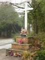
(2) After three gentle bends, when Rue de la Vieille Fontaine comes to a house and turns sharply left, turn right onto theGRP® towards Butte de Malmont (red and yellow markings). At the first junction, keep left and go round the Butte de Malmont to the north. Stay on theGRP® trail, continuing straight on at every junction. At the junction with a cross, go straight on again; and at the junction with aPR® trail, continue straight on along the GRP®. This will take you to a road.
(3) Turn right onto the road and immediately take the first path on the left, passing close to a signpost for the Route du Poteau de Paradis. After a bend to the left, take the firstpath on the right towards the Trépied Chêne. Further on, keep left at a Fork in the road. Ignore a path coming from the left and, at the next junction, turn left.
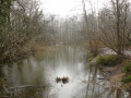
(4) You’ll come out onto a track (Boulevard de l’Ouest on the map) and follow it to the right. Ignore a turn-off on the right and you’ll soon reach a crossroads. Then take thesecond left, at a 90° angle, onto the Route de la Croix Saint-Jacques (leaving the signposted route). You’ll arrive at Étang Godard and begin walking round it anti-clockwise.
(5) Leave the lake via thesecond path on the right (south-west). Continue straight on at the next junction. At the following junction, turn left onto Boulevard du Midi. Continue straight on until you reach the Pont du Diable.
(6) Then turn left and carry on straight ahead at the first three junctions. Atthe fourth junction, turn right onto Route de la Croix Saint-Jacques. After a good fifty metres, turn left onto a path and follow theGR®1(red and white markings). At the next junction, go straight on and then veer left. Cross the Route Forestière des Parquets, then the Boulevard du Nord, and continue along the GR®. At the next junction, veer left and you’ll immediately come to a crossroads.
(7) Turn right onto the Route du Milieu (let theGR® continue straight ahead). Cross the D192p and continue straight ahead onto the Chemin Départemental de la Demie-Lieue. Ignore a path on the right to reach the Carrefour du Milieu. Continue straight ahead and immediately ignore a path branching off to the left.
(8) At the next junction, turn slightly left, still on the Chemin Départemental de la Demie-Lieue. Stay on this wide track (east-southeast) and ignore all side paths until you reach the Carrefour du Champ Perdriel.
(9) Then take thesecond track on the right (south-east) towards the Tour du Plumet. At a Fork in the road, keep left and continue on to the tower.
(10) Turn sharply right and head down towards Étang Marie. When you reach a track, follow it to the right.
(11) Ignore a path branching off to the left (this will be the return route) and stay on the track, which soon turns left. Reach Étang Marie and turn left to walk alongside it on your right-hand side. When you’re almost at the end of the lake, take thefirst path on the left.
(11) At its end (the junction you passed through earlier), head right towards the Château de la Chasse. Immediately ignore a turn-off on the left (the path taken on the descent from the Tour du Plumet) and one on the right. Stay on the Route du Plumet, which climbs up to a sort of pass. Continue straight on and you’ll soon reach a crossroads.
(12) Go straight on along the Route du Plumet, which immediately turns right to head east-north-east. Head downhill and turn north-north-east. At a junction, take a track on the right and follow it to the Château de la Chasse.
(13) Turn right and walk alongside a pond on your left. At the end of the pond, at its south-eastern tip, head straight on (south) along a path crossing the Bouquet de la Vallée. Join the D909 at a car park.
(14) Cross the road (take care) and, opposite, take the Route du Pont d’Enghien à la White Cross, which starts just to the right of a car park. Follow this road all the way, heading east-southeast then southeast. Walk alongside a golf course on your left. Reach the D124E and follow it to the left for about 500 m.
(15) Take thefirst right, the D123 towards Fort de Domont, and walk alongside it on your left. Pass an old quarry on your right, then the access road to a secondary school.
(16) Immediately afterwards, take the first path on the right. At the bottom of a descent, take thefirst path on the left. Ignore a path coming from the right and, at the next junction, turn right to join a track straight away.
(17) Continue along this track (Route du Prieuré) and follow the red and yellowGRP® markings. Keep going straight on (south-east) until you reach the end of the track.
(18) Then turn left (east). When the path bends left with theGRP®, carry straight on along a sunken track and head downhill.
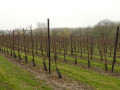
(19) At the junction, turn right towards Saint-Brice-sous-Forêt and head out into the fields. At the next junction, turn left onto a track that runs alongside vineyards and passes near the Fontaine du Noyer. Continue to the houses in Saint-Brice-sous-Forêt.
(20) At the end of the road, turn right onto Rue de la Planchette. Immediately turn left onto Rue du Maréchal Foch. At the roundabout, carry straight on along the same road. Ignore two streets on the left. At the junction, first turn right then left onto Avenue des Tilleuls. At the end of the avenue, turn right onto Avenue du Général de Gaulle, then take thefirst left.
(21) At the roundabout, go straight on along Boulevard de la Gare. Pass under the D301 and continue straight on. At the roundabout, continue straight on, then turn left into a car park (Sentier Florent on the map). At the end, turn right to reach Saint-Brice-sous-Forêt station straight away (E).
The return journey by train is described in the ‘Practical information’ section.


 Visorando Member
 Moderate
  Association / Club / Walk leader
 Easy
Easy 
 Very difficult
