


Refine your search for walks in Gare de Mérens-les-Vals
Gare de Mérens-les-Vals walks


 Ax-les-Thermes - Mérens via the Chemin de Llatta
 Visorando Member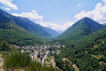
 8.43 mi
 +3,563 ft
 -2,087 ft
 7h 00
7h 00
 Difficult
 Departure from Ax-les-Thermes (Ariège)
A challenging first stage of exploration in an unspoilt environment.A basic understanding of map reading and navigation is required.The GPX track on Visorando or on a GPS is very useful from the start and at the numerous junctions.It is entirely possible to shorten the route if necessary: see practical information.
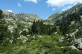
From L’Hospitalet-près-l’Andore to Mérens-les-Vals via Porteille des Bésines
 10.31 mi
+3,353 ft
-4,577 ft
7h 40
Difficult
Departure from L'Hospitalet-près-l'Andorre (Ariège)
10.31 mi
+3,353 ft
-4,577 ft
7h 40
Difficult
Departure from L'Hospitalet-près-l'Andorre (Ariège)
A hike from station to station with 900 m of ascent and nearly 1,300 m of descent, passing through the Refuge des Bésines and the eponymous Porteille, and following theGR®107CandGR®10trails.
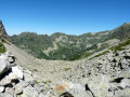
Mérens – L’Hospitalet-près-l’Andorre via the Bésines refuge
 9.54 mi
+4,160 ft
-3,225 ft
8h 00
Difficult
Departure from Mérens-les-Vals (Ariège)
9.54 mi
+4,160 ft
-3,225 ft
8h 00
Difficult
Departure from Mérens-les-Vals (Ariège)
A challenging second stage with a steep gradient on the ascent of the Porteille des Bésines.
This day’s walk follows good, well-signposted paths.
Stopping off at the Refuge des Bésines may be useful for drinking water and, possibly, lunch.
The climb to Les Bésines and the descent towards L’Hospitalet are not very busy (as observed on 2 August 2022).
Walks near Gare de Mérens-les-Vals
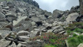
From Mérens-les-Vals to Étang de Pédourrés via Étang de Couard
 6.55 mi
+4,052 ft
-400 ft
6h 35
Difficult
Departure from Mérens-les-Vals (Ariège)
6.55 mi
+4,052 ft
-400 ft
6h 35
Difficult
Departure from Mérens-les-Vals (Ariège)
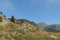
The first stage of the journey! We leave the village of Mérens-les-Vals to reach Étang de Pédourès via the rugged slopes of the Ariège mountains; the scenery is magnificent and very wild. The main difficulty lies between the Étang de Comte and the Étang de Couard, where the well-marked path follows a very long and at times arduous scree slope; once you reach the Étang de Couard, the beauty of the scenery makes up for the hard work.
Auberge du Nabre – Refuge des Bésines
 5.69 mi
+4,442 ft
-1,312 ft
6h 30
Difficult
Departure from Mérens-les-Vals (Ariège)
5.69 mi
+4,442 ft
-1,312 ft
6h 30
Difficult
Departure from Mérens-les-Vals (Ariège)
Second stage of the tour of the Orlu nature reserves and the Montagne d’Ax.
A challenging stage due to its 1,350-metre elevation gain. The ascent is, however, steady.
The scenery is magnificent.
This itinerary details the route taking in the magnificent Étang Soula Couloumé.
This stage follows theGR®10, apart from the short detour (5), (6), (7) off the marked trail at the lake.
Ascent to the Refuge du Rulhe from the Cascade des Escaliers (Mérens)
 6.01 mi
+3,727 ft
-1,260 ft
6h 00
Difficult
Departure from Mérens-les-Vals (Ariège)
6.01 mi
+3,727 ft
-1,260 ft
6h 00
Difficult
Departure from Mérens-les-Vals (Ariège)
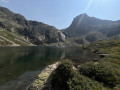
First day’s hike to the Refuge du Rulhe.With a 1,000 m elevation gain over 5.5 km, the average gradient of the climb to the Pyramide de Lherbés is 18%. IBP difficulty rating = 105 (“very difficult” for a hiker of average fitness).Allow 6½ hours with a light rucksack.This day takes place in the high mountains, far from any roads, tracks, etc.The landscapes and environments you’ll pass through are majestic.
Ax 3 Domaines Plateau du Saquet - Rulhe Refuge
6.69 mi
+2,293 ft
-1,677 ft
5h 05
Difficult
Departure from Ax-les-Thermes (Ariège)
This is a magnificent hike that starts from the Plateau du Saquet, and therefore the Ax 3 Domaines ski slopes, and ends at the Refuge de Rulhe, where a good local rataf will do you good. Once you reach the top of the resort, long desert plateaus await you before you descend into the austere scree slopes at the foot of Rulhe and finish sliding down to the Refuge de Rulhe. This first stage is wild and challenging, in the scree slopes. Be careful on the descent from the Col de Lhasse, which is very steep (but the GR® is well marked).
From Ax Trois Domaines/Le Saquet to Castelet via the Refuge de Rhule
17.68 mi
+3,251 ft
-7,635 ft
2 days
Difficult
Departure from Ax-les-Thermes (Ariège)
A long hike in Haute Ariège to admire the lakes, ridges and magical landscapes with a stop at the ideally located Refuge de Rulhe, an opportunity to taste the local rataf'. On the second day, you can admire the whole area from the ridges.
From the Pra Redoun Refuge to the Juclar Refuge
 5.47 mi
+2,884 ft
-1,168 ft
5h 00
5.47 mi
+2,884 ft
-1,168 ft
5h 00
 Moderate
Departure from Savignac-les-Ormeaux (Ariège)
Moderate
Departure from Savignac-les-Ormeaux (Ariège)
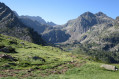
The second stage of the “Ax-les-Thermes to Latour-de-Carol” route; this is a beautiful high-mountain stage with magnificent scenery. Favourable weather is recommended.
This route follows a path which is initially very poorly signposted, climbing steeply towards the first pass, the Col de Behl, before reaching the Refuge de Ruhle, then the beautiful ascent to the Col de Juclar and finally the descent into Andorra towards the manned refuge of the same name.
Refuge des Bésines - Refuge d'En Beys
 4.85 mi
+1,532 ft
-1,978 ft
3h 35
Difficult
Departure from Mérens-les-Vals (Ariège)
4.85 mi
+1,532 ft
-1,978 ft
3h 35
Difficult
Departure from Mérens-les-Vals (Ariège)
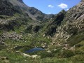
Part of the long (9-day) itinerary around Carlit, hiking from refuge to refuge, based on the Peyrics tour and using various marked trails.
Refuge des Bésines - Refuge d'en Beys
 8.43 mi
+3,015 ft
-3,435 ft
6h 30
Difficult
Departure from Mérens-les-Vals (Ariège)
8.43 mi
+3,015 ft
-3,435 ft
6h 30
Difficult
Departure from Mérens-les-Vals (Ariège)
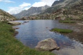
The third stage takes you through Cerdagne, in the Eastern Pyrenees.The return trip along the ridge (3) to (4) should be done in the absence of fog, rain or frost.I have classified this hike as difficult due to the ridge crossing from (4) to (5) and the descent through the rocks from the Faury pond (10) to the En Beys refuge (E).There are numerous places to stop for a break at the lakes along the way.Be careful of the multiple marked trails:GR®®10-GR®®107-GR®®107-GR®®107(variant) andGRP®® Tour des Pérics -GRP®® Tour des Montagnes d'Ax. Follow the description, the GPX track and the signs on the ground carefully.
⚠️ From (8) to (E)you are in the Orlu National Hunting and Wildlife Reserve, where regulations must be observed. See practical information.
Refuge des Bésines - Barrage des Bouillouses
 10.15 mi
+2,152 ft
-2,434 ft
6h 35
Moderate
Departure from Mérens-les-Vals (Ariège)
10.15 mi
+2,152 ft
-2,434 ft
6h 35
Moderate
Departure from Mérens-les-Vals (Ariège)
Modification on 12 September 2022: validated on Sunday 11 September 2022.
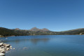
Fourth and final stage of the Tour Des Pérics. The scenery is consistently stunning.
This is a fairly long stage, with cars being collected by shuttle buses.
See practical information on the Tour des Pérics.
 Easy
Easy