Country:

 City:
City:


Red and white markings.GR® 107 andGR® 10. TheGR® markings take precedence over those ofthe GRP® Tour de la Montagne d’Ax.
(S) From your accommodation, set off along the reverse route of the previous day, heading uphill. Cross the road four times.
Turn right onto the road and follow it for 100 m.
Yellow signposting
(1) Let theGR® andGRP® routes pass by on the left. Continue to the end of the road. Directly beneath the power line, turn left heading due south. Ford a few streams.
Cross the Ruisseau du Nabre via the footbridge.
Red and white markings. TheGR® 10 markings take precedence over those of theGRP® Tour de la Montagne d’Ax.
(2) Turn right and head uphill along theGR® 10. Continue along the right bank of the stream. Pass the Fontanasse. The climb is gradual. Look out for the Saut du Nabreil waterfall on your right.
You’ll reach another footbridge.
(3) Cross the Ruisseau du Nabre again via the footbridge and continue the ascent along the left bank, turning south-east. You’ll reach the Présasse wetland, with several streams and a spring.
(4) Begin the ascent of the Porteille here. The path turns due south then south-west.
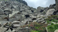
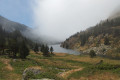
Pass the Estagnas pond. The path levels out and climbs towards a passage through the rocks. Reach the Porteille des Bésines. A lovely spot for a well-deserved break. The view is magnificent.
(5) You have two options depending on how tired you are, how much time you have and the weather.
Please note: you have already climbed 1,100 metres in altitude.
Follow the red and white markings – this is the easiest option.
- Continue along theGR® 10. The path continues south-west until the next junction at around 2,090 m at the Fontaine de Courtal Subra.
Where there are no cairns and the path is barely visible on the ground, follow the route shown on the map.
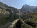
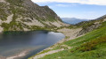
- Turn right, heading due west, along a path on the right that climbs slightly. Pass the highest point overlooking the pond and descend to it via a faint path, heading west, to reach Étang Soula Couloumé. Walk along the left-hand side of the pond towards the spillway.
(6) Stay on the left bank of the stream after the spillway. Cross the first stream, which may be dry. Continue due south and turn left at the second stream you come to. Join theGR® 10 at the crossroads at the Fontaine de Courtal Subra.
Red and white markings
(7) Turn right onto theGR® 10 towards the mountain hut, following the Ruisseau des Bésines on its left bank. You’ll reach a fork at around 2,080 m.
No signposting; cairns and a marked path on the ground.
(8) Leave theGR® 10and continue to the right, south-west, along a safe grassy corridor.
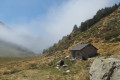
Reach the Cabane des Bésines (1,980 m), in a beautiful summer pasture area.
(9) Cross this area heading south-east. Join theGR® 107C coming from L’Hospitalet-près-l’Andorre. Climb left along this good path to the refuge (2,101 m) (E).


 Visorando Member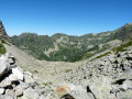
 Moderate