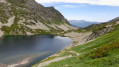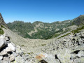
Mérens – L’Hospitalet-près-l’Andorre via the Bésines refuge

A challenging second stage with a steep gradient on the ascent of the Porteille des Bésines.
This day’s walk follows good, well-signposted paths.
Stopping off at the Refuge des Bésines may be useful for drinking water and, possibly, lunch.
The climb to Les Bésines and the descent towards L’Hospitalet are not very busy (as observed on 2 August 2022).

This walk is part of a multi-day hike: Tour de la Montagne d’Ax et de Mérens en Haute-Ariège

Details

n°24911664
Creation:
Last update:
Last review:
  • Walking
    Activity: Walking
  • ↔
    Distance: 9.54 mi
  • ◔
    Average duration: 8h 00 
  • ▲
    Difficulty: Difficult

  • ⚐
    Back to start: No
  • ↗
    Ascent: + 4,160 ft
  • ↘
    Descent: - 3,225 ft

  • ▲
    Highest point: 7,644 ft
  • ▼
    Lowest point: 3,740 ft

Photos

Description of the walk

Red and white markings for theGR®10–GR®107variant

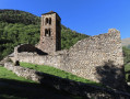
(S) From the hostel, head up towards the Chapelle Saint-Pierre de Mérens-d’en-Haut and cut across all the hairpin bends in the road via a stony track. Join the road at a crossroads and a car park. Directional signposts.

(1) Turn right, heading due south along theGR®10, towards Les Bésines. After 150 metres on tarmac, you’ll reach the start of a path on the left.

(2) Head up to the left along this path. Pass the hot springs on your left. Then continue climbing to the right along theGR®10.

(3) Admire the waterfall, known as the Saut du Nabreil. Continue the climb.

(4) Cross a steel footbridge. Walk along the left bank of the Ruisseau du Nabre and reach a fork in the path.

(5) Carry on climbing even more steeply due south. You’ll reach the Étang de l’Estagnas on your left at an elevation of 2056.

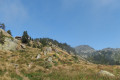
(6) The gradient becomes very steep and the path levels out. Don’t hesitate to take a few breaks to enjoy this beautiful scenery. With one final effort, reach the Porteille des Bésines, marked by a huge cairn at an elevation of 2333.
There’sa stunning view from this pass. It’s a lovely, spacious spot for a well-deserved lunch break.

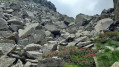
(7) Then head down due south, south-west. Further down, the approach to the refuge involves climbing up and down rocky terrain. This is the officialGR®10route. You’ll reach a relatively flat area near the Refuge des Bésines: drinking water, meals, drinks. Signposts.

(8) Head straight south down to a fork in the path a little further down.

White and red markings. It is easy to get confused due to the many paths crossing at this point.

(9) Leave theGR®10–GR®107variant andGRP® and head left.
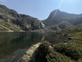
Turn right onto theGR®107Ctowards the Étang des Bésines. Walk along its left-hand side until you reach the EDF dam facilities and the dilapidated Cabane des Bésines.

(10) Continue along the old railway right-of-way used during the construction of the dam.

(11) Leave the old railway line and turn right, now heading downhill, and continue along this balcony path.

(12) As you pass the Crête du Tos Bessateil, carry on straight ahead on theGR®107C. Begin the descent proper. Pass the small waterfall on the Ruisseau d’Espousouillette. You’ll reach a clearly marked junction.

(13) Leave the climb to Puymorens on your left and continue along the right-hand branch ofthe GR®107towards Hospitalet for about 500 m.

(14) Turn right and join the N22.

(15) Cross this road carefully and continue straight ahead along the path above the village. You’ll arrive at the square in L’Hospitalet-près-l’Andorre. Continue for 20 m and turn right.

(E) L’Hospitalité stopover lodge: today’s stopover.

Waypoints

  1. S : mi 0 - alt. 3,760 ft - Auberge du Nabre - Gare de Mérens-les-Vals
  2. 1 : mi 0.18 - alt. 3,878 ft - Crossroads. Car park
  3. 2 : mi 0.25 - alt. 3,885 ft - Junction
  4. 3 : mi 2.01 - alt. 5,554 ft - Nabreil Gap
  5. 4 : mi 2.32 - alt. 5,676 ft - Footbridge
  6. 5 : mi 3.05 - alt. 6,293 ft - Junction
  7. 6 : mi 3.42 - alt. 6,759 ft - Étang de l'Estagnas
  8. 7 : mi 4.04 - alt. 7,641 ft - Porteille des Bésines
  9. 8 : mi 5.08 - alt. 6,857 ft - Refuge des Bésines
  10. 9 : mi 5.09 - alt. 6,821 ft - Junction
  11. 10 : mi 6.1 - alt. 6,470 ft - Old railway line right-of-way - Étang des Bésines
  12. 11 : mi 6.71 - alt. 6,414 ft - Route
  13. 12 : mi 7.84 - alt. 5,912 ft - Junction. Tos Bessatei ridge
  14. 13 : mi 8.77 - alt. 5,217 ft - Junction
  15. 14 : mi 9.04 - alt. 5,046 ft - Junction
  16. 15 : mi 9.26 - alt. 4,921 ft - N22
  17. E : mi 9.54 - alt. 4,698 ft - L’Hospitalité stopover lodge - Gare d'Andorre-L'Hospitalet

Notes

Mountain environment: you will therefore need suitable kit, including: warm clothing and rainwear, two litres of water, walking poles, a compass, GPS or Visorando, a 1:25,000 map, a GPX track and route description.

L’Hospitalet-près-l’Andorre: lodge, hotel, grocery shop, fast-food outlets, TER train, bus.

Drinking water available at (S) and the Bésines hostel and refuge (8).

If you run into any problems, you can cut the trip short here and travel to Ax by public transport.

Worth a visit

Always be cautious and plan ahead when you're outdoors. Visorando and the author of this route cannot be held responsible for any accidents occurring on this route.

The GR® and PR® markings are the intellectual property of the Fédération Française de Randonnée Pédestre.

Reviews and comments

5 / 5
Based on 1 review

Reliability of the description
5 / 5
Ease of following the route
5 / 5
Route interest
5 / 5
Gazoulette
Gazoulette

Overall rating : 5 / 5

Date of your route : Aug 17, 2014
Reliability of the description : ★★★★★ Very good
Ease of following the route : ★★★★★ Very good
Route interest : ★★★★★ Very good
Very busy route : Yes

A magnificent route I completed a few years ago, though in the opposite direction and as a ‘one-way’ trip, which means the total elevation gain is lower (around 980m) and the climbs are less steep (so it’s the descent that’s the tough bit). However, this also means you’ll need to arrange your return journey to L’Hospitalet, either by leaving a car in Mérens beforehand or by train. Apart from these considerations, it’s a very beautiful route, which poses no navigation problems as it’s signposted. As mentioned, do take care near the refuge. On the other hand, the section between L’Hospitalet and Les Bésines is quite busy, much more so than the second part. In any case, it makes you want to do it again!

Machine-translated

Other walks in the area

For more walks, use our search engine .

The GPS track and description are the property of this route's author. Please do not copy them without permission.