


 Country:

 City:
City:


Hébergements :
J1 : Refuge de Furfande.
J2 : Gîte Grand Rochebrune à Souliers.
J3 : Gîte le Teppio à La Chalp.
J4 : Les chalets de Clapeyto en boucle à partir de La Chalp.
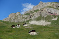
Chalets et bergeries d'estive autour d'Arvieux

Circuit de 4 jours pour découvrir les chalets d'estive de Furfande, les bergeries de Souliers et les chalets de Clapeyto.
Details
Creation:
Last update:
Last review:
–
–
-
 Activity: Walking
 -
 Distance: 33.04 mi
 -
 Average duration: 4 days
 -
 Difficulty: Difficult
 -
-
 Back to start: No
 -
 Ascent: + 12,126 ft
 -
 Descent: - 11,778 ft
 -
-
 Highest point: 9,337 ft
 -
 Lowest point: 4,587 ft
Photos
Stages of the route
This route needs several days, find the details below:
Notes
Other walks in the area
Arvieux – Furfande Refuge
 Visorando Member
4.30 mi
+3,123 ft
-676 ft
4h 40
Visorando Member
4.30 mi
+3,123 ft
-676 ft
4h 40
 Moderate
 Departure from Arvieux (Hautes-Alpes)
Ascent to the Furfande Refuge from Arvieux via theGR®58.
Hike completed on 5 July 2018 as part of a route.
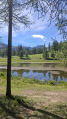
Loop around Lac de Roue and the hamlet of Souliers
 6.23 mi
+1,083 ft
-1,083 ft
3h 50
Moderate
Departure from Arvieux (Hautes-Alpes)
6.23 mi
+1,083 ft
-1,083 ft
3h 50
Moderate
Departure from Arvieux (Hautes-Alpes)
Easy hike. Little elevation gain, which is very gradual, except for a slightly steep 300m trail at the start and 500m at the end.
Mostly in the forest, with superb viewpoints over the Guil Valley, then the Souliers Valley and finally Arvieux.
50/50 forest track and trails.
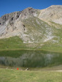
Circular loop around Lacs de Roue and Lacs de Souliers from Arvieux
 9.53 mi
+3,219 ft
-3,222 ft
7h 10
Difficult
Departure from Arvieux (Hautes-Alpes)
9.53 mi
+3,219 ft
-3,222 ft
7h 10
Difficult
Departure from Arvieux (Hautes-Alpes)
A large circular loop with a 1,000m elevation gain connecting two beautiful mountain lakes from "Les Maisons" near Arvieux.
Lac de Roue at the start of the Maisons
3.14 mi
+728 ft
-748 ft
2h 05
 Easy
Departure from Arvieux (Hautes-Alpes)
Easy
Departure from Arvieux (Hautes-Alpes)
A short walk with little elevation gain starting from the hamlet of Les Maisons, passing by Lac de Roue and Arvieux.
La Chalp - Ceillac
12.81 mi
+4,272 ft
-4,416 ft
9h 35
Difficult
Departure from Arvieux (Hautes-Alpes)
Étape du GR®5 de La Chalp à Ceillac par le Col du Fromage dans le Queyras authentique et sauvage en passant par Chateau-Queyras.
The Clapeyto chalets
9.71 mi
+3,337 ft
-3,369 ft
7h 20
Difficult
Departure from Arvieux (Hautes-Alpes)
A circular walk exploring the Clapeyto summer chalets above Brunissard, via the Col du Cros and back via the Col du Lauzon.
La Chalp – Ceillac
 15.36 mi
+5,279 ft
-5,358 ft
10 hrs
15.36 mi
+5,279 ft
-5,358 ft
10 hrs
 Very difficult
Departure from Arvieux (Hautes-Alpes)
Very difficult
Departure from Arvieux (Hautes-Alpes)
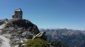
Ascent to Col Fromage through fields of flowers in July.The alternative route via the old signal station offers a 360° panoramic view and a bird’s-eye view of the valley.
From La Chalp to the Cime du Mélezet mountain hut
 15.97 mi
+4,888 ft
-4,452 ft
11h 35
Difficult
Departure from Arvieux (Hautes-Alpes)
15.97 mi
+4,888 ft
-4,452 ft
11h 35
Difficult
Departure from Arvieux (Hautes-Alpes)
This fourteenth stage completes the crossing of the Queyras Massif. From La Chalp, the GR® 5 climbs along the left bank of the Torrent de l’Izoard above Arvieux, then reaches the hamlet of Les Maisons. From there, it heads towards Lac de Roue before descending to Château-Queyras. The route climbs the steep slope on the opposite side, on the right bank of the Torrent de Bramousse, joins a road at a hairpin bend and leaves it at the next one. It continues through the torrent’s valley, reaches the ridge separating the Bramousse and Riou Vert valleys, and, hugging the hillside beneath the peaks of La Selle and Rasis, reaches the Col Fromage. The path descends along the right bank of the Ravin de Rasis to reach Le Villard before arriving at Ceillac, from where it follows the Torrent du Mélezet, alternating between the left and right banks, before reaching the Refuge de la Cime du Mélezet.
For more walks, use our search engine .
The GPS track and description are the property of this route's author. Please do not copy them without permission.

