


Refine your search for walks in Fort du Randouillet
Fort du Randouillet walks


 The Fort du Randouillet at the start of the route from Briançon
 Visorando Member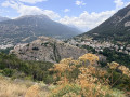
 5.28 mi
 +1,430 ft
 -1,427 ft
 3h 40
3h 40
 Moderate
 Departure from Briançon (Hautes-Alpes)
The Fort du Randouillet overlooks Briançon, and a visit offers a wonderful insight into this former garrison on the Franco-Italian border. Listed as a UNESCO World Heritage Site in 2008, along with the other forts in the Briançon area, it was once used to transport goods between Briançon and the forts of L’Infernet and La Cochette via several cableways.
Walks near Fort du Randouillet
Briançon - La Chalp
14.64 mi
+4,544 ft
-3,389 ft
10h 40
 Difficult
Departure from Briançon (Hautes-Alpes)
Difficult
Departure from Briançon (Hautes-Alpes)
Étape de la Grande Traversée des Alpes de Briançon à La Chalp par le Col des Ayes.
From Val des Prés to La Chalp
 15.95 mi
+4,905 ft
-3,868 ft
11h 35
Difficult
Departure from Val-des-Prés (Hautes-Alpes)
15.95 mi
+4,905 ft
-3,868 ft
11h 35
Difficult
Departure from Val-des-Prés (Hautes-Alpes)
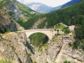
This thirteenth stage marks the start of the crossing of the Queyras Massif. From La Vachette, the previous day’s trail joins the GR®5. After a flat start, the forest path winds its way along the banks of the Durance as it descends towards the hamlet of L’Envers du Fontenil, before climbing up to a fortification at the foot of the Fort des Trois Têtes and then crossing the remarkable Pont d’Asfeld. The GR®5 climbs to the Cité Vauban in Briançon, one of France’s finest fortified towns, and descends via the Portes d’Embrun to the Parc de la Schappe. It heads south towards Villar-Saint-Pancrace, then veers off towards Les Ayes via the hamlets of La Mourande, Sachas and Soubeyran, from where it climbs to the Chapelle Saint-Laurent, then on to Le Lauzin, before reaching the Chalets des Ayes. It reaches the Col des Ayes, descends the opposite slope, joins a track at L’Eychaillon and turns left onto it, running alongside the Torrent de la Rivière as far as Brunissard and then La Chalp.
Cime Saurel from Montgenèvre
 9.61 mi
+784 ft
-2,766 ft
5h 05
Moderate
Departure from Montgenèvre (Hautes-Alpes)
9.61 mi
+784 ft
-2,766 ft
5h 05
Moderate
Departure from Montgenèvre (Hautes-Alpes)
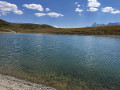
This high-altitude walk, accessible from the Télémix des Chalmettes and the Gondrans chairlift, will allow you to discover several magnificent spots such as Lake Gignoux and the Cime Saurel, all whilst enjoying stunning views of the surrounding peaks.
The Chenaillet Geological Trail via the lakes
 4.33 mi
+1,286 ft
-2,080 ft
3h 05
Moderate
Departure from Montgenèvre (Hautes-Alpes)
4.33 mi
+1,286 ft
-2,080 ft
3h 05
Moderate
Departure from Montgenèvre (Hautes-Alpes)
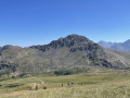
This high-altitude route will allow you to explore the famous Chenaillet Geological Trail, as well as Lac de Chaussé and the source of the Doire. This walk is accessible via the Chalmettes Télémix and the Gondrans chairlift.
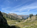
The Small Pass via Lac Gignoux
 6.08 mi
+1,014 ft
-1,811 ft
3h 40
Moderate
Departure from Montgenèvre (Hautes-Alpes)
6.08 mi
+1,014 ft
-1,811 ft
3h 40
Moderate
Departure from Montgenèvre (Hautes-Alpes)
This route, starting from the Sommet des Anges and accessible via the Télémix des Chalmettes followed by the Télésiège des Gondrans, will allow you to discover several magnificent viewpoints as you pass through the Col du Gondran and its small lake, Lac Gignoux, the Col de Gimont and the small pass of Collet Vert.
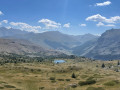
The Lakes Circuit starting from Montgenèvre
 8.78 mi
+1,959 ft
-3,120 ft
5h 45
Moderate
Departure from Montgenèvre (Hautes-Alpes)
8.78 mi
+1,959 ft
-3,120 ft
5h 45
Moderate
Departure from Montgenèvre (Hautes-Alpes)
This walk, starting from the Télémix des Chalmettes, will allow you to enjoy several magnificent viewpoints, such as the Grand Charvia or Lake Gignoux, and to discover the eight lakes near the route, all whilst taking in a magnificent view of the Clarée Valley.
Pamplinet - Refuge du Chardonnet
8.03 mi
+2,546 ft
-135 ft
5h 55
Difficult
Departure from Névache (Hautes-Alpes)
This section corresponds to the second stage of the crossing of France, following the 45th parallel. This stage is magnificent and can be a hike in its own right. You follow the Clarée valley and discover beautiful waterfalls before climbing up to the Refuge du Chardonnet.
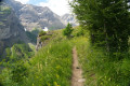
Argentière station - Ravin des Serres
 11.12 mi
+4,564 ft
-223 ft
9h 05
Difficult
Departure from L'Argentière-la-Bessée (Hautes-Alpes)
11.12 mi
+4,564 ft
-223 ft
9h 05
Difficult
Departure from L'Argentière-la-Bessée (Hautes-Alpes)
For this first stage, you will begin your journey at the Argentière-les-Écrins train station. The hike follows the GR®54A, taking you through the Fournel valley and the Deslioures biological reserve. You will finally arrive at a plateau that is ideal for camping.
Please note: landslide in July 2025
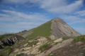
Wild crossing of the Écrins
 73.32 mi
+28,494 ft
-29,314 ft
7 days
73.32 mi
+28,494 ft
-29,314 ft
7 days
 Very difficult
Departure from L'Argentière-la-Bessée (Hautes-Alpes)
Very difficult
Departure from L'Argentière-la-Bessée (Hautes-Alpes)
This 7-day trek is for hikers who are used to camping in tents.Although there are a few refuges along the route, the stages are designed for those who wish to sleep in the heart of nature.The circuit crosses the Écrins massif and offers total immersion in the alpine landscape, where you can encounter local flora and fauna.Ideal for walkers who are used to the mountains, it is a complete adventure that will challenge you with its significant elevation changes and occasional technical or unmarked sections.
Refuge des Fonts de Cervières – Andrea Tornior Bivouac
 9.76 mi
+4,888 ft
-3,291 ft
8h 45
Difficult
Departure from Cervières (Hautes-Alpes)
9.76 mi
+4,888 ft
-3,291 ft
8h 45
Difficult
Departure from Cervières (Hautes-Alpes)
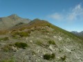
A fairly alpine stage of the Queyras Transfrontière, featuring the ascent of a magnificent 3,000-metre peak: Le Grand Glaiza.
The start of this stage is accessible by car via Cervières on the D902 from Briançon, then the D89T through Cervières.