


 Country:

 City:
City:


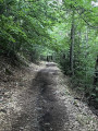
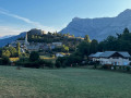
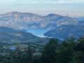
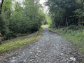
A classic walk starting from the Saint-Jean Montclar resort. Set off from the car park at the resort’s northern exit (44°24'49.3"N 6°21'03.9"E).
(S/E) Take the footpath running alongside the road. When you reach the Chapel of Saint-Jean, carry on straight ahead. Cross the D900 with care.
(1)Take the footpath to the left of the road. At the end of this path, near the Chapel of Saint-Antoine, cross the road carefully again
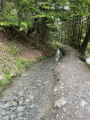
(2) Take the signposted path towards Saint-Vincent-les-Forts. Follow this path, known as the Chemin Vert and marked with red-and-yellow and yellow signposts, all the way to Saint-Vincent-les-Forts.
(3) You’ll come to a fork in the path, which is a shortcut. Continue on to the Quatre Chemins crossroads.
(4) Head straight ahead and continue to the village of Saint-Vincent-les-Forts. You can visit the village and, depending on the day and time, watch the paragliders take off.
(5) Turn roundto return to Les Quatre Chemins.
(4) Follow the path you took on the way there in the opposite direction until you reach the start of a path on the right, the second Chemin Vert.
(3) Take this path after passing through a gate; don’t forget to close it properly. Continue along this path until you reach the road. Stay on level ground, ignoring the paths that branch off to the right and lead downhill.
(6) Cross the D900, taking great care. Keep well to the right of the road, then rejoin the footpath you took on the way there.
(2) Follow the same route back as on the way there to reach the Col Saint-Jean car park (S/E).
 Visorando Member

 Moderate
 Very difficult
