


 Country:

 City:
City:


Start from Saint-Jean-Montclar Station 44°24'49.3"N 6°21'04.2"E, accessible by bus route 68 Marseille–Barcelonnette
(S/E) Take the footpath on the right-hand side of the road, heading north, following the yellow markings. Turn left onto the D207 towards the chapel.
(1) Cross the road at the Col Saint-Jean sign and take the path opposite. Walk uphill, passing houses on your way. You’ll come to a junction.
(2) Take the yellow-marked path on the right. Continue along this path until you reach another junction.
(3) Leave the signposted path and turn left onto a track that climbs through the forest; pass two gates; the slope becomes steep; and you’ll come to another signposted path, which you should follow for a few dozen metres to the right.
(4) Leave this path and continue straight on: there are no markings here again. The path climbs to the hamlet of Clapouse (elevation 1402) then descends to join a wider track and, shortly afterwards, a GRP®-marked path, which you should follow for about fifty metres to the left.
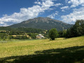
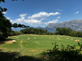
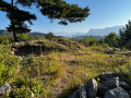
(5) Take a path that heads straight on; it is flat at first but then descends quite steeply through the forest to a bend of almost 180°. You can make a quick detour to a field on the right, which offers a lovely view of the Pic de Morgon.
(6) Continue along this path to a hut. Then turn right and continue down through the forest , before heading back up to reach the Pierre à Sacrifices (information board).
(7) Take the signposted path on the right and leave it shortly afterwards to take a track on the left which goes round Lac de St-Léger, though you never actually catch a glimpse of it! You’ll reach a signposted path coming from Risolet.
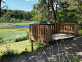
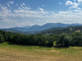
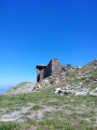
(8) Turn left. Beautiful view of Mount Dormillouse and then of the lake. You’ll reach a road; take the track on the left for a round trip to the new observatory.
(9) Return to the road and turn right onto another track to follow the lake’s edge until you reach a path on the right.
(10) Follow this path, which climbs through the dense, leafy forest and joins another path; follow this to the right. You’ll reach a signposted path coming from the Chapelle Saint-Léger. Take a return trip to the right as far as the chapel.
(11) On the way back, rejoin the yellow-marked path and follow it to the junction of the second circular loop, which you passed on the way out.
(4) Continue straight ahead along the signposted path to the junction of the circular loop, which you also passed on the way out.
(2) Carry on straight ahead, in the opposite direction to the outward journey, until you reach the station (S/E).

 Visorando Member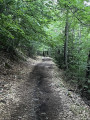

 Moderate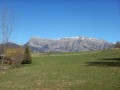
 Very difficult
