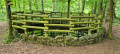
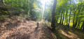
Warndt Forest: Rehbruchweiher and Differten Wildlife Park

A walk that alternates between forest trails and footpaths, with a few points of interest along the way.
The GPX track may prove useful.

Details

n°60917978
Creation:
Last update:
Last review:
  • Walking
    Activity: Walking
  • ↔
    Distance: 8.27 mi
  • ◔
    Average duration: 4h 25 
  • ▲
    Difficulty: Moderate

  • ⚐
    Back to start: Yes
  • ↗
    Ascent: + 719 ft
  • ↘
    Descent: - 692 ft

  • ▲
    Highest point: 909 ft
  • ▼
    Lowest point: 636 ft

Description of the walk

The walk starts at the chapel in Differten. You can park on the street or at the Reiterklause, right next door.

(S/E) With your back to the chapel, turn right onto Zollhausstraße.

(1) At the end of the road, take the path on the right, signposted “Werbelner Geschichte Weg”. Continue straight on, keeping to the edge of the forest.

(2) Take the path on the left, signposted “Saarwanderweg”, which leads to the road. Turn right and walk alongside the road for about 250 metres.

(3) Cross the road at the car parks and continue straight ahead on the signposted path. Turn right at the first junction and keep to the right at the next two.

(4) Leave the signposted path and take a parallel path on the right. Carry on straight ahead at every junction you come to.

(5) At this fork, head down to the left.

(6) Follow a small path to the right which leads to the Rehbruchweiher pond. Start walking round it, going clockwise.

(7) Leave the path round the pond by turning left. Continue to the left at the three-way junction, then follow a straight stretch of path.

(8) Take the steps on the left, continue to the right, and join Völklinger Strasse. Follow it to the right for about a hundred metres.

(9) Cross at the pedestrian crossing, which is a little further on past the petrol station, and stay on Völklinger Strasse.

(10) Walk round the back of the bank and turn right onto Hugenottenstrasse.

(11) Once at the end of the street, carry on straight ahead along the signposted path.

(12) At the three-way junction, turn right, staying on the signposted path.

(13) Leave the signposted path and take the track opposite, which veers slightly to the right.

(14) Turn right at the junction.

(15) Just past the house, take the path leading off to the left to go round the wildlife park.

(16) Turn left to cross the wildlife park.

(17) At the end, turn left to complete the loop, then turn right to return to the original junction.

(15) Turn left to return to the starting point at the chapel (S/E).

Waypoints

  1. S/E : mi 0 - alt. 791 ft - Differten Chapel
  2. 1 : mi 0.35 - alt. 748 ft - Werbelner History Trail
  3. 2 : mi 0.99 - alt. 659 ft - Saarwanderweg
  4. 3 : mi 1.14 - alt. 689 ft - Car parks
  5. 4 : mi 1.42 - alt. 738 ft - End of marked trail
  6. 5 : mi 2.38 - alt. 774 ft - Junction, turn left
  7. 6 : mi 2.52 - alt. 705 ft - Path on the right
  8. 7 : mi 2.75 - alt. 682 ft - Rehbruchweiher
  9. 8 : mi 3.12 - alt. 699 ft - Stairs
  10. 9 : mi 3.31 - alt. 650 ft - Pedestrian crossing
  11. 10 : mi 3.75 - alt. 669 ft - Hugenottenstrasse.
  12. 11 : mi 4.44 - alt. 830 ft - Start of the signposted trail
  13. 12 : mi 5.31 - alt. 873 ft - Three-way junction, turn right
  14. 13 : mi 6.13 - alt. 738 ft - End of marked trail
  15. 14 : mi 7.08 - alt. 837 ft - Junction, turn right
  16. 15 : mi 7.19 - alt. 837 ft - Circular animal park junction
  17. 16 : mi 7.46 - alt. 722 ft - Differten Wildlife Park
  18. 17 : mi 7.7 - alt. 774 ft - On leaving the park, turn left
  19. S/E : mi 8.27 - alt. 791 ft - Differten Chapel

Notes

There are several sheltered picnic areas along the way.

Worth a visit

You can stop for an ice cream in Ludweiler (depending on the day and time).

Reviews and comments

4.2 / 5
Based on 2 reviews

Reliability of the description
4.5 / 5
Ease of following the route
4.5 / 5
Route interest
3.5 / 5
User 30028415

Overall rating : 3.7 / 5

Date of your route : Oct 30, 2026
Reliability of the description : ★★★★☆ Good
Ease of following the route : ★★★★☆ Good
Route interest : ★★★☆☆ Average
Very busy route : No

Part of the route closed due to engineering works
We had to find another route to continue the walk
The stretch through town was too long. It’s a shame – it spoils the walk.

Machine-translated

SCHROEDERVINCENT
SCHROEDERVINCENT

Overall rating : 4.7 / 5

Date of your route : May 05, 2026
Reliability of the description : ★★★★★ Very good
Ease of following the route : ★★★★★ Very good
Route interest : ★★★★☆ Good
Very busy route : No

A lovely walk on 1 May in glorious sunshine.

Machine-translated

Other walks in the area

For more walks, use our search engine .

The GPS track and description are the property of this route's author. Please do not copy them without permission.