Through the Rodenberg and Heidenberg woods from Varsberg

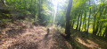
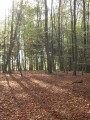
A short walk through the woods of Varsberg. The route can be shortened if necessary.

Details

40134321
Creation:
Last update:
Last review:
  • Walking
    Activity: Walking
  • ↔
    Distance: 3.66 mi
  • ◔
    Average duration: 1h 55 
  • ▲
    Difficulty: Easy

  • ⚐
    Back to start: Yes
  • ↗
    Ascent: + 299 ft
  • ↘
    Descent: - 312 ft

  • ▲
    Highest point: 1,073 ft
  • ▼
    Lowest point: 758 ft

Photos

Description of the walk

Park in the car park by the town hall.

(S/E) Set off along Rue des Jardins, turn left onto the second track and take the path that climbs, skirting a meadow, towards the statue of the Virgin Mary.

(1) Continue south-west until you reach the junction.

(2) Go straight on into the Bois du Heidenberg and exit at a crossroads (elevation 315).

(3) Turn left, heading east, and begin a lovely descent to a track.

(4) At the bottom, turn right and head south for 300 m until you reach a crossroads (elevation 248).

(5) Head east, passing through a deforested area. Then turn off northwards. Follow the path straight on through the Bois du Rodenberg until you reach a Fork in the road.

(6) Turn left, north-west, then due west, and leave the woods.

(7) At the next junction (bench, cross), turn right (north). Enter the village and continue straight on along Rue de Boucheporn until you reach the car park (S/E).


Waypoints

  1. S/E : mi 0 - alt. 787 ft - Town Hall car park
  2. 1 : mi 0.22 - alt. 928 ft - Statue of the Virgin Mary
  3. 2 : mi 0.63 - alt. 925 ft - Junction
  4. 3 : mi 1.38 - alt. 1,033 ft - Crossroads
  5. 4 : mi 1.8 - alt. 807 ft - Junction
  6. 5 : mi 2.01 - alt. 817 ft - Crossroads
  7. 6 : mi 2.82 - alt. 807 ft - T-junction
  8. 7 : mi 3.16 - alt. 787 ft - Crossroads
  9. S/E : mi 3.66 - alt. 787 ft - Town Hall car park

Notes

Two fairly steep climbs.

Worth a visit

(1) Statue of the Virgin Mary

Reviews and comments

4.7 / 5
Based on 2 reviews

Reliability of the description
5 / 5
Ease of following the route
5 / 5
Route interest
4 / 5
MmtAkh
MmtAkh

Overall rating : 4.3 / 5

Date of your route : Jul 28, 2025
Reliability of the description : ★★★★★ Very good
Ease of following the route : ★★★★★ Very good
Route interest : ★★★☆☆ Average
Very busy route : No

A well-marked route, mostly through woodland. I was swarmed by horseflies on the walk and had to fight hard to avoid being bitten.

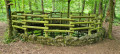
Please note that the first part of the walk is technically off-limits due to fallen trees. Once you’re at the car park, I’d advise heading up to the left towards the statue – there are concrete steps and a green railing, if I remember correctly – to avoid the off-limits area.

Machine-translated

Valelind57
Valelind57
• Edited:

Overall rating : 5 / 5

Date of your route : Mar 17, 2024
Reliability of the description : ★★★★★ Very good
Ease of following the route : ★★★★★ Very good
Route interest : ★★★★★ Very good
Very busy route : No

The climbs are quite long and steep if you’re planning to do this route with children. It’s great because you can shorten the route if needed, and the paths are very clearly marked – you can’t go wrong. 👍

Machine-translated

Other walks in the area

For more walks, use our search engine .

The GPS track and description are the property of this route's author. Please do not copy them without permission.