


Refine your search for walks in Fontaine des Gabets
Fontaine des Gabets walks


 From Pas de l'Ours to La Molière from Autrans
 Visorando Member
 7.69 mi
 +2,359 ft
 -2,359 ft
 5h 35
5h 35
 Average
 Departure from Autrans (Isère)
From the hamlet of Le Truc at the north-eastern entrance to the village of Autrans, you can access La Molière mountain and discover the Isère valley and the city of Grenoble through a gap in the mountain. Higher up, you will see all the mountains surrounding Grenoble and its region. Don't look for the "pas" (step) of the bear as a paw print because, here as is often the case in the mountains, "pas" is a diminutive of "passage" (passage).
Walks near Fontaine des Gabets
Crossing the Vercors from Engins to Saint-Gervais
21.71 mi
+5,394 ft
-7,323 ft
14h 40
 Extremely difficult
Departure from Engins (Isère)
Extremely difficult
Departure from Engins (Isère)
This traverse of the northern Vercors links Engins to Saint-Gervais from east to west, passing over three peaks and through particularly wild sections. The route offers a wonderful variety of landscapes, ranging from forests to mountain pastures and the ridges typical of the Vercors. The higher ground offers stunning views over the Isère valley, the Chartreuse and the surrounding Alpine massifs. The route alternates between open stretches and more wooded sections, some of which are very remote.
⚠️ This route is intended solely for experienced and well-trained walkers. A GPX track is essential. See practical information.
 Saint-Nizier-du-Moucherotte – Lans-en-Vercors
 6.55 mi
+2,425 ft
-1,686 ft
6 hrs
Average
Departure from Saint-Nizier-du-Moucherotte (Isère)
6.55 mi
+2,425 ft
-1,686 ft
6 hrs
Average
Departure from Saint-Nizier-du-Moucherotte (Isère)
Following theGR®9route connects Saint-Nizier-du-Moucherotte to the Lans-en-Vercors Ski Centre via Moucherotte. Two vehicles are required.
Saint-Nizier-du-Moucherotte - Cabane de Roybon
 12.38 mi
+4,573 ft
-3,652 ft
9h 40
12.38 mi
+4,573 ft
-3,652 ft
9h 40
 Difficult
Departure from Saint-Nizier-du-Moucherotte (Isère)
Difficult
Departure from Saint-Nizier-du-Moucherotte (Isère)
First stage of the circular route from Saint Nizier to Corrençon en Vercors, with a stop at the Cabane de Roybon below the Col Vert.Whilst the first part is easy, the section between Col de l’Arc and Col Vertis challenging, with sections over a sheer drop!Take great care.
Saint-Nizier-du-Moucherotte - La Fauge Shelter
 12.21 mi
+2,526 ft
-2,070 ft
7h 50
Difficult
Departure from Saint-Nizier-du-Moucherotte (Isère)
12.21 mi
+2,526 ft
-2,070 ft
7h 50
Difficult
Departure from Saint-Nizier-du-Moucherotte (Isère)
The second stage of the Vercors crossing, offering stunning views of the Vercors villages.
The Molière Plateau
 8.44 mi
+1,604 ft
-1,621 ft
5 hrs
Average
Departure from Autrans (Isère)
8.44 mi
+1,604 ft
-1,621 ft
5 hrs
Average
Departure from Autrans (Isère)
A winter snowshoe hike through magnificent landscapes, offering stunning views in unspoilt, peaceful natural surroundings.
Pic Saint-Michel via the Vertige des Cimes
6.58 mi
+2,110 ft
-2,474 ft
4h 50
Average
Departure from Lans-en-Vercors (Isère)
A very classic route that takes you to four remarkable viewpoints in succession, offering views of Grenoble and its valley, as well as the Vercors plateau, the Rocher de l’Ours and the Roc Cornafion. It’s a hike you should do at least once if you’re in the area.
Ideally, you should take two cars up and leave one at the finish, which is at the Parking des Barnets, two hairpin bends below the start point at the Lans-en-Vercors resort.
From Sassenage to Noyarey on the slopes of the Vercors
 3.77 mi
+1,125 ft
-1,119 ft
2h 45
Average
Departure from Sassenage (Isère)
3.77 mi
+1,125 ft
-1,119 ft
2h 45
Average
Departure from Sassenage (Isère)
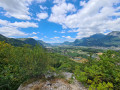
This exploratory hike along the paths on the northern flank of the Vercors should be treated as a training session if it is cold higher up. There are three viewpoints, two of which have been developed.
That said, the constant change in gradient along this route is sure to please any hiker or runner hoping to tackle the drovers' road leading to the Sornin plateau at a later date.
This walk is only enjoyable in dry weather, as the slopes become slippery after rain.
Malleval-en-Vercors – Rencurel (Les Rimets)
 8.39 mi
+2,156 ft
-1,896 ft
5h 45
Average
Departure from Malleval-en-Vercors (Isère)
8.39 mi
+2,156 ft
-1,896 ft
5h 45
Average
Departure from Malleval-en-Vercors (Isère)
Stage2 of the Tour des Coulmes.
This is the longest stage and the one with the steepest gradient.
The final section takes place entirely through woodland.
Fountain - Saint-Nizier-du-Moucherotte
 6.11 mi
+3,196 ft
-49 ft
5h 35
Average
Departure from Seyssinet-Pariset (Isère)
6.11 mi
+3,196 ft
-49 ft
5h 35
Average
Departure from Seyssinet-Pariset (Isère)
This first stage takes you on an assault on the Vercors, gradually leaving the urban environment behind you.
5-day crossing of the Vercors from Grenoble to Châtillon-en-Diois
 54.45 mi
+10,722 ft
-9,469 ft
5 days
Difficult
Departure from Seyssinet-Pariset (Isère)
54.45 mi
+10,722 ft
-9,469 ft
5 days
Difficult
Departure from Seyssinet-Pariset (Isère)
This is a trek across the Vercors via the high plateaus, the wildest and most unspoilt part of the Vercors.
From the north to the south of the Vercors, an 88km hike through spectacular landscapes. You’ll be camping in tents or in the various shelters lining theGR®.