The Northern Ridges of the Vercors from Autrans to Méaudre

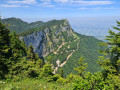
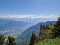
A long, day-long hike that takes you along the northern ridges and high above the cliffs. The first section offers some stunning views. Make arrangements for accommodation for the night as the finish point is different from the starting point. The following day, another route will take you back to your car.
Best undertaken from spring onwards, once the snow has melted.

Details

n°2130380
Creation:
Last update:
Last review:
  • Walking
    Activity: Walking
  • ↔
    Distance: 13.60 mi
  • ◔
    Average duration: 9h 00 
  • ▲
    Difficulty: Difficult

  • ⚐
    Back to start: No
  • ↗
    Ascent: + 3,143 ft
  • ↘
    Descent: - 4,117 ft

  • ▲
    Highest point: 5,348 ft
  • ▼
    Lowest point: 3,255 ft

Photos

Description of the walk

Park in the car park at the La Sure ski resort, north of Autrans.

(S) Head towards the ski slopes to the east and climb the Red run. It’s advisable to zigzag as it’s quite steep; continuing in an east-north-easterly direction, join theGR®9and follow it to the left to reach the summit of La Sure.

(1) Turn left again to follow thisGR® trail, keeping clear of the cliffs, to reach the summit of La Buffe.

(2) Then head due west to reach the Grande Brêche. Turn left towards the south, but stay on the red and white-markedGR® trail. Turn west again to reach the Pas de la Clé, a major junction of paths.

(3) Stay on theGR® heading west, skirting the Clé rocks. Pass the Pas Brochier to reach the westernmost point of this ridge, known as the Bec de l’Orient.

(4) Continue south, keeping a distance from the cliffs, until you finish skirting them as you reach the Signal de Nave.

(5) Turn left, still on theGR®, which then follows the Sentier de Pierre Taillée. Begin a very gentle descent across the terrain. Ignore the path on the right leading to the Pas de Montbrand. Cut across the track to pass by Font Renard. The descent becomes steeper as you reach the crossroads of paths above the Nave clearings.

(6) Stay on theGR® to the right, which is now almost level, to reach the Source des Plagneux.

(7) Here, first turn left then right, follow the edge of the woodland and rejoin theGRP® for the Tour des Quatre Montagnes at the junction. Leave theGR® and follow theGRP® to the left for a few metres until you reach the Blanc Brude junction.

(8) Here, leave theGRP® and turn right onto the small road that passes through the hamlets of Les Tranchants, Les Gonnets, La Truite, Les Eymes, Cochet and Les Farlaix. Head to the car park at Méaudre resort, where you’ll find the Domaine des Mateaux accommodation on your left (E).

Waypoints

  1. S : mi 0 - alt. 4,249 ft - Car park at La Sure, north of Autrans
  2. 1 : mi 1.36 - alt. 5,315 ft - Pointe de la Sure
  3. 2 : mi 2.4 - alt. 5,240 ft - La Buffe
  4. 3 : mi 3.64 - alt. 4,954 ft - Pas de la Clé 1,509m
  5. 4 : mi 4.77 - alt. 5,085 ft - Bec de l’Orient
  6. 5 : mi 5.76 - alt. 5,207 ft - Nave signpost
  7. 6 : mi 8.41 - alt. 3,822 ft - Crossroads at the Nave clearing
  8. 7 : mi 9.31 - alt. 3,724 ft - Source des Plagneux
  9. 8 : mi 10.42 - alt. 3,337 ft - Blanc Brude
  10. E : mi 13.6 - alt. 3,268 ft - Domaine des Mateaux

Notes

In spring, be sure to pack warm clothes as it’s cool in the morning at an altitude of 1,000 metres (5 to 10 degrees). The northern section of the ridge is often quite windy. Make sure you wrap up warm depending on the date of your hike. However, during the day, bring a cap, sunglasses and sun cream.
At least 2 litres of water.
A 30-litre rucksack.
The following day, do the ‘Les Crêtes Est du Vercors’ walk from Méaudre to Autrans to get back to your car.

This route passes through multiple protected areas, which may be subject to special regulations:

Worth a visit

For accommodation in Méaudre, Le Domaine des Mateaux is excellent.
The three of us stayed in a four-bed room (two bunk beds) with very comfortable beds and one bathroom.
Half-board: the evening meal was very good and very generous. A small beer in the lounge on arrival. Breakfast was very good.
The scenery along the ridges is wonderful, often through woodland.

Always be cautious and plan ahead when you're outdoors. Visorando and the author of this route cannot be held responsible for any accidents occurring on this route.

The GR® and PR® markings are the intellectual property of the Fédération Française de Randonnée Pédestre.

Reviews and comments

4.7 / 5
Based on 1 review

Reliability of the description
5 / 5
Ease of following the route
4 / 5
Route interest
5 / 5
oponcin
oponcin

Overall rating : 4.7 / 5

Date of your route : May 17, 2025
Reliability of the description : ★★★★★ Very good
Ease of following the route : ★★★★☆ Good
Route interest : ★★★★★ Very good
Very busy route : No

Hike limited to the north ridge from point 4 to 7 in a loop
In pictures: https://youtu.be/uWe25BI-E1A?si=BkqhK49D...
Superb views at various points along the route

Machine-translated

Other walks in the area

For more walks, use our search engine .

The GPS track and description are the property of this route's author. Please do not copy them without permission.