Refine your search for walks in Bez ou Bès (rivière) à finaliser
Bez ou Bès (rivière) à finaliser walks


 Foot of Glandasse via the Marateste
 Visorando Member
 4.68 mi
 +1,506 ft
 -1,503 ft
 3h 30
3h 30
 Moderate
 Departure from Châtillon-en-Diois (Drôme)
At the foot of Montagne du Glandasse, I recommend a lovely walk in the hills above Châtillon-en-Diois.
From Châtillon-en-Diois to Ravel-et-Ferriers via the six passes
 11.58 mi
+4,177 ft
-4,173 ft
9h 00
11.58 mi
+4,177 ft
-4,173 ft
9h 00
 Difficult
Departure from Châtillon-en-Diois (Drôme)
Difficult
Departure from Châtillon-en-Diois (Drôme)
The aim of this hike is to follow a good circular route from Châtillon-en-Diois to the hamlets of Ravel-et-Ferrier, then return via Serre Chanuit (1,430m), crossing six passes in the process, including the Col du Pinet.
Three walks in one, around Châtillon-en-Diois
4.11 mi
+489 ft
-489 ft
2h 20
 Easy
Departure from Menglon (Drôme)
Easy
Departure from Menglon (Drôme)
A series of very easy circular walks around and through Châtillon-en-Diois, offering a wide variety of scenery:
- a geological discovery trail running alongside the River Bès,
- a stroll through the narrow streets of the old village,
- a short walk towards the Adoux Waterfall and the Giono Forest.
Montagne de Glandasse, long circular loop
 23.36 mi
+6,450 ft
-6,450 ft
12 hrs
23.36 mi
+6,450 ft
-6,450 ft
12 hrs
 Very difficult
Departure from Châtillon-en-Diois (Drôme)
Very difficult
Departure from Châtillon-en-Diois (Drôme)
A long circular walk starting from the picturesque Mediterranean village of Châtillon-en-Diois. Fabulous scenery over the Glandasse and the Vercors High Plateaus, with a bit of a challenge when it comes to navigation. It is possible to spread the walk over two days by stopping for the night near the magnificent Pas de l’Aiguille.
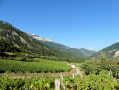
Short walk along the paths of the Châtillon-en-Diois vineyards
 2.98 mi
+207 ft
-207 ft
1h 35
Easy
Departure from Châtillon-en-Diois (Drôme)
2.98 mi
+207 ft
-207 ft
1h 35
Easy
Departure from Châtillon-en-Diois (Drôme)
I suggest you try this lovely route through the vineyards of Châtillon-en-Diois, taking in some beautiful views (notably Pié de Bœuf, Glandasse, Piémard and La Grésière).
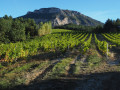
Châtillon-en-Diois (Le Beffroi) – Die (SNCF station), through the vineyards
 11.32 mi
+541 ft
-1,152 ft
5h 40
Moderate
Departure from Châtillon-en-Diois (Drôme)
11.32 mi
+541 ft
-1,152 ft
5h 40
Moderate
Departure from Châtillon-en-Diois (Drôme)
This lovely walk allows visitors staying in Châtillon-en-Diois to reach Die on foot, passing through vineyards and walnut groves situated in the foothills of the Glandasse, the southern outcrop of the Vercors overlooking the Drôme valley and the Baronnies.
The route allows time to appreciate the uniformity of this geographical landscape, which characterises the upper Drôme and its tributary, the Bez.
Walks near Bez ou Bès (rivière) à finaliser
Les Amayères - La Jarjatte
8.55 mi
+2,805 ft
-2,762 ft
6h 20
Moderate
Departure from Lus-la-Croix-Haute (Drôme)
Discover a beautiful peak on the border between Trièves and Le Dévoluy, Pointe Feuillette.
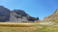
La Jarjatte - Lachaup
 8.40 mi
+3,140 ft
-2,434 ft
6h 35
Difficult
Departure from Lus-la-Croix-Haute (Drôme)
8.40 mi
+3,140 ft
-2,434 ft
6h 35
Difficult
Departure from Lus-la-Croix-Haute (Drôme)
This link via the Col des Aiguilles involves an ascent facing the Aiguilles de Lus. The descent into the wild Aiguilles valley offers a glimpse of the slopes of the Joue du Loup resort.
From the Cabane de l’Essaure to Clelles station
 Association / Club / Walk leader
 5.54 mi
+174 ft
-2,858 ft
2h 40
Easy
Departure from Treschenu-Creyers (Drôme)
5.54 mi
+174 ft
-2,858 ft
2h 40
Easy
Departure from Treschenu-Creyers (Drôme)
The fourth and final stage of the Vercors crossing. We leave the plateau to descend via Chichilianne to the foot of Mont Aiguille. Choosing Clelles station as the end point for this crossing means you can do the whole thing from Grenoble, but it’s of course possible to arrange for a car to be waiting in Chichilianne before setting off.
Col des Aiguilles - Return circular via Le Chauvet
 7.94 mi
+2,743 ft
-2,723 ft
6h 00
Difficult
Departure from Agnières-en-Dévoluy (Hautes-Alpes)
7.94 mi
+2,743 ft
-2,723 ft
6h 00
Difficult
Departure from Agnières-en-Dévoluy (Hautes-Alpes)
Most of the route follows theGRP® Tour du Dévoluy trail markedGR®94.
For the return journey, rather than going back the same way, you can vary the route by returning via Small Pass and Le Charvet. This is an off-trail route.
This alternative route must be taken in good visibility and requires the ability to use a map and compass, which is essential for off-trail hiking.
The view from Le Chauvet over Le Dévoluy is magnificent.
Lachaup – Les Amayères
 12.04 mi
+4,262 ft
-5,033 ft
9h 15
Difficult
Departure from Agnières-en-Dévoluy (Hautes-Alpes)
12.04 mi
+4,262 ft
-5,033 ft
9h 15
Difficult
Departure from Agnières-en-Dévoluy (Hautes-Alpes)
Through the Charnier valley at the foot of the Grand Ferrand, then via Pointe Feuillette, the final stage of this route.
Chichilianne - Bénevise via the Pas de l'Essaure and the Vallon Combau
 8.98 mi
+2,365 ft
-2,254 ft
6h 10
Difficult
Departure from Chichilianne (Isère)
8.98 mi
+2,365 ft
-2,254 ft
6h 10
Difficult
Departure from Chichilianne (Isère)
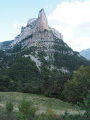
This beautiful hike takes you to the Hauts Plateaux du Vercors National Nature Reserve via the Pas de l'Essaure, then down the Drôme side through one of the most beautiful sites in the Vercors, the Vallon Combau, before reaching the hamlet of Bénevise on a promontory.It offers beautiful views of Mont Aiguille, the valley and the Combau rock, a feast for the senses, combined with the historical, geological, botanical and faunal riches of the area you are crossing.
From Chichilianne to Clelles-Mens station
 3.14 mi
+161 ft
-646 ft
1h 35
Easy
Departure from Chichilianne (Isère)
3.14 mi
+161 ft
-646 ft
1h 35
Easy
Departure from Chichilianne (Isère)
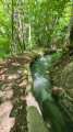
Chichilianne is a treasure trove of hikes towards the Vercors plateau. Once finished, some people take the train which stops at Clelles. But few hikers know that you can set off from Chichilianne or La Richardière and reach Clelles station in under two hours, walking alongside an irrigation canal for nearly three kilometres. This return walk to Clelles can also be taken in the opposite direction when you start your journey.