Mont Barral

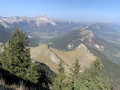
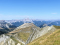
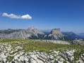
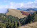
A lovely little walk with magnificent views from the summit.

Details

53011
Creation:
Last update:
Last review:
  • Walking
    Activity: Walking
  • ↔
    Distance: 2.78 mi
  • ◔
    Average duration: 2h 40 
  • ▲
    Difficulty: Moderate

  • ⚐
    Back to start: Yes
  • ↗
    Ascent: + 1,601 ft
  • ↘
    Descent: - 1,601 ft

  • ▲
    Highest point: 6,230 ft
  • ▼
    Lowest point: 4,629 ft

Photos

Description of the walk

By car, head to the Col de Menée and park before the tunnel if you’re coming from the Chichilianne side

(S/E) Take the path that branches off to the right of the road and leads to the top of the tunnel.

(1) From there, take the path on the left which climbs through the meadow and then through woodland. After about a quarter of an hour, you’ll reach another meadow and a fork in the path.

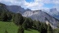
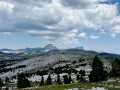
(2) Take the path on the right. The climb continues through woodland on a gentle slope. After another meadow, the slope becomes steeper, and the path now climbs along the hillside, sometimes through woodland and sometimes in open country.

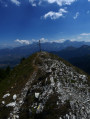
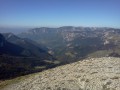
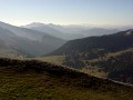
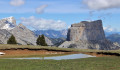
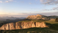
As you approach the summit, the view opens up completely, taking in the Diois, the Vercors and the Trièves. To reach the summit, follow the markings and cairns.

(3) All that remains is to enjoy the panoramic view and head back down the same path you came up via to the Col de Menée car park (S/E).

Waypoints

  1. S/E : mi 0 - alt. 4,629 ft - Car park before the Col de Menée tunnel - Col de Menée
  2. 1 : mi 0.12 - alt. 4,783 ft - Col de Menée
  3. 2 : mi 0.4 - alt. 5,052 ft - Turn right (outward journey) and left (return journey)
  4. 3 : mi 1.39 - alt. 6,224 ft - Summit of Mont Barral - Mont Barral
  5. S/E : mi 2.78 - alt. 4,629 ft - Car park before the Col de Menée tunnel - Col de Menée

Notes

There are no water sources or shelters.

Reviews and comments

4.6 / 5
Based on 3 reviews

Reliability of the description
4.3 / 5
Ease of following the route
4.3 / 5
Route interest
5 / 5
bernardino
bernardino ★

Patous or not Patous, sheep or not sheep, flocks or not flocks, walkers or not walkers?
These are interesting questions, and everyone has their own answer.
As for the Patous – normally, and I do mean normally – there’s often a green sign at the start of many walks warning of the presence of these large dogs. Hikers are then warned, and it’s up to them to decide whether or not to set off on these routes.
Next, what should you do in your situation? Why not contact the police? The mayor is also an option, as are no doubt other public bodies.
As for the dog’s unpredictable behaviour, you must also bear in mind that it is simply doing its job as a guard dog and cannot tell whether a hiker is a friend or a foe.
But I fully sympathise with the stress you must have felt in this situation.
All the best, and enjoy your future hikes.

Machine-translated

pepesquat
pepesquat

Overall rating : 5 / 5

Date of your route : Jul 18, 2018
Reliability of the description : ★★★★★ Very good
Ease of following the route : ★★★★★ Very good
Route interest : ★★★★★ Very good

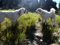
The only problem – and it was a big one – was the Patous! I found myself surrounded by 10 Patous guarding sheep on the slopes of Mount Barral! They were all very agitated and menacing! They were coming at me from all sides, barking! One of them got right behind me! I’d placed my walking stick just behind me to protect myself, and he even bit it! I tried to calm the dogs down with words, whistles, then with firmer commands like: ‘Down!’ and finally I managed to get past! But no shepherds??? Where were they? I came across several other people who’d had the same problem, but with just four dogs – so imagine what it was like for me with ten! What should you do? Call the police? Where, and in which municipality? Anyway, be very careful – these dogs can be unpredictable at times!

Machine-translated

petitspas26
petitspas26

Overall rating : 4.3 / 5

Date of your route : Sep 03, 2016
Reliability of the description : ★★★★☆ Good
Ease of following the route : ★★★★☆ Good
Route interest : ★★★★★ Very good

We carried on as far as Le Jocou: allow about 6 hours for the round trip from the start of the walk – it’s a very, very steep climb (and consequently a very steep descent) – but it’s definitely worth it if you’ve got time to spare!

Machine-translated

Bernard.G
Bernard.G

Overall rating : 4.3 / 5

Date of your route : Oct 05, 2014
Reliability of the description : ★★★★☆ Good
Ease of following the route : ★★★★☆ Good
Route interest : ★★★★★ Very good

A lovely walk.
We opted for a circular route, passing through the meadow, climbing up to the ridge, admiring the rather superb scenery and ‘climbing’ to the summit, then heading back down the path and through the forest
The “climb” is quite steep but well worth the effort.
The vultures kept us company throughout the walk.
The descent is quite slippery… it’s best to do this walk in dry weather.

Machine-translated

Other walks in the area

For more walks, use our search engine .

The GPS track and description are the property of this route's author. Please do not copy them without permission.