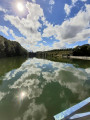
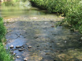
In the countryside around Hantes-Wihéries

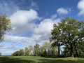
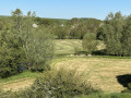
This walk will take you on a tour of the village of Hantes-Wihéries and the surrounding countryside. The route offers beautiful panoramic views of the Hantes valley and the village. It is a mixed route combining farm tracks and small village roads.

Details

13724053
Creation:
Last update:
Last review:
  • Walking
    Activity: Walking
  • ↔
    Distance: 8.70 mi
  • ◔
    Average duration: 4h 15 
  • ▲
    Difficulty: Moderate

  • ⚐
    Back to start: Yes
  • ↗
    Ascent: + 259 ft
  • ↘
    Descent: - 279 ft

  • ▲
    Highest point: 551 ft
  • ▼
    Lowest point: 397 ft

Photos

Description of the walk

The starting point of the walk is on Place Robaulx.

(S/E) With your back to the gate of Robaulx Castle, take the street to the right. At the junction with Rue du Jeu de Balle, turn left. Turn left into Rue des Fontaines and walk past the old buildings of the ‘ferme d’en-bas’ and Château Lengrand.

(1) Opposite the village church, turn right onto Rue d’en-Bas and follow it straight on until you reach Route de Thuin.

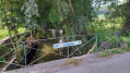
(2) Turn left, cross the bridge over the Hantes and you’ll come to a junction.

(3) On the left, take the dirt track and, after the bridge, continue left onto the old Chimay track. Wind your way through the fields to reach Rue de Wihéries.
At the fork, turn right and carry on for 100 m.

(4) Turn left onto the road that descends steeply. Cross the River Hantes again and pass close to the restaurant: Le Grand Pré. Carry on through the hamlet, which consists of houses built from local stone.

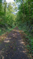
(5) Just past a farm building, take the sharp right-hand bend onto a narrow path. This is a former local tramway track. Continue across the meadows and then through the woods until you reach the road.

(6) At the junction, turn left. At the top of the hill, take the farm track on the left and continue across the fields until you reach a junction.

(7) Take the hairpin bend to the right and carry on south-east until you reach a cross-road.

(8) Turn right, cross the woodland and continue along the path, winding its way through fields and meadows.

(9) At the junction with the Chemin de la Drève, turn left. The road first descends steeply before climbing again, passing a few houses in the village of Montignies-Saint-Christophe. At the top of the hill, turn left onto the farm track and continue across the fields.

(10) Just past a solitary tree, at the crossroads, turn left onto theGR® 125-129 long-distance footpath.
At a place called Chapelle Berteaux, at the junction formed by the farm tracks, carry straight on to head down towards the village of Hantes-Wihéries.

(11) Turn left onto the small path running alongside a stone wall, then turn right to reach the Place du Jeu de Balle.

(12) At the crossroads, turn left and head downhill alongside the houses.

(13) A little further down from the junction with Rue Wez Gobeau, turn right to continue along the old tram line. Walk alongside the River Hantes. At the pétanque court, turn right towards the houses. At the junction with Rue de l’Église, turn right then immediately left to head back up Rue Chêneau.

(14) At the top of the street, turn left onto Rue du Jeu de Balle. Take the first left to return to the starting point at Place Robaulx (S/E).

Waypoints

  1. S/E : mi 0 - alt. 456 ft - Place Robaulx - Chateau Robaulx
  2. 1 : mi 0.37 - alt. 453 ft - Église Saint-Rémi (Hantes-Wihéries)
  3. 2 : mi 0.68 - alt. 420 ft - Rue d’En Bas x Route de Thuin - Hantes (rivière)
  4. 3 : mi 0.82 - alt. 400 ft - Farm track junction
  5. 4 : mi 2.1 - alt. 509 ft - Rue du Grand Pré junction
  6. 5 : mi 2.78 - alt. 466 ft - Tram track junction
  7. 6 : mi 3.33 - alt. 449 ft - Route Sainte-Anne junction
  8. 7 : mi 3.94 - alt. 492 ft - Farm track junction
  9. 8 : mi 4.54 - alt. 505 ft - Farm track junction
  10. 9 : mi 5.43 - alt. 515 ft - Chemin de la Drève junction
  11. 10 : mi 6.23 - alt. 545 ft - GR junction
  12. 11 : mi 7.9 - alt. 459 ft - Path junction
  13. 12 : mi 8.09 - alt. 459 ft - Place du Jeu de Balle
  14. 13 : mi 8.17 - alt. 430 ft - Tram track junction
  15. 14 : mi 8.54 - alt. 459 ft - Rue du Jeu de Balle junction
  16. S/E : mi 8.7 - alt. 456 ft - Place Robaulx

Notes

Parking is easy at Place Robaulx.

Worth a visit

For information on the history and heritage of Hantes-Wihéries, see here.

Always be cautious and plan ahead when you're outdoors. Visorando and the author of this route cannot be held responsible for any accidents occurring on this route.

The GR® and PR® markings are the intellectual property of the Fédération Française de Randonnée Pédestre.

Reviews and comments

4.5 / 5
Based on 2 reviews

Reliability of the description
5 / 5
Ease of following the route
5 / 5
Route interest
3.5 / 5
ArinaTomberg
ArinaTomberg

Overall rating : 4.3 / 5

Date of your route : Oct 22, 2022
Reliability of the description : ★★★★★ Very good
Ease of following the route : ★★★★★ Very good
Route interest : ★★★☆☆ Average
Very busy route : No

A lovely walk with picturesque views of the fields.

Machine-translated

etx61
etx61

Overall rating : 4.7 / 5

Date of your route : Sep 22, 2021
Reliability of the description : ★★★★★ Very good
Ease of following the route : ★★★★★ Very good
Route interest : ★★★★☆ Good
Very busy route : No

A lovely walk on Wednesday 22 September 2021 – a sunny day
The description was absolutely spot on.
Wide open spaces, varied crops, lovely views.
Villages and hamlets.
A real breath of fresh air.
A small wood halfway along the route for a lunch break and to set up the hammock for a nap accompanied by the sounds of birdsong.

Machine-translated

Other walks in the area

For more walks, use our search engine .

The GPS track and description are the property of this route's author. Please do not copy them without permission.