Amidst vineyards and church spires, starting from Charmes

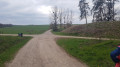
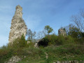
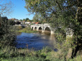
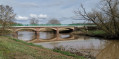
A scenic trail offering magnificent views of the Moselle Valley, the blue ridge of the Vosges, the Hill of Sion and the Saintois region. There are also many cultural and natural attractions to discover: churches, wash houses, fountains, the Canal de l’Est, ponds and the Moselle.

Details

34859736
Creation:
Last update:
Last review:
  • Walking
    Activity: Walking
  • ↔
    Distance: 10.00 mi
  • ◔
    Average duration: 5h 10 
  • ▲
    Difficulty: Moderate

  • ⚐
    Back to start: Yes
  • ↗
    Ascent: + 676 ft
  • ↘
    Descent: - 673 ft

  • ▲
    Highest point: 1,247 ft
  • ▼
    Lowest point: 863 ft

Description of the walk

From Épinal, take the N57 towards Nancy and leave it at the Charmes junction. Park at the “Les Îles” campsite or in the car park on Rue du Patis near the crossroads in Charmes.

Signposting: Yellow Rectangle on a grey background along the entire route

(S/E) Setting off from the Charmes campsite, head west and follow the Canal de l’Est. Pass through a lock to reach the junction marking the start of the circular route.

(1) Carry on straight ahead. Pass close to a shooting range, go past the first bridge to reach the second one at the Étangs du Pâquis (lock) at a T-junction.

(2) Turn left; further on, cross the D157 with care and take Rue Principale to pass through the village of Socourt. Continue straight on at the junction in the centre of the village, pass the town hall, leave Rue de Verdun on your right and take the next street (Rue de Viacelle) for 100 m until you reach a Y-junction.

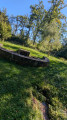
(3) Head up the slope to the left along Chemin des Vignes, which leads up to the higher parts of the village. Enjoy a magnificent view of the Moselle valley, the Canal de l’Est and the neighbouring villages. Continue for 500 m, gradually discovering the surrounding countryside, with its local flora and fauna well worth admiring. You’ll come to a road.

(4) Take the road opposite and carry on straight ahead until you reach another track (Route d’Hergugney) to join the N 57.

(5) After passing under the N 57, turn left and continue along the track for about 300 metres.

(6) Turn right twice. Continue down the road until you reach a four-way junction.

(7) Carry on straight ahead along the road (Rue Saint-Romaric). Pass the Croix Saint-Romaric on your left just before Avrainville. As you enter the village, do take a moment to admire the fountains and old farmhouses. Go past the church and the cemetery until you reach a junction. Turn right, then immediately left onto Rue Eugène Jeandin, with the town hall on your right.

(8) Take this road towards Florémont, a charming village built on the hillside. Continue straight on for 1.5 km (there is only one junction: go straight on) until you reach a stony track which forms part ofthe GR®507(second junction).

(9) Follow the red and white markings ofthe GR®507, heading straight on. Continue straight ahead until you reach the next street (Rue Croix Vincent). Follow this street until you reach the first buildings in Florémont.

(10) Turn left to stay on the street, continuing straight ahead and ignoring all paths to the right and left until you reach Rue du Saulcy (on the left).

(11) Take the street opposite, which leads to a stony track for 600 m before reaching a junction.

(12) Turn right, then left, continuing to follow theGR®507. 50 m further on, carry straight on until you approach the N 57.

(13) Take the Chemin des Coteaux and pass under the N 57. Continue straight on, following theGR®507signposts. After carefully crossing the D157a, turn right onto a footpath. At the end of the path, turn left onto Rue des Bretonnes and follow it to the end, then turn right onto the D157 until you reach the next junction in Charmes.

(14) Turn left and carry on straight ahead along Rue de l’Écluse, crossing the Canal de l’Est to rejoin the starting point of the circular route.

(1) Turn right to return to the starting point (S/E).

Waypoints

  1. S/E : mi 0 - alt. 879 ft - Car park at Les Iles campsite - Moselle (la)
  2. 1 : mi 0.16 - alt. 892 ft - Junction at the start of the circular loop - Canal de l'Est
  3. 2 : mi 2.07 - alt. 873 ft - Étang du Pâquis
  4. 3 : mi 2.87 - alt. 896 ft - Chemin des Vignes
  5. 4 : mi 3.27 - alt. 1,096 ft - Crossroads
  6. 5 : mi 3.7 - alt. 1,230 ft - RN57
  7. 6 : mi 3.88 - alt. 1,234 ft - Turn off to the right
  8. 7 : mi 4.98 - alt. 978 ft - Crossroads of four paths
  9. 8 : mi 5.61 - alt. 892 ft - Rue Eugène Jeandin
  10. 9 : mi 6.66 - alt. 994 ft - GR507
  11. 10 : mi 7.54 - alt. 1,056 ft - The first buildings in Florémont
  12. 11 : mi 7.85 - alt. 1,027 ft - Rue du Saulcy
  13. 12 : mi 8.21 - alt. 1,066 ft - Junction
  14. 13 : mi 8.63 - alt. 935 ft - RN57
  15. 14 : mi 9.69 - alt. 886 ft - Charmes
  16. S/E : mi 10 - alt. 879 ft - Car park at Les Iles campsite - Moselle (la)

Notes

Thank you to the FRPP for organising this walk and for the work carried out by its teams throughout the year to signpost and maintain these paths.

This circular trail can be started from various points: the car park at Les Iles campsite in Charmes, the car park at the Socourt community hall (near (3)), Place des Chanoinesses in Avrainville (near (8)) or in front of the town hall in Florémont (near (11)).

Worth a visit

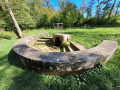
(2) Étang du Pâquis.

Between (7) and (8): Croix Saint-Romaric.

In the village of Florémont: Saint-Basle Church, dating from 1789.

Always be cautious and plan ahead when you're outdoors. Visorando and the author of this route cannot be held responsible for any accidents occurring on this route.

The GR® and PR® markings are the intellectual property of the Fédération Française de Randonnée Pédestre.

Reviews and comments

3.9 / 5
Based on 4 reviews

Reliability of the description
4 / 5
Ease of following the route
3.8 / 5
Route interest
4 / 5
bebert48
bebert48
• Edited:

Overall rating : 3.5 / 5

Date of your route : Aug 04, 2025
Reliability of the description : ★★★★☆ Good
Ease of following the route : ★★★☆☆ Average
Route interest : Not used / Not applicable
Very busy route : No

At first, it's a rather uninteresting walk along the cycle path. Then, due to land consolidation in SAUCOURT, the paths disappear and you have to take the road. What a shame, because the views of the Meurthe valley are remarkable.

Machine-translated

lolonancy54
lolonancy54
• Edited:

Overall rating : 5 / 5

Date of your route : Aug 11, 2024
Reliability of the description : ★★★★★ Very good
Ease of following the route : ★★★★★ Very good
Route interest : ★★★★★ Very good
Very busy route : No

Route followed using GPS, no problems, but take care after the 5 km mark and when crossing the field.
No shade at all except at the end, which is great for soaking up the sun; there are drinking fountains in the villages along the route.
A lovely ice cream in the centre of Charmes before heading back to the car.

Machine-translated

Francis MICHEL
Francis MICHEL

Overall rating : 3.7 / 5

Date of your route : May 16, 2024
Reliability of the description : ★★★★☆ Good
Ease of following the route : ★★★★☆ Good
Route interest : ★★★☆☆ Average
Very busy route : No

A group went on a walk the day after heavy rain. We were able to follow the route easily thanks to the GPS on our phones. Some sections of sticky mud were less pleasant. I’d like to point out the lack of benches and tables for a picnic, despite the option of taking shelter under the wash house in Avrainville.

Machine-translated

mireille88700
mireille88700

Overall rating : 3.3 / 5

Date of your route : Apr 15, 2024
Reliability of the description : ★★★☆☆ Average
Ease of following the route : ★★★☆☆ Average
Route interest : ★★★★☆ Good
Very busy route : No

Route completed this Sunday; there’s a lot missing in terms of signposting – you’re supposed to follow the yellow rectangles on a grey background (FFRP markings), but there are very few of them, or none at all (perhaps they’ve gone missing).
However, everything’s fine once you’re on the GR.
At point 3, you really have to just head off at random; we were at the entrance to a park with no animals when we passed through, but is that always the case?
Otherwise, it’s a pleasant walk with lovely scenery.

Machine-translated

Other walks in the area

For more walks, use our search engine .

The GPS track and description are the property of this route's author. Please do not copy them without permission.