The Madon Trail in Ambacourt

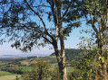
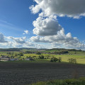
A pleasant little walk around Ambacourt, starting on the banks of the Madon, with lovely, unobstructed views of the surrounding countryside, interspersed with refreshing stretches through the woodland.

Details

46937959
Creation:
Last update:
Last review:
  • Walking
    Activity: Walking
  • ↔
    Distance: 3.08 mi
  • ◔
    Average duration: 1h 45 
  • ▲
    Difficulty: Easy

  • ⚐
    Back to start: Yes
  • ↗
    Ascent: + 381 ft
  • ↘
    Descent: - 381 ft

  • ▲
    Highest point: 1,171 ft
  • ▼
    Lowest point: 843 ft
  • ⚐ Country: France
  • ⚐ City: Ambacourt (88500)
  • ⚑
    Start/End: N 48.347632° / E 6.143163°
  • ❏
    IGN map(s): Ref. 3417O
  • Hour-by-hour weather

Photos

Description of the walk

Ambacourt is 5 km north of Mirecourt via the D413, D55 and D255.
Car park below the town hall.

Marked with a yellow line

(S/E) With your back to the car park, take Rue Paul-Gérard, which climbs to the left of Saint-Pierre Church, and continue as far as the last houses.

(1) Turn left towards the pylon with the aerial. The small tarmac road continues as a grassy track, then as a narrow path between a meadow and the edge of the woodland until you reach the entrance to the woods.

(2) Turn left into the wide tree-lined gully and, further on, turn left again to reach the reservoir.

(3) Head down the road to the left until you reach the edge of the woods.

(4) Head back up the track on the right which enters the Bois du Roi. At the top, turn left onto a small path through the undergrowth which leads onto a forest track.

(5) Turn left onto this unpaved track which descends to Ambacourt.

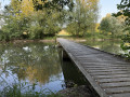
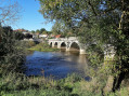
(6) At the first house, turn right into the village onto Rue de Bellevue and, further on, left onto Rue Frédéric Chopin. Head down the small flight of steps on the right, which continues as a pretty little boardwalk and leads to the banks of the Madon (lovely bridge). Follow the road to the left to return to the car park (S/E).

Waypoints

  1. S/E : mi 0 - alt. 853 ft - Car park below the town hall - Madon (le)
  2. 1 : mi 0.2 - alt. 922 ft - Fork
  3. 2 : mi 1 - alt. 1,152 ft - Entrance to the woods
  4. 3 : mi 1.44 - alt. 1,145 ft - Reservoir
  5. 4 : mi 1.82 - alt. 1,007 ft - Fork in the Bois du Roi
  6. 5 : mi 2.25 - alt. 1,053 ft - Maintenance track
  7. 6 : mi 2.81 - alt. 902 ft - Rue de Bellevue
  8. S/E : mi 3.08 - alt. 853 ft - Car park below the town hall

Worth a visit

The Madon: an important river for the region. Rising in the Vôge hills in the Monts Faucilles, it flows for 106 km and drains a catchment area of 1,030 km². Its average annual flow is 4.75 m³ at Mirecourt, compared with 10.56 m³ at Pulligny in Meurthe-et-Moselle. Its floodplain is approximately 200 m wide, sometimes reaching 500 m, as to the east of Ambacourt. Its main tributaries are: the Illon, the Gitte, the Saule, the Val d’Arol, the Colon and the Brénon.

Reviews and comments

4.7 / 5
Based on 2 reviews

Reliability of the description
5 / 5
Ease of following the route
5 / 5
Route interest
4 / 5
User 28653687

Overall rating : 4.7 / 5

Date of your route : Sep 07, 2026
Reliability of the description : ★★★★★ Very good
Ease of following the route : ★★★★★ Very good
Route interest : ★★★★☆ Good
Very busy route : No

A very well-maintained path
Easy to find. A very pretty forest

Machine-translated

User 28653687

Overall rating : 4.7 / 5

Date of your route : Sep 07, 2026
Reliability of the description : ★★★★★ Very good
Ease of following the route : ★★★★★ Very good
Route interest : ★★★★☆ Good
Very busy route : No

A very well-maintained path
Easy to find. A very pretty forest

Machine-translated

Other walks in the area

For more walks, use our search engine .

The GPS track and description are the property of this route's author. Please do not copy them without permission.