The Portieux Glassworks and the Glassmakers’ Trail

Starting from the annexe of the Marie de la Verrerie in Portieux, take a detour through the forest, discover a remarkable tree and return via the old glassmakers’ railway line.

Details

7945796
Creation:
Last update:
Last review:
  • Walking
    Activity: Walking
  • ↔
    Distance: 3.83 mi
  • ◔
    Average duration: 1h 55 
  • ▲
    Difficulty: Easy

  • ⚐
    Back to start: Yes
  • ↗
    Ascent: + 220 ft
  • ↘
    Descent: - 230 ft

  • ▲
    Highest point: 1,142 ft
  • ▼
    Lowest point: 1,014 ft
  • ⚐ Country: France
  • ⚐ City: Portieux (88330)
  • ⚑
    Start/End: N 48.357132° / E 6.389057°
  • ❏
    IGN map(s): Ref. 3417E
  • Hour-by-hour weather

Photos

Description of the walk

Park at the Portieux Town Hall annexe, Rue de la Mairie.

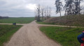
(S/E) Follow the old railway line that served the glassworks, keeping to the right of the Ruisseau du Rochon. You’ll arrive level with the stadium.

(1) Turn left, following thePR® signposts. Leave the old railway line and head up a forest track, which may be muddy at certain times of the year. Horses may pass as the climb is gentle. The track ends at a small wooden bridge spanning the ditch.

(2) Turn right onto the forest track known as the Tranchée du Torlot. After two 90° bends – first turn right then left – the Tranchée du Torlot crosses the Rochon: continue for about a hundred metres.

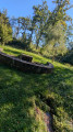
(3) Turn right onto a path that climbs quite steeply towards the notable tree (the service tree).

(4) Stop to see the remarkable tree, the Moriville service tree. Continue along the path marked by Blue Circles. Information about this tree is displayed further on.

(5) At the end of the path, turn right onto the restored Tranchée du Torlot.

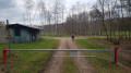
(6) At the end of this trench, after the gate and the forest workers’ hut, turn right onto the Tranchée de l’Hémery and continue to the junction where it crosses the old railway line.

(7) Turn right. From here, leave thePR® markings. The old railway line winds its way through fields and woods. On the left, it runs alongside the meandering Mori stream, which flows into the Rochon before the stadium.

(1) Carry on straight ahead to return to the starting point (S/E).

Waypoints

  1. S/E : mi 0 - alt. 1,024 ft - Town Hall Annex
  2. 1 : mi 0.37 - alt. 1,017 ft - Stade – Junction of the circular loop
  3. 2 : mi 0.6 - alt. 1,096 ft - Tranchée du Torlot
  4. 3 : mi 0.99 - alt. 1,056 ft - Path on the right
  5. 4 : mi 1.04 - alt. 1,099 ft - Remarkable tree - Arbre remarquable Cormier
  6. 5 : mi 1.23 - alt. 1,142 ft - Tranchée du Torlot
  7. 6 : mi 1.84 - alt. 1,037 ft - Tranchée de l’Hémery
  8. 7 : mi 2.28 - alt. 1,070 ft - Old railway line
  9. S/E : mi 3.83 - alt. 1,024 ft - Town Hall Annex

Notes

The climb through the forest between (1) and (2) and the old railway line may be muddy in places, depending on the weather and the season.

(3) For those unable to manage this fairly steep climb, it is possible to continue via the Tranchée du Torlot along a gentler ascent which joins point (5) further on. To still see the remarkable tree, it is possible to return from point (5) to point (4) via a section with no significant change in elevation.

Worth a visit

La Verrerie de Portieux is a small hamlet belonging to Portieux, situated a few kilometres away. The town hall is in Portieux.
This village is known for the Portieux Crystal Works, known as the Verreries de Portieux, which have made it famous since 1690. An eco-museum can be visited to trace the entire history of the Verrerie de Portieux.
From the starting point, which is opposite the village, you can see the Moulin du Pilan lodge and also the large buildings of the glassworks.

Always be cautious and plan ahead when you're outdoors. Visorando and the author of this route cannot be held responsible for any accidents occurring on this route.

The GR® and PR® markings are the intellectual property of the Fédération Française de Randonnée Pédestre.

Reviews and comments

4.1 / 5
Based on 4 reviews

Reliability of the description
4.5 / 5
Ease of following the route
4 / 5
Route interest
3.8 / 5
Martynn
Martynn
• Edited:

Overall rating : 4 / 5

Date of your route : Jul 24, 2026
Reliability of the description : ★★★★☆ Good
Ease of following the route : ★★★★☆ Good
Route interest : ★★★★☆ Good
Very busy route : No

A lovely walk – it’s a shame the forest has been cleared, which means that when we walk through it we’re out in the sun, so it’s best to avoid it during hot weather. Also, make sure you download the app as there aren’t many signposts. Otherwise, it’s a lovely route 😊

Machine-translated

Nbornel
Nbornel

Overall rating : 3.7 / 5

Date of your route : Aug 01, 2025
Reliability of the description : ★★★★☆ Good
Ease of following the route : ★★★★☆ Good
Route interest : ★★★☆☆ Average
Very busy route : No

A short walk in the forest that is fairly easy to follow and not very busy.

Machine-translated

Claudonfamilly
Claudonfamilly

Overall rating : 4.3 / 5

Date of your route : Jun 11, 2024
Reliability of the description : ★★★★★ Very good
Ease of following the route : ★★★★☆ Good
Route interest : ★★★★☆ Good
Very busy route : No

An easy walk suitable for families.

Machine-translated

christopheprunauxcazer

Overall rating : 4.3 / 5

Date of your route : May 10, 2021
Reliability of the description : ★★★★★ Very good
Ease of following the route : ★★★★☆ Good
Route interest : ★★★★☆ Good
Very busy route : No

An easy walk, alternating between woodland and fields; a pleasant walk

Machine-translated

Other walks in the area

For more walks, use our search engine .

The GPS track and description are the property of this route's author. Please do not copy them without permission.