


 Country:
 City:
City:


Park opposite the church in Mangonville on Grande Rue.
(S/E) Leave the car park and head towards the church to take Grande Rue to the left, heading south-south-west. Continue straight ahead until the road turns left and becomes Rue de la Fontaine. At this point, take Chemin de la Banasse opposite the bend (on the right-hand side of the street). After the last house on the left, this road turns sharply to the right and changes from a tarmac road to an unpaved track. It is lined with trees on both sides.
(1) At the junction with a path on the right, Chemin de la Banasse turns sharply left. Follow it southwards. The path climbs up the hillside, initially through a clearing, then along the edge of a wood on the right, before entering the wood. Further on, it runs close to the edge of a cultivated clearing on the right towards the top of the hill and descends the gently sloping hillside.
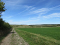
It eventually leaves the woods and crosses a mixed area of crops and irregular tree plantations. It joins Rue des Vignes in Bainville aux Miroirs.
Turn left and go down Rue des Vignes to the junction with Rue de Lebeuville. Cross Rue de Lebeuville carefully, which has two lanes.
(2) Turn right and follow Rue de Lebeuville westwards until you reach the junction with Chemin J. Carreau (a tarmac road for about 50 metres, then unpaved), which climbs slightly. Turn left onto Chemin J. Carreau and follow it to Chemin Blanc de la Grande Corvée. Follow this road to the left, heading east.
At the next crossroads, turn left onto Chemin de la Grande Côte, which passes close to the cemetery on your right, with the church a little further away at the back of the cemetery.
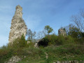
Descend the hill via Chemin de la Grande Côte, noting the ruins of Bainville-aux-Miroirs castle on your right.
When you reach Rue de Lebeuville, cross it carefully and follow it to the right towards the D570 road.
Cross the D570 road with caution and continue straight ahead on the Montauban road. As you pass, admire the old nail factory and its large wheel. Cross the Canal de l'Est (southern branch) at lock no. 36.
(3) Continue straight ahead with caution on the road to cross the Moselle towards the south-east.
Just after the pumping station on your left, turn right onto the path that starts at the Nature Reserve (Sensitive Natural Area) welcome signs located in the car park.
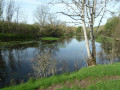
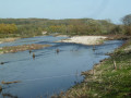
Follow the path and head towards the river. Admire the landscape and the Moselle's continuous work on its banks. Be careful and do not get too close.
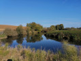
Continue along the river upstream. Observe the traces of old irrigation canals in the meadows.
Further on, the Moselle splits into two. Continue until you reach a crossroads.
(4) At the crossroads, take the left-hand path through the woods. Now is the time to discover the forest and its inhabitants.
Continue to a crossroads in a small clearing. Turn left and continue on theGR®5F, which will take you back to the road. Turn left to return to the welcome point and continue straight ahead to cross the Moselle and return to lock no. 36.
(3) Turn right onto the towpath - VC de Chaurupt - which runs alongside the Canal de l'Est (southern branch) on your left. Follow it to the junction with Chemin de la Grande Parmentière at lock no. 37 in Chaud Rupt.
After crossing the road, continue along the towpath opposite.
(5) Further on, the path crosses the national road, which passes over a bridge over the canal on the left and serves the area known as Pré le Châtelain. Continue opposite on the towpath to lock no. 38 at Roville-devant-Bayon.
(6) Turn left and cross the Canal de l'Est via a bridge over which the Chemin de l'Écluse passes. Follow this path to enter the village.
At the next crossroads, turn right onto Rue du 4 Septembre 1944, which joins Avenue du Général Leclerc (the D570 road).
(7) Cross the D570 road carefully (at the pedestrian crossing) and take Rue des Acacias opposite.
Continue straight ahead on this road, which climbs gently between two hills, until you reach a crossroads at the end of a small wood on your right. At this point, the road crosses a small stream that has been running alongside it on the left for about 400 metres.
(8) Turn left and continue on the main path. This path goes around the Côte Rochot on the left before heading south. The path runs along the edge of a small plateau before descending towards the village of Mangonville. The path arrives in a small valley where an intermittent stream flows and enters Mangonville via the Petite Rue, a tarmac road at the level of the first houses. This street curves around the cemetery on the right-hand side. Continue along this road until you reach the steps on the left just before a house.
Turn left and take the steps to reach Grande Rue. Turn left to pass in front of the church. Cross Grande Rue and you will find the parking spot opposite the church (S/E).

 Visorando Member
 Easy
Easy 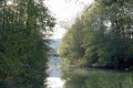
 Tourist office
