Country:
 City:


Leave Vernot via the D103 and park on the right-hand side along a dirt track, taking care not to obstruct the farmers’ access: there is space for four to five vehicles. If you are coming from Villecomte, this track will be on your left, about a hundred metres before the Vernot sign.
(S/E) Start with your back to the road and walk up the Combe de Cisseux until you come out onto the forest track.
(1) Turn left and continue uphill until you reach a viewpoint overlooking Villecomte and the Combe Milvy.
(2) Carry on along the forest road, skirting the Combe Quinquendolle Biological Reserve. Pass a viewpoint before coming to a gate.
(3) Turn left and head towards a junction at a viewpoint overlooking the Ignon Valley.
(4) Carry on straight ahead for a lovely descent leading to a wide, carriageable track.
(5) Turn right and climb gently until you reach the edge of the woods and an open area.
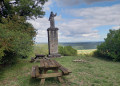
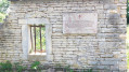
(6) Keep left at the three-way junction, follow the edge of the woodland and you’ll reach a junction: on the right, in the small copse, lies the old Mortière farm, a key site of the Resistance.
(7) Turn left into the woods and follow the path downhill towards the fields at a place called Le Derrière de Coutre. Walk alongside these fields, then turn left at the crossroads to reach a fork shaped like an inverted Y.
(8) Turn left to head up the Combe Vaudry. Enter the woods again and carry on straight ahead until you reach the cave known as Peuptu de la Combe Millot.
(9) Turn right, then head left at the junction to walk up the Combe Millot.
(10) Head right along the path leading to the hut. After 100 metres, go round a fallen tree on the right: it’s a bit of a steep climb, but only for about thirty metres. At the top, continue along the path leading to the hut, keeping it on your right. You’ll come across a log bridge.
(11) At the next junction, turn left to follow the main path straight ahead until you reach the edge of the Combe Chaignay.
(12) Follow the path on the right which runs alongside the valley whilst descending steadily.
(13) Take a small path on the left which leads down to the road. Be careful: just before you reach the road, head left, staying on top of the embankment. You’ll soon reach the car park on the left (S/E).
 Visorando Member
 Difficult

 Easy