Country:
 City:
City:


Parking is available at the side of the road next to the Saussy cemetery on Rue de la Mare.
(S/E) With your back to the cemetery, turn right along the road (red and white GR®7 markings) heading towards the Château des Charmes (riding school). At the junction (opposite a stone cross), turn left and then stay on the GR® until you reach the junction with the access road to the riding school and the Château des Charmes.
(1) Pass the entrance to the château on your right, keep left on the track until you reach a junction with several paths.
(2) Let the GR®7 branch off to the left, ignore the access routes to the château on the right, and carry on straight ahead along the wide track. It first turns left then right, and meets a junction with a path that crosses the track at a right angle.
(3) Take this path to the left and follow it for just over 200 m until you reach another path intersecting at a right angle. Turn left and head westwards for just over 500 m until you rejoin the GR®7.
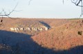
(4) Follow it on your right to the lovely Combe Quinquendolle viewpoint. Take in the scenery.
(5) Retrace your steps to the previous junction.
(4) Leave the GR® and turn right, walking along the edge of the plateau. Follow this path for about 3 km, ignoring any turn-offs to the left or right. As you walk along the plateau, the path leads to the village of Saussy and joins the Chemin de la Tour (tarmac road). Follow it for about fifty metres.
(6) Then leave this road, keeping to the right towards the wash house and the Saussy spring, which are situated just below the tower. Continue along the path which climbs back up towards the village. After leaving the forest, you’ll reach Rue de Curtil. Walk a few metres to the left until you reach the start of Chemin de la Tour. The tower is clearly visible on the left.
(7) Follow this path to the foot of the tower (information board).
(8) Retrace your steps to the previous junction.
(7) Take Rue de Curtil on the left until you reach the start of Grand Rue near the church. Turn left onto Grand Rue until you reach the start of Rue de la Mare on the right.
(9) Follow Rue de la Mare for about 250 m until you reach Saussy cemetery (S/E).
 Visorando Member
 Difficult
 Moderate