Country:
 City:
City:


Park opposite the town hall in Curtil-Saint-Seine.
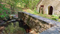
(S/E) With your back to the town hall, turn right and walk along the Grande Rue. Take the Rue de la Fontaine on the left, which soon turns into a footpath. Head for the wash house, which is on the left in the field below the path.
(1) After admiring this pretty wash house, return to Rue de la Fontaine and follow it to the left until the end. Then take the street on your right and return to the Grande Rue. Carry on to the right, cross over and turn left onto Rue Durand to reach the town hall again. Head left, walk towards the church, then continue on to the Croix Colin.
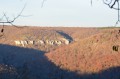
(2) Take the path on your left to the edge of the forest, and follow the path along the edge. You will then reach the very top of the valley overlooking the Coteau Baron.
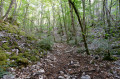
(3) Turn right onto the rather steep path that descends the valley for about 500 metres. You’ll come out onto a forest track overlooking the dry valley floor of Francheville.
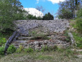
(4) Head slightly to the right to follow this track, which leads to the Fontaine des Essarts: admire the spring on your right, the wash house on your left, and below, the two retting pits which were used to soften (retting) the fibres of the hemp stalks before weaving them. You’ll also see some pretty little waterfalls cascading over the tuff deposits.
(5) Carry on, then turn right to follow the path which climbs up the Combe de la Fontaine and returns to the Croix Colin.
(2) Head straight on towards the village and make your way to the car park (S/E).
 Visorando Member
 Moderate
 Difficult