Between the Sambre and Meuse rivers, via Villers-en-Fagne, Sautour and Merlemont

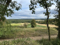
A short circular walk in the countryside around Villers-en-Fagne, between the Sambre and Meuse rivers.

Details

n°8618324
Creation:
Last update:
Last review:
  • Walking
    Activity: Walking
  • ↔
    Distance: 4.89 mi
  • ◔
    Average duration: 2h 40 
  • ▲
    Difficulty: Easy

  • ⚐
    Back to start: Yes
  • ↗
    Ascent: + 466 ft
  • ↘
    Descent: - 443 ft

  • ▲
    Highest point: 879 ft
  • ▼
    Lowest point: 584 ft

Photos

Description of the walk

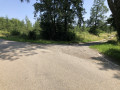
Park at the far end of the ‘Petite Suisse’ housing estate, a chalet development near Villers-en-Fagne.

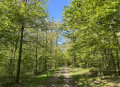
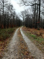
(S/E) Enter the woods. Cross the gully formed by the gas pipeline, marked by orange posts. A few metres further on, turn right and follow the path, which soon curves to the left. After 50 m, turn right and continue along this path for a further 1 km or so

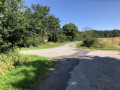
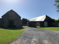
(1) Emerge from the woods at the top of the Villers-en-Fagne–Sautour road and follow it to the right towards Sautour. After the long straight stretch, cross the bridge over the Hermeton and, after a short climb, pass in front of a magnificent farmhouse before reaching the junction with the Sautour–Merlemont road.

(2) Cross with care and take the path opposite, which climbs slightly.

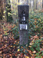
(3) After 370 m, at the next junction, turn right and continue straight on, slightly uphill, for about 1 km until you reach a small wayside shrine dedicated to the ‘guardian angel’. (Read the information board explaining the legends associated with this shrine)

(4) Turn right and follow the path for about 1.2 km until you come out onto a road at the edge of the woods, near a few houses

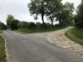
(5) Follow the road to the left. The road first bends to the right and then, very quickly, to the left at the next bend; leave the road and follow a path straight ahead which passes to the right of a cluster of houses. This path joins the Merlemont–Villers-en-Fagne road 500 m further on.

(6) Turn right to follow this road, which descends and passes over the Hermeton before climbing again.

(7) About 150 metres after the stream, leave the road and take a small tarmac road on the left which climbs and joins the main road further up.
Follow the road to the left until you reach the summit. Shortly after the descent towards Villers-en-Fagne begins, take the entrance to the Petite Suisse housing estate on the right and head to the car park (S/E).

Waypoints

  1. S/E : mi 0 - alt. 659 ft
  2. 1 : mi 0.76 - alt. 823 ft - Road junction – Turn right
  3. 2 : mi 1.56 - alt. 669 ft - Crossing the Sautour–Merlemont road
  4. 3 : mi 1.8 - alt. 722 ft - Junction, turn right
  5. 4 : mi 2.45 - alt. 853 ft - Cross – Right
  6. 5 : mi 3.27 - alt. 732 ft - Exit from the woods
  7. 6 : mi 3.72 - alt. 646 ft - Road junction – Turn right
  8. 7 : mi 4.15 - alt. 620 ft - Path to the left after the - Hermeton (rivière) - Belgique
  9. S/E : mi 4.89 - alt. 663 ft

Notes

During the hunting season, look out for the signs at the entrances to the woods; these signs indicate the days when driven hunts take place

Reviews and comments

4.3 / 5
Based on 2 reviews

Reliability of the description
4 / 5
Ease of following the route
4 / 5
Route interest
5 / 5
GCO1
GCO1

Overall rating : 4 / 5

Date of your route : Feb 21, 2022
Reliability of the description : ★★★★☆ Good
Ease of following the route : ★★★☆☆ Average
Route interest : ★★★★★ Very good
Very busy route : No

Very satisfied with the route overall.
We did have to ask passers-by for directions on a few occasions because the route description was too vague (e.g. a ‘wide’ gravel path – what does ‘wide’ mean? – 2) turn left at the ‘T’ junction, => the T junction was actually an ‘S’ junction… etc.
It’s a shame about these issues, which caused us to lose a bit of time.
Otherwise, no complaints.
Thank you

Machine-translated

joel mosbeux
joel mosbeux

Thank you for your comment. Could you please tell me what would be needed to improve the accuracy of the description? Thank you in advance.

Machine-translated

Duchene fre
Duchene fre

Overall rating : 4.7 / 5

Date of your route : Jun 21, 2021
Reliability of the description : ★★★★☆ Good
Ease of following the route : ★★★★★ Very good
Route interest : ★★★★★ Very good
Very busy route : No

There weren’t many vehicles, although there were a few roads covering about one-sixth of the route; it’s a little-known area, with lovely forests and blue stone houses – I really enjoyed it

Machine-translated

Other walks in the area

For more walks, use our search engine .

The GPS track and description are the property of this route's author. Please do not copy them without permission.