Country:
 City:
City:


Park in the small square in the village of Samart, next to the church (Place Saint-Médard).
(S/E) Opposite the red-brick house, take the road to the right. Walk up the street, continuing straight on, leaving house no. 6 on your left, until you reach a Fork in the road.
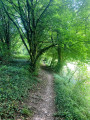
(1) At the fork in the road, where there is a small farm building situated between the two paths, take the path on the left. Continue along this stony path, which climbs towards a new housing estate. Do not take the path branching off to the right; carry on until you reach the junction with the road.
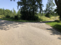
(2) At the junction, take the tarmac road to the left. Carry on straight ahead along this road until you reach the junction with a main road, which is closed off by a barrier. Continue to the left along the footpath to the left of the safety barrier. Leave the footpath to the right, crossing the road at the coloured crossing opposite the bus shelter. Carry on along the side of the road for a few more metres, then turn right onto the bridge that crosses over the RN5. Carry on along this road, passing the water tower; go straight ahead at the small roundabout (going round it on the right) and carry on along the road, which then curves to the right.
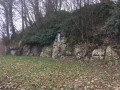
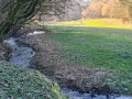
(3) At the bend, take the road that descends to the left and runs to the left of the safety barrier. Keep to the left, passing to the left of the stone building in the middle of the small square. Then take the path that runs alongside a wall and then the motorway for a few metres (be careful!), go down the ramp and take the tunnel that takes you under the motorway. At the tunnel exit, carry on straight ahead along the path, cross over the Ruisseau de Samart and go round the stone buildings. Follow the stony path straight on until you reach the Grotte Notre-Dame de Lourdes on your right.
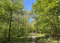
(4) Immediately after the Grotto, take the small path that climbs steeply to the right. At the top of the slope, where the path disappears into the woods, head left towards the farm building. Then turn right onto the stony path which enters the woods again and descends to a crossroads.
(5) At the bottom of the short descent, at the crossroads, leave the track and take the footpath to the left. At the end of the footpath, by the chalet visible on your right, take the hairpin bend to the left until you reach the tarmac road.
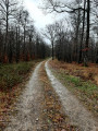
(6) At the tarmac road, head to the right and, at the next crossroads where there is a bench, take the stony path to the left. Follow this path which, at a solitary tree, curves at a right angle to the left. Pass a pond on your right and continue along the path which climbs up to a crossroads with another tarmac road.
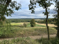
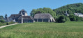
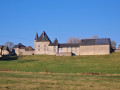
(7) At the junction, turn left. The tarmac road takes you back to the first houses in the village (on the left, facing the houses, there is a lovely view of the valley). A little further on, the path curves to the right, running alongside the stone wall of Samart Castle. At the next fork, turn left and then left again to return to the car park where you started (S/E) .

 Visorando Member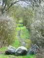
 Moderate
 Difficult