Country:
 City:


Park in Samart on Place Saint-Médard opposite the chapel.
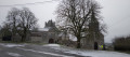
The castle farm, Saint-Médard Chapel, the old cemetery and the two chestnut trees on the square already help to make the village one of the most picturesque in the region.
(S/E) Leave the square and head up Rue de la Chapelle towards Philippeville.
(1) Turn straight onto Rue Ernest Lahaye to the right of the castle barn. Follow theGR®12signposts all the way to Sautour. You’ll spot a statue in a niche high up on the gable of the barn. This Virgin and Child is the work of the sculptor Ernest Lahaye, who was born in Samart in 1872 and is buried alongside his parents in the old cemetery to the right of Samart Chapel.
Continue along the castle’s surrounding wall, passing the small semi-circular turret with arrowslits.
The keystone of the entrance archway to the old barn dates from 1738. Leave the new buildings overlooking the schist-covered Fagne behind and head down towards the Bois Corroy, ignoring the first path on the right which leads down to the pond below.
(2) Pass close to the boundary stone dated 1776, which marked the border between the Kingdom of France and the Principality of Liège. Opposite, in the woods, lies the quarry once used for marble production. Continue to the end of the path.
(3) Turn right and walk down the street to the old mill. On the left as you go down, you’ll catch a glimpse of the old buildings of the Tienne al’Gatte quarry. The site is due to be restored given its great biological importance.
(4) At the Chapel of Notre-Dame au Cœur d’Or, take the tarmac road on the right. Cross the bridge over the Ruisseau des Gérinaux.
(5) Take the path on the left into the copse. Walk uphill and, at the signpost, turn right, following the sign for ‘Haut-du-village’. Over the stream, you can see a blue stone structure consisting of two vertical posts topped by a lintel. This is the water-retention sluice gate of the old mill.
(6) After passing between the house and the chapel, turn right. Saint-Roch Chapel with a semi-circular apse, built of limed limestone rubble. The funerary cross of Lorens Remi († 1606) is set into the gable. At the second house, on the right-hand side of the side wall, your attention will be drawn to the remains of an old tower.
You’ll reach the entrance to the small square with its Dutch lime tree and sycamore maple. Admire the lintels above the doors of the old houses: No. 11 (1650), No. 14 (1623) and No. 34 (1683). Take the street on the right.
Your attention will be drawn to an imposing building made of fine limestone, which is thought to have been the residence of the fortress commander.
Continue on to Saint-Lambert’s Church, passing in front of the wall enclosing the garden of the former vicarage. This new church was built around 1840. The keystone of the entrance portal was reused from the old chapel. Take the narrow lane on the right straight away. A glance over the low wall will reveal the terraced gardens.
(7) Pass through the gate known as the ‘Roman’ or ‘Postienne’ gate, recognisable by its arched vault. This was probably the second entrance, or rather the postern gate, of the ramparts. Go down the very steep path, turn immediately right and walk past the school. You will then leave theGR®12trail! At the far end, take the tarmac path on the right and, a little further on at the ‘end of built-up area’ sign, take the footpath on the left.
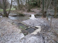
(8) Gouviat Fountain. This spring, whose water remains cool at all times, is surrounded by a basin that drains into the Gérinaux stream and then into the Hermeton. Next, cross the bridge and take the path that runs along the edge of the woodland. At the end of the path, cross the pasture, go over the bridge spanning the Hermeton and take the path on the right. As you emerge from the woods, you’ll see the ruins of the old Samart mill on your right. Continue straight on towards Samart cemetery. After the cemetery, turn right and cross the Hermeton.
(9) Saint-Médard Fountain. This fountain is a cylindrical structure built from large blocks of limestone, featuring two stone basins, the larger of which resembles a washhouse. In the past, its water was reputed to have healing properties for headaches. Continue towards the pumping station building and, at the fork, turn off towards the woods. Head towards the house and take the path to the right of it. At the first crossroads in the woods, turn immediately right. Pass the farm and head down towards Place Saint-Médard (S/E).

 Association / Club / Walk leader

 Visorando Member
 Moderate
 Difficult