From Villers-en-Fagne to Matagne-la-Grande and Fagnolle via the RAVEL

An easy circular walk starting from Villers-en-Fagne towards Matagne-la-Grande and Fagnolle, following the RAVEL cycle route in the Entre-Sambre-et-Meuse region (also suitable for mountain biking)

Details

8988109
Creation:
Last update:
Last review:
  • Walking
    Activity: Walking
  • ↔
    Distance: 9.16 mi
  • ◔
    Average duration: 4h 30 
  • ▲
    Difficulty: Moderate

  • ⚐
    Back to start: Yes
  • ↗
    Ascent: + 354 ft
  • ↘
    Descent: - 367 ft

  • ▲
    Highest point: 787 ft
  • ▼
    Lowest point: 535 ft

Photos

Description of the walk

Starting point: the centre of Villers-en-Fagne, at the junction of Rue de l’Église and Rue de Matagne. Plenty of parking available at the foot of the church.

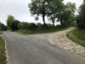
(S/E) Head north along the road towards Merlemont and Sart-en-Fagne. Cross Rue du Centre on the right-hand side and turn right. Cross Rue des Grillons on the left-hand side and follow Route du Grand Ry downhill.

(1) Cross over the Grand-Ri stream before heading straight up the hill (leave the road to the right towards Sart-en-Fagne).

(2) Shortly after the top of the hill and before a left-hand bend in the road, take a path on the right. After about a hundred metres, turn right. This path becomes a small road (in poor condition) and passes through a housing estate with a few chalets. Pass two paths on your left before coming out onto the Villers-en-Fagne–Sart-en-Fagne road.

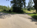
(3) Turn left, then immediately right to follow a wide track that runs alongside meadows.

(4) After about 400 m, the path enters the forest, crossing the Grand Ri stream near the Villers-en-Fagne hunting grounds (hunters’ huts).

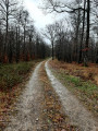
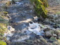
(5) Continue straight on along this path, which narrows and crosses a small stream (fording). The section that follows is somewhat tricky as the path is not very well marked. Keep going in the same direction; the path soon becomes more clearly defined before widening out again.

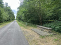
(6) You’ll come to a tarmac forest road; follow it to the right. After about 300 metres, ignore a path on your left and carry straight on along the tarmac road.

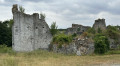
(7) The forest road passes behind the disused and dilapidated buildings of the former Matagne-la-Grande gunpowder magazine. Continue along this forest road until it joins a main road, ignoring a path coming from the left

(8) Turn left towards the village centre and you will soon reach the junction with the RAVEL.

(9) Take the RAVEL to the right and follow it for approximately 4.3 km, until it joins the Fagnolle-Roly road near a few houses, where you’ll meet theGR®12.

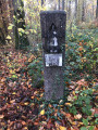
(10) Follow this road to the right along theGR®12(red-and-white markings). Ignore two paths running perpendicular to the road on the left and right at the entrance to the forest.

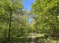
(11) Leave the road and take a wide path to the right through the forest, which follows the route ofthe GR®12and an underground gas pipeline. After 1.5 km, the path crosses a bridge before emerging from the forest near the hamlet of Ingremez. Continue along this path, which soon becomes a tarmac road.

(12) Carry on straight ahead along the tarmac road (leaving theGR®12, which heads off to the left towards Roly). The road descends at first, then levels out until you reach the village centre.

(13) At the Fork in the road, carry on straight ahead to return to the village centre and the church at Villers-en-Fagne (S/E).

Waypoints

  1. S/E : mi 0 - alt. 679 ft - Rue de l’Église x Rue de Matagne
  2. 1 : mi 0.44 - alt. 610 ft - Grand Ri
  3. 2 : mi 0.98 - alt. 692 ft - Start of the path
  4. 3 : mi 1.42 - alt. 607 ft - Road junction
  5. 4 : mi 1.74 - alt. 594 ft - The Villers hunting grounds
  6. 5 : mi 1.97 - alt. 600 ft - Fording
  7. 6 : mi 2.58 - alt. 600 ft - Tarmac forest track
  8. 7 : mi 2.98 - alt. 640 ft - Behind the Matagne powder magazine
  9. 8 : mi 3.52 - alt. 591 ft - Matagne la Grande
  10. 9 : mi 3.62 - alt. 594 ft - RAVEL
  11. 10 : mi 6.38 - alt. 545 ft - Fagnolle–Roly Road – GR12
  12. 11 : mi 6.58 - alt. 600 ft - Start of the path – GR12
  13. 12 : mi 8.65 - alt. 781 ft - GR12 junction
  14. 13 : mi 8.92 - alt. 699 ft - T-junction
  15. S/E : mi 9.16 - alt. 679 ft - Rue de l’Église x Rue de Matagne

Always be cautious and plan ahead when you're outdoors. Visorando and the author of this route cannot be held responsible for any accidents occurring on this route.

The GR® and PR® markings are the intellectual property of the Fédération Française de Randonnée Pédestre.

Reviews and comments

4.2 / 5
Based on 3 reviews

Reliability of the description
4.3 / 5
Ease of following the route
4.7 / 5
Route interest
3.7 / 5
ArinaTomberg
ArinaTomberg

Overall rating : 4.3 / 5

Date of your route : Jul 22, 2026
Reliability of the description : ★★★★★ Very good
Ease of following the route : ★★★★★ Very good
Route interest : ★★★☆☆ Average
Very busy route : No

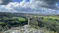
An easy and pleasant walk, though rather monotonous, mainly along forest paths and cycle paths. For us, the main points of interest were the ruins of the medieval castle at Fagnolle, as well as the village of the same name, which is listed as one of the most beautiful villages in Wallonia. They are situated a short distance from point 10.

Machine-translated

Feu violet
Feu violet

Overall rating : 4.3 / 5

Date of your route : Jan 28, 2024
Reliability of the description : ★★★★☆ Good
Ease of following the route : ★★★★☆ Good
Route interest : ★★★★★ Very good
Very busy route : No

Between kilometres 2 and 4, the path is very muddy – probably due to the rain, I suppose (although I’ve done this route before in summer and it was already like that… even without rain)

Machine-translated

jamy quintens
jamy quintens

Overall rating : 4 / 5

Date of your route : Aug 08, 2021
Reliability of the description : ★★★★☆ Good
Ease of following the route : ★★★★★ Very good
Route interest : ★★★☆☆ Average
Very busy route : No

Hello,
We tried this route today. It wasn’t anything special, especially the long straights, which are rather monotonous.
It was really disappointing – the final section, which for 1–2 km runs along a concrete road busy with motorbikes and cars travelling at high speed (long straights)!

Machine-translated

Other walks in the area

For more walks, use our search engine .

The GPS track and description are the property of this route's author. Please do not copy them without permission.