The powder magazine between Villers-en-Fagne and Matagne-la-Grande

A circular route starting from Villers-en-Fagne towards Matagne-la-Grande, passing close to the disused site of a former powder magazine (in the Entre Sambre et Meuse region)

Details

9441399
Creation:
Last update:
Last review:
  • Walking
    Activity: Walking
  • ↔
    Distance: 5.75 mi
  • ◔
    Average duration: 2h 55 
  • ▲
    Difficulty: Easy

  • ⚐
    Back to start: Yes
  • ↗
    Ascent: + 335 ft
  • ↘
    Descent: - 331 ft

  • ▲
    Highest point: 702 ft
  • ▼
    Lowest point: 584 ft

Photos

Description of the walk

Start from the centre of the village of Villers-en-Fagne at the junction of Rue du Centre and Route de Roly.

(S/E) Head towards Merlemont to the north-east. Ignore a road on the left and a track on the right. Follow the road, which initially descends to cross over the Grand-Ri stream. Climb up the other side and leave the road on the right heading towards Sart-en-Fagne.

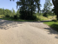
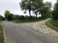
(1) Shortly after the top of the hill and before a left-hand bend in the road, take a track on the right. After about a hundred metres, turn right. The track turns into a small tarmac road (in very poor condition) and passes through a sparsely populated housing estate. Ignore the two tracks on the left to come out onto a road.

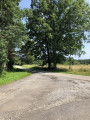
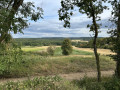
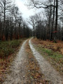
(2) Turn left towards Sart-en-Fagne, then very quickly right onto a wide path running alongside meadows. Further on, the path enters the forest at the bridge crossing the Gran-RI stream, near the Villers-en-Fagne hunting grounds (hunters’ huts). Continue south-east.

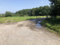
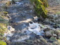
(3) Cross a stream (ford). Here, the path is not very well marked: carry on straight ahead in the same direction to quickly rejoin a better-marked path before it widens out again.

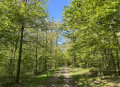
(4) At the next junction, the path joins a tarmac forest track; follow this to the right. Stay on this forest track (south-south-east) and pass behind the disused and dilapidated buildings of the former Matagne-la-Grande gunpowder magazine. Further on, ignore a path coming from the left and continue along the track until you reach the main road to Matagne-la-Grande, near a few houses.

(5) Then turn right and follow the road which runs in front of the Matagne-la-Grande gunpowder factory buildings. Cross the Ruisseau des Bruyères and continue up the road.

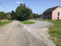
(6) At the top of the hill, in a slight bend to the left, turn right onto a path that leads into the woods. Go downhill and cross a stream. Then head back uphill between the fields. Stay on the main path and enter Villers-en-Fagne via Rue du Centre. You will immediately reach the car park (S/E).

Waypoints

  1. S/E : mi 0 - alt. 676 ft - Rue du Centre x Route de Roly
  2. 1 : mi 0.92 - alt. 692 ft - Start of the path
  3. 2 : mi 1.37 - alt. 607 ft - Junction
  4. 3 : mi 1.92 - alt. 600 ft - Fording
  5. 4 : mi 2.51 - alt. 600 ft - Junction with a tarmac forest road
  6. 5 : mi 3.44 - alt. 591 ft - Route de Matagne-la-Grande
  7. 6 : mi 4.82 - alt. 702 ft - Top of the hill – Start of the path
  8. S/E : mi 5.75 - alt. 679 ft - Rue du Centre x Route de Roly

Notes

This route is suitable for mountain bikes, with a short tricky section at the ford at (3).

Worth a visit

A disused site of a former powder magazine and factory producing civilian and military explosives, abandoned since 1990.

Reviews and comments

4.7 / 5
Based on 2 reviews

Reliability of the description
5 / 5
Ease of following the route
5 / 5
Route interest
4 / 5
JeanFlorennes
JeanFlorennes

Overall rating : 4.7 / 5

Date of your route : Aug 26, 2024
Reliability of the description : ★★★★★ Very good
Ease of following the route : ★★★★★ Very good
Route interest : ★★★★☆ Good
Very busy route : No

A brilliant hike! At the moment, some of the paths have been used by forestry machinery, which has left deep ruts, puddles and mud. It’s a shame that there are also two fairly long sections of the route on concrete roads.

Machine-translated

pphilippe
pphilippe

Overall rating : 4.7 / 5

Date of your route : Feb 27, 2022
Reliability of the description : ★★★★★ Very good
Ease of following the route : ★★★★★ Very good
Route interest : ★★★★☆ Good
Very busy route : No

Between the start and point 1, and then between 5 and 6, the road is tarmac… but not very busy (at least on this Sunday, 27 February…): you don’t need both hands to count the number of cars! The route is mainly through woodland, with open countryside at the start and end. All in all, a pleasant and easy walk to get a good breath of fresh air. At point 3, the path is completely invisible for 100 metres, especially as you’re in a spongy, marshy area (at the end of February, at least). The blue GPS marker on the map is really useful for keeping your bearings, as you have to zigzag your way through to avoid getting your feet too wet. But this doesn’t last very long (afterwards, you can walk along a small path on the left, running parallel to the main track, which is very ‘wet’).

Machine-translated

Other walks in the area

For more walks, use our search engine .

The GPS track and description are the property of this route's author. Please do not copy them without permission.