Around Villers-en-Fagne

A short circular walk in the vicinity of Villers-en-Fagne (between the Sambre and Meuse rivers)

Details

n°9015671
Creation:
Last update:
Last review:
  • Walking
    Activity: Walking
  • ↔
    Distance: 2.64 mi
  • ◔
    Average duration: 1h 25 
  • ▲
    Difficulty: Easy

  • ⚐
    Back to start: Yes
  • ↗
    Ascent: + 220 ft
  • ↘
    Descent: - 220 ft

  • ▲
    Highest point: 899 ft
  • ▼
    Lowest point: 666 ft

Photos

Description of the walk

Start from the centre of the village of Villers-en-Fagne. Park near the junction of Rue de la Matagne and Rue de l’Église (bus stop).

(S/E) Set off south-west, towards Matagne-la-Grande.

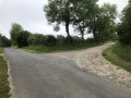
(1) At the Fork in the road, take the road on the right that goes uphill. Further on, ignore Rue de Matagne on the left.

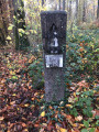
(2) Just before a cluster of houses, turn right onto a forest track and follow theGR®12. Stay on this signposted forest track until you reach a T-junction.

(3) Then turn right towards Villers-en-Fagne (leaving theGR®12, which heads left). Continue north-east until you reach the Roly road in Villers-en-Fagne.

(4) Follow the road to the right. In the village, turn right to return to the starting point (S/E).

Waypoints

  1. S/E : mi 0 - alt. 679 ft - Villers-en-Fagne
  2. 1 : mi 0.24 - alt. 699 ft - Fork
  3. 2 : mi 0.51 - alt. 781 ft - Junction – GR12
  4. 3 : mi 1.37 - alt. 860 ft - T-junction
  5. 4 : mi 2.42 - alt. 679 ft - Road junction
  6. S/E : mi 2.64 - alt. 679 ft - Villers-en-Fagne

Always be cautious and plan ahead when you're outdoors. Visorando and the author of this route cannot be held responsible for any accidents occurring on this route.

The GR® and PR® markings are the intellectual property of the Fédération Française de Randonnée Pédestre.

Reviews and comments

4.3 / 5
Based on 2 reviews

Reliability of the description
4.5 / 5
Ease of following the route
4 / 5
Route interest
4.5 / 5
alainviso
alainviso

Overall rating : 4 / 5

Date of your route : Nov 19, 2023
Reliability of the description : ★★★★☆ Good
Ease of following the route : ★★★★☆ Good
Route interest : ★★★★☆ Good
Very busy route : No

A lovely walk.

Machine-translated

isabelleseny
isabelleseny

Overall rating : 4.7 / 5

Date of your route : Jun 26, 2021
Reliability of the description : ★★★★★ Very good
Ease of following the route : ★★★★☆ Good
Route interest : ★★★★★ Very good
Very busy route : No

A really lovely, peaceful walk. The directions for where to park the car are a bit vague (bus station??).
And don’t rely on the app: there’s no signal and 4G doesn’t work there, but as the route is straightforward, it wasn’t a problem for us.

Machine-translated

Other walks in the area

For more walks, use our search engine .

The GPS track and description are the property of this route's author. Please do not copy them without permission.