Country:

 City:
City:


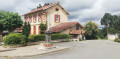
From Mane, follow signs for Rouède (D83), then Saint-Martin at a place called Sarrous (D83F). At the entrance to the village, park just before the school on the right, on Chemin de Cravarisse.
(S/E) Walk slightly uphill along the Route des Diligences, which you arrived on, cross it, then take the Chemin du Nougaròu (a small tarmac road) opposite. From the top of the path, admire the Crête de Cornudère opposite and, to the right, the Pic du Cagire (1,912 m). After a few houses, the path descends quite steeply to cross the D83.
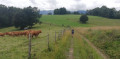
(1) Carry on straight ahead to continue along the Chemin du Col de Lamothe, which winds its way through fields and pastures, crosses the Ruisseau de la Justale and then climbs quite steeply to reach the hamlet of Cazals.
(2) Turn right onto the Chemin Cazala (yellow signpost). The path begins with a tarmac section before turning into a stony track and then a simple track across the fields (watch out for puddles, which can be tricky). The path passes through a small copse before veering to the left and soon reaching several farmsteads.
(3) Continue to the right, still following the Chemin du Col de Lamothe. At a place called Clarède, keep to the right and follow the Route du Pont de Prades for about 300 metres before reaching a crossroads with four paths.
(4) Turn right and follow this long, well-marked path which climbs gently before descending through the woodland to reach a ford where you can cross the Ruisseau de la Justale once more. The path climbs slightly before crossing the D83 one last time.
(5) Turn left and follow the departmental road for about fifty metres before leaving it to turn right onto the Chemin de la Carrère, which climbs quite steeply before reaching the Church of Saint-Martin.
(6) Turn right onto the Chemin de l’Église Saint-Martin and return to the car park located just past the school (S/E).

 Visorando Member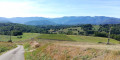
 Moderate
 Association / Club / Walk leader