Between Saint-Martin-de-Brômes and Allemagne-en-Provence

A circular route between Saint-Martin-de-Brômes, passing by the Clock Tower and the church, then along the Chemin de la Crête de Saint-Pierre, with views of the mountains behind Moustiers, a descent along a lovely path towards Allemagne-en-Provence, passing by the Château de Castellane, and back down to the plain via the cycle path.

Details

2701103
Creation:
Last update:
Last review:
  • Walking
    Activity: Walking
  • ↔
    Distance: 10.10 mi
  • ◔
    Average duration: 5h 25 
  • ▲
    Difficulty: Moderate

  • ⚐
    Back to start: Yes
  • ↗
    Ascent: + 866 ft
  • ↘
    Descent: - 869 ft

  • ▲
    Highest point: 1,919 ft
  • ▼
    Lowest point: 1,148 ft

Photos

Description of the walk

Start at the lower car park, next to the D952 in Saint-Martin-de-Brômes.

(S/E) Head right as you face the village; on leaving the car park, turn left, then right, then left onto Rue des Logis. At the junction with the Grande Rue, carry straight on, take the steps to come out onto Rue Maisons Neuves. Turn left and carry straight on to reach the foot of the tower.

(1) At the foot of the tower, turn right, go up the steps, walk past the church, turn right after the cemetery and join a small road.

(2) At the small road, turn left and, at the end of the road, carry on straight ahead along the uphill track, following the red and whiteGR® markings.

(3) At the end of the track, by the olive grove, take the small path on the left which joins a track.

(4) At Chemin de la Crête de Saint-Pierre, turn left and follow this track to the Valensole road.

(5) Turn right and continue along the road until you reach a 360° bend.

(6) At the bend in the road, take the track leading uphill to the left, the Chemin de Trinité.

(7) Take the second track on the right after leaving the woods; leave the red and white markings and follow the mountain bike markings.

(8) At the T-junction by the Ravin des Brus signpost, follow the small path to the left to join the Route de Valensole.

(9) At the road, turn left, head towards the village past the château and arrive at the D952.

(10) In the village, cross the D952 at the pedestrian crossing and turn right onto Rue Félix Arnoux. On leaving the village, turn left towards Esparron,

(11) At the first junction, turn right onto the cycle path and continue towards Saint-Martin-de-Brômes.

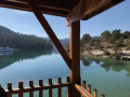
(12) At the bend in the D82, carry on straight ahead and cross the bridge over the Colostre. At the end of the bridge, turn left behind the wooden railings. At the pedestrian crossing, cross the D952 and return to the starting point (S/E).

Waypoints

  1. S/E : mi 0 - alt. 1,161 ft - Car park next to the D952
  2. 1 : mi 0.17 - alt. 1,234 ft - Saint Martin de Bromes "la tour"
  3. 2 : mi 0.23 - alt. 1,257 ft - Junction with a small road
  4. 3 : mi 0.84 - alt. 1,447 ft - Field of olive trees
  5. 4 : mi 1.24 - alt. 1,578 ft - Chemin de la Crête de Saint-Pierre
  6. 5 : mi 4.5 - alt. 1,906 ft - Valensole Road
  7. 6 : mi 4.85 - alt. 1,834 ft - Chemin de la Trinité
  8. 7 : mi 5.09 - alt. 1,919 ft - A fork in the path after a wood
  9. 8 : mi 5.42 - alt. 1,857 ft - Ravin des Brus signpost
  10. 9 : mi 5.97 - alt. 1,490 ft - Valensole Road
  11. 10 : mi 6.75 - alt. 1,378 ft - Rue Félix Arnoux
  12. 11 : mi 6.96 - alt. 1,407 ft - Cycle path
  13. 12 : mi 9.77 - alt. 1,194 ft - D82 - Colostre (rivière)
  14. S/E : mi 10.1 - alt. 1,161 ft - Return to the car park via the D952

Worth a visit

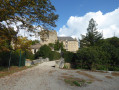
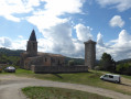
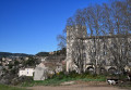
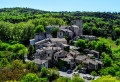
The village of Saint-Martin-de-Brômes with its clock tower and Saint-Martin Church.
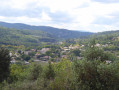
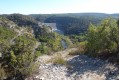
On the Chemin de Crêtes de Saint-Pierre, views of the mountains behind Moustiers-Sainte-Marie.
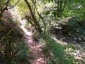
The descent along the pleasant Ravin des Brus path.
Passing by Castellane Castle in Allemagne-en-Provence.

Always be cautious and plan ahead when you're outdoors. Visorando and the author of this route cannot be held responsible for any accidents occurring on this route.

The GR® and PR® markings are the intellectual property of the Fédération Française de Randonnée Pédestre.

Reviews and comments

3.9 / 5
Based on 4 reviews

Reliability of the description
4.8 / 5
Ease of following the route
4.8 / 5
Route interest
2.3 / 5
lepapou
lepapou

Overall rating : 4 / 5

Date of your route : Sep 07, 2023
Reliability of the description : ★★★★★ Very good
Ease of following the route : ★★★★★ Very good
Route interest : ★★☆☆☆ Disappointing
Very busy route : No

A rather tedious walk on both sides, with very few views.

Machine-translated

Hermellin  henri
Hermellin henri

will take place in the spring

Machine-translated

jrco
jrco

Overall rating : 3.7 / 5

Date of your route : Nov 14, 2022
Reliability of the description : ★★★★☆ Good
Ease of following the route : ★★★★☆ Good
Route interest : ★★★☆☆ Average
Very busy route : No

It wasn’t an easy start; the St Pierre ridge lacks views.

Machine-translated

manonroro
manonroro

Overall rating : 4.3 / 5

Date of your route : Oct 26, 2022
Reliability of the description : ★★★★★ Very good
Ease of following the route : ★★★★★ Very good
Route interest : ★★★☆☆ Average
Very busy route : No

An easy walk, with no difficulties but a bit monotonous, especially the return journey along the small tarmac local road.

Machine-translated

DG-Visorando
DG-Visorando

Overall rating : 3.7 / 5

Date of your route : Oct 27, 2022
Reliability of the description : ★★★★★ Very good
Ease of following the route : ★★★★★ Very good
Route interest : ★☆☆☆☆ Very disappointing
Very busy route : No

An endless straight track, lots of road, nothing to see, a rubbish walk.

Machine-translated

Other walks in the area

For more walks, use our search engine .

The GPS track and description are the property of this route's author. Please do not copy them without permission.