The Grand Devançon circular walk from Château Laval

A walk in the hills above Gréoux-les-Bains, starting from Château Laval, along signposted paths through the woods and lavender fields.

Details

1759397
Creation:
Last update:
Last review:
  • Walking
    Activity: Walking
  • ↔
    Distance: 10.47 mi
  • ◔
    Average duration: 5h 50 
  • ▲
    Difficulty: Moderate

  • ⚐
    Back to start: Yes
  • ↗
    Ascent: + 1,198 ft
  • ↘
    Descent: - 1,201 ft

  • ▲
    Highest point: 1,722 ft
  • ▼
    Lowest point: 1,037 ft

Photos

Description of the walk

Starting point: Domaine de Château Laval, at the ‘Château Laval’ signpost, next to a building, at the junction of the Route du Centre Équestre and the Chemin du Pyrethiers; parking is available a little further up.

(S/E) Head towards the Route de Valensole; at the road, turn right and, after 50 metres, turn left onto the small path. Join another small path.

(1) Turn right; at the next T-junction, carry on straight ahead along the edge of the field until you reach the Chemin de Ferre

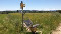
(2) At the “Pierrisnard” signpost, turn left towards La Fare, following the yellow markings, and after 20 m, take the track on the right that leads uphill. At the Y-junction, turn left and join another track at the “La Fare” signpost.

(3) Turn right onto the track towards Fare Est, pass the “Fare Est” signpost and continue straight on towards Jauffret.

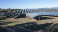
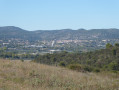
(4) At the junction of two tracks, by the “Jauffret” signpost, take a hairpin bend onto the track on the left towards Le Grand Devançon, pass by the solar farm and, at the Y-junction after the viewpoint overlooking Manosque and at the end of a tarmac section, turn left onto the descending track

(5) At the Grand Devançon building, turn left towards Les Arnavels and, at the T-junction, turn left.

(6) Join the road to Manosque, turn right, continue for 20 metres, turn left and cross the road with care.

(7) Take the track uphill towards La Blache; at the Y-junction, turn left between the fence and the trees; at another Y-junction, turn left, then at the next junction turn left along the fence. You’ll reach a track at the signpost marked ‘La Blache’.

(8) Turn slightly left, join the D82 and follow the small path to the right between the road and the field. Cross a track and continue straight on.

(9) At the “RD82” signpost, carry on along the track beside the road towards Gréoux and, at the “Ancien Chemin de Gréoux” signpost, carry on straight ahead.

(10) At the “l’Agasse” signpost, turn left towards Gréoux and carry on straight down the slope; the track turns into a small road.

(11) At the junction with the signpost marked “Château”, turn left onto the D82, cross the road and continue to the right on the pavement.

(12) Take the first street on the left, Chemin de Sainte-Annette.

(13) At the end of the road, cross the Route de Valensole at the pedestrian crossing, turn right and then immediately left.

(14) Turn into the first street on the left, Impasse de la Gamatte, turn right to cross over the stream and, after the stream, continue along the small path on the right.

(15) Take the hairpin bend into the first small path on the left, then go straight on to join a track and continue to the right.

(16) At the Y-junction, veer to the right, then immediately to the left, and continue along the small track to reach the Domaine de Château Laval (S/E).

Waypoints

  1. S/E : mi 0 - alt. 1,142 ft - Signpost - Château Laval
  2. 1 : mi 0.24 - alt. 1,155 ft - A junction of small paths
  3. 2 : mi 0.47 - alt. 1,178 ft - Pierrisnard
  4. 3 : mi 1.76 - alt. 1,677 ft - La Fare
  5. 4 : mi 2.54 - alt. 1,722 ft - Jauffret
  6. 5 : mi 4.22 - alt. 1,490 ft - Junction
  7. 6 : mi 5.76 - alt. 1,207 ft - The Grand Devançon
  8. 7 : mi 5.96 - alt. 1,115 ft - The road to Manosque
  9. 8 : mi 6 - alt. 1,125 ft - Les Arnavels
  10. 9 : mi 7.36 - alt. 1,624 ft - La Blache
  11. 10 : mi 7.75 - alt. 1,634 ft - D82 road
  12. 11 : mi 8.34 - alt. 1,581 ft - L’Agasse
  13. 12 : mi 9.14 - alt. 1,243 ft - The Castle
  14. 13 : mi 9.32 - alt. 1,181 ft - Sainte-Annette Path
  15. 14 : mi 9.56 - alt. 1,089 ft - Cité Paradis
  16. 15 : mi 9.73 - alt. 1,050 ft - Impasse de la Gamatte
  17. 16 : mi 9.83 - alt. 1,050 ft - The Pontoise Canal
  18. 17 : mi 10.22 - alt. 1,083 ft - Notre-Dame Stream
  19. S/E : mi 10.47 - alt. 1,145 ft - Signpost - Château Laval

Worth a visit

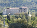
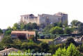
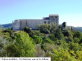
Château Laval
Gréoux-les-Bains Castle
The lavender fields with a view of the Valensole plateau
The solar farm at Gréoux-les-Bains
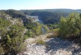
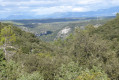
The view over the valley and the town of Manosque before reaching the Grands Devançon
The olive groves of La Brunetière

Reviews and comments

4.1 / 5
Based on 3 reviews

Reliability of the description
4.5 / 5
Ease of following the route
4.7 / 5
Route interest
3 / 5
Géryf
Géryf

Overall rating : 4.7 / 5

Date of your route : Feb 24, 2026
Reliability of the description : ★★★★★ Very good
Ease of following the route : ★★★★★ Very good
Route interest : ★★★★☆ Good
Very busy route : No

A slightly long but fairly easy hike along trails and, unfortunately, a bit of tarmac with traffic, but it's not always easy for the hike designer to avoid this in order to create a circular hike. You can shorten it at point 10 (easy parking) if you want to avoid crossing Gréoux by leaving a car there.
I recommend stopping at the ruined farm at point 6 for a picnic in a meadow under the almond trees (which were in bloom when we visited).

Machine-translated

alain069
alain069

Overall rating : 3 / 5

Date of your route : May 30, 2024
Reliability of the description : ★★★★☆ Good
Ease of following the route : ★★★★☆ Good
Route interest : ★☆☆☆☆ Very disappointing
Very busy route : No

I was very disappointed with this route, which I did with a group of 20 walkers. The section between the reservoir and Le Grand Devançon is completely uninteresting – it’s a 4-metre-wide track, partly dirt and partly tarmac, which has been widened to facilitate access to and monitoring of the solar panel fields stretching for kilometres. Not to be done in fine weather – there’s very little shade on this section.
Alain

Machine-translated

Pierre de Peyrolles
Pierre de Peyrolles
• Edited:

Overall rating : 4.5 / 5

Date of your route : Feb 05, 2023
Reliability of the description : Not used / Not applicable
Ease of following the route : ★★★★★ Very good
Route interest : ★★★★☆ Good
Very busy route : No

A pleasant walk, mostly along paths. Upon reaching the plateau (at point 1), we find ourselves in the middle of a driven hunt. A very understanding hunter alerts his colleagues by radio. We pass fields of lavender, which must be magnificent for photographs in late June. A little further on, we walk alongside a vast field of solar panels, originally arranged to follow the contours of the land. A bird of prey with a wingspan of at least two metres hovers low in the air, circling. About a hundred metres further on, we come across a flock of sheep huddled close together. The griffon vulture, however, is not a predator but rather a scavenger. The track crosses a beautiful field of olive trees. Snack break (6) near the ruins of the pretty Grand Devançon farm and its well. From point 9 and for 1 km, we walk alongside a road – take care, as cars travel fast. From km 14 and for 500 m, there’s a rather tricky descent over large pebbles that roll beneath our feet. Duration of the walk for hikers/nature-watchers like us: 3 hours in the morning + half an hour’s break + 3 hours in the afternoon for the 16 km

Machine-translated

Other walks in the area

For more walks, use our search engine .

The GPS track and description are the property of this route's author. Please do not copy them without permission.