Between Les Cades and Esparron-de-Verdon

A circular walk starting from the road between Gréoux-les-Bains and Esparron-de-Verdon, a stretch through the heath, a visit to the village of Esparron-de-Verdon and a return route through the mountains.

Details

2699618
Creation:
Last update:
Last review:
  • Walking
    Activity: Walking
  • ↔
    Distance: 9.27 mi
  • ◔
    Average duration: 5h 20 
  • ▲
    Difficulty: Moderate

  • ⚐
    Back to start: Yes
  • ↗
    Ascent: + 1,243 ft
  • ↘
    Descent: - 1,253 ft

  • ▲
    Highest point: 1,624 ft
  • ▼
    Lowest point: 1,198 ft

Photos

Description of the walk

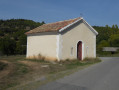
Park in the small car park on the road from Gréoux-les-Bains to Esparron-de-Verdon, between Lourmant and Les Cades; the car park has a glass recycling bin and a small building opposite.

(S/E) Cross the road and take a small path that runs behind the small building; follow the red and white markings ofthe GR®4. Head towards the signpost for Source des Cades.

(1) Turn right and, behind the building, continue towards Esparron. You’ll come to a track; turn right, pass under a high-voltage power line and reach a road.

(2) Cross it and continue along the track opposite after passing through the barrier to keep out cars. At the end of the track, turn left onto the small road known as Chemin de l’Adrech du Deffends. You’ll reach a Y-junction at the end of this path.

(3) Keep to the right, still following the red and whiteGR® markings, cross a ford and, a little further on, join a road on the edge of the forest at a place called La Calade.

(4) Cross it carefully; leave theGR® here and take the uphill track opposite. Continue through the forest. You’ll soon come to a tarmac road. Follow it for a few metres, cut across the bend and rejoin it. Turn right off it, rejoin it once more and arrive at the car park of the Esparron-de-Verdon Emergency Services Centre.

(5) Turn left onto Rue des Fontaines. At the junction with the tree, continue straight on to reach Rue Sainte-Anne.

(6) Turn right onto this street, then left onto Rue des Gîtes. Next, take the steps on the right; at the bottom of the steps, continue to the left to reach Rue de la Chapelle and then Place de la Chapelle. Walk past the building on the left and carry on down the steps. At the bottom of the steps, turn left, then take the first set of steps on the right, which will lead you to Route du Cor des Aires.

(7) Turn left onto this road, then turn right to visit the harbour.

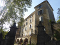
(8) Return to Route du Cor des Aires, then continue along Route du Sorbiou, which follows on from it. You will reach the castle.

(9) Carry on to the right along Rue du Château to visit the church and return to this point. Continue straight ahead along the uphill road. At the junction, turn left onto Route d’Albiosc. Walk past the Sainte-Magdeleine Chapel, then turn left onto Chemin des Fourches. Follow this path until you reach a crossroads just before Rue des Fontaines, which you took on the way out.

(10) Turn right onto this small, ascending path. Pass a ruin and, at the next junction, rejoin theGR®4; take this path and follow its red and white markings to reach the La Colle signpost.

(11) Stay on theGR® to the left and, after a downhill section, join a wider track.

(12) Turn left and return to the Calade crossroads you passed on the way out.

(4) Turn right and retrace your steps along the route you took on the way there to reach the Chemin de l’Adrech du Deffends junction.

(3) Leave theGR® here and continue straight on towards Bertagne; before entering the estate, turn left, join a track and turn right. Join the D82, keeping slightly to the left, to reach the junction with the D315.

(13) Turn left onto it for about ten metres, then take thefirst small path leading uphill to the right. Back on the road, continue for a few metres, then turn left onto the ridge path. Follow it due west until you reach a signpost.

(14) Turn left towards Esparron-de-Verdon. At the bottom of the descent, join the Gréoux road. Cross it carefully and then return to the car park (S/E).

Waypoints

  1. S/E : mi 0 - alt. 1,414 ft - Car park between Lormant and Les Cades
  2. 1 : mi 0.62 - alt. 1,339 ft - Sources des Cades
  3. 2 : mi 1.04 - alt. 1,526 ft - Naturist centre
  4. 3 : mi 2.47 - alt. 1,371 ft - Adrech du Deffends
  5. 4 : mi 2.7 - alt. 1,335 ft - Paved slanting street
  6. 5 : mi 3.33 - alt. 1,348 ft - Esparron-de-Verdon Emergency Response Centre
  7. 6 : mi 3.53 - alt. 1,273 ft - Rue Sainte Anne
  8. 7 : mi 3.8 - alt. 1,243 ft - Cor des Aires
  9. 8 : mi 3.92 - alt. 1,198 ft - The Harbour - Verdon (rivière)
  10. 9 : mi 4.34 - alt. 1,270 ft - Esparron Castle
  11. 10 : mi 5.3 - alt. 1,325 ft - Chemin des Fourches
  12. 11 : mi 5.71 - alt. 1,558 ft - La Colle
  13. 12 : mi 6.1 - alt. 1,368 ft - Trail junction
  14. 13 : mi 7.55 - alt. 1,457 ft - Trente Plain
  15. 14 : mi 8.93 - alt. 1,601 ft - Signpost
  16. S/E : mi 9.27 - alt. 1,424 ft - Car park between Lormant and Les Cades

Worth a visit

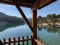
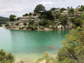
The heath between the starting point and Esparron, with views of the lake and the castle.
The two chapels in Esparron.
The harbour at Esparron.
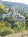
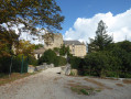
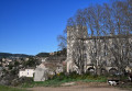
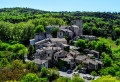
The church and the castle in Esparron.
The village of Esparron-de-Verdon.
The view across the countryside towards Albiosc and the mountains beyond.
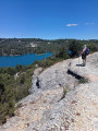
Views of the lake all along the route.

Always be cautious and plan ahead when you're outdoors. Visorando and the author of this route cannot be held responsible for any accidents occurring on this route.

The GR® and PR® markings are the intellectual property of the Fédération Française de Randonnée Pédestre.

Reviews and comments

3.7 / 5
Based on 4 reviews

Reliability of the description
4.3 / 5
Ease of following the route
3.5 / 5
Route interest
3.3 / 5
papineschi
papineschi

Overall rating : 4 / 5

Date of your route : Feb 16, 2025
Reliability of the description : ★★★★★ Very good
Ease of following the route : ★★★★☆ Good
Route interest : ★★★☆☆ Average
Very busy route : No

A few comments:
(2) at the end: ... the end of this road (it is tarmac-surfaced up to this point).
(10) Turn right just before the police station onto this path … ruin not visible …
(13) for 30–40 metres … the small path climbing to the right with several tracks, up to the road
I counted exactly 14 km.
Didier Papineschi

Machine-translated

Chantal&Olivier
Chantal&Olivier

Overall rating : 3 / 5

Date of your route : Mar 13, 2023
Reliability of the description : ★★★★★ Very good
Ease of following the route : ★★★☆☆ Average
Route interest : ★☆☆☆☆ Very disappointing
Very busy route : No

In Esparon, it’s impossible to follow the route description
Lots of tarmac and few views of the lake.
On the A3 after Bertagne, when you rejoin the D82, you have to keep going right for quite a long way before you reach the D315.
The track leading to number 14 is of no interest whatsoever

Machine-translated

Géryf
Géryf

Overall rating : 4.3 / 5

Date of your route : Feb 20, 2023
Reliability of the description : ★★★★☆ Good
Ease of following the route : ★★★★☆ Good
Route interest : ★★★★★ Very good
Very busy route : No

This is a walk best done in winter, as the largely exposed route leaves you vulnerable to the sun’s rays. The route takes you through the pretty village of Esparron-de-Verdon, which is the highlight of this walk. I recommend having a picnic there: if you stray about fifty metres from the described route, to the right of the harbour there is a cove with a beach and a lifeguard post with a picnic table; we had lunch there as it is unused out of season.
As for the route issue raised by carp, this difficulty is encountered on a very short stretch between point 3 and point 4, which is the only section shared by the outward and return journeys: there’s a grumpy local who’s put up a large sign prohibiting passage. On the outward journey, the GR bypasses it on the left, passing through a ditch and then along the edge of the landowner’s field for 20 metres. He’d placed three thorny branches across this path at the entrance and exit of this short stretch. We got past them without any trouble. We even said hello to two people who were moving rocks in the ditch, and they replied kindly. You shouldn’t let yourself be intimidated.
My only criticism is that there’s a bit too much tarmac on this route, particularly towards the end – as is often the case when using the GR trails. I spotted a small error, which was corrected by the GPS: on the return leg, between points 3 and 13, it says: “join the D82. Turn onto it slightly to the left to reach the junction with the D315”, which led to one of those marvellous squabbles, well known to walkers, between those who follow the text and those who follow the GPS. In fact, you need to follow the D82 to the RIGHT but keep to the LEFT of the road through a large field of fruit trees to avoid the cars.
A big thank you to LAURENT FRANCOIS, the author of this lovely walk. Critics should be reminded of the difficulty involved in creating a route, mapping it out correctly, and walking it two or three times to improve the description – all on a voluntary basis, simply out of a love of walking and sharing.

Machine-translated

carp
carp

Overall rating : 3.3 / 5

Date of your route : Oct 24, 2022
Reliability of the description : ★★★☆☆ Average
Ease of following the route : ★★★☆☆ Average
Route interest : ★★★★☆ Good
Very busy route : No

At first glance, it looked like a lovely walk on paper, but the GRP route has been altered at one point due to private property. A visit to Esparron is well worth it; the chapel, the church and the castle are all worth a look. The village was buzzing with excitement ahead of the upcoming pumpkin festival and the American-style celebrations on 31 October.
The return journey was more challenging; we struggled to find the path back up, as ‘private property’ signs blocked our progress, so we ended up retracing our steps along the same route as on the way there.
We’ll have to do it again, setting off earlier so we have time to find the route.

Machine-translated

Other walks in the area

For more walks, use our search engine .

The GPS track and description are the property of this route's author. Please do not copy them without permission.