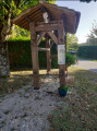
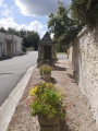
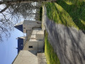
Through small hamlets, woods and fields in Nonac

A walk through rolling countryside, with beautiful scenery, amongst vineyards and woods.

Details

n°4091709
Creation:
Last update:
Last review:
  • Walking
    Activity: Walking
  • ↔
    Distance: 5.66 mi
  • ◔
    Average duration: 2h 50 
  • ▲
    Difficulty: Easy

  • ⚐
    Back to start: Yes
  • ↗
    Ascent: + 315 ft
  • ↘
    Descent: - 344 ft

  • ▲
    Highest point: 502 ft
  • ▼
    Lowest point: 285 ft
  • ⚐ Country: France
  • ⚐ City: Nonac (16190)
  • ⚑
    Start/End: N 45.419518° / E 0.056504°
  • ❏
    IGN map(s): Ref. 1733O
  • Hour-by-hour weather

Photos

Description of the walk

Park in the car park at the Salle des Fêtes, opposite the restaurant.

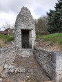
(S/E) Turn right, heading south, and follow the D74 road with care as far as the hamlet of Chez Lucaud. Take the second road on the right, towards Le Grand Sablon. Keep to the left at all times, follow the signs for Forêt de la Serpe and pass the pretty miniature mill on your right.

(1) Turn left at the first gap between the buildings and follow the path marked in yellow. Continue along the path which descends and veers slightly to the right. Follow the path to the small stream, cross it and turn right, following the edge of the field for about 200 m, then turn left to follow the path which climbs (the path is barely visible).

(2) After about 150 m, turn right onto the path that descends through the fields. Pass between two hedges, with a small pond just behind you on your right. Continue for about 250 m and turn right at the first path, walking alongside a wire fence on your left. Carry on until you reach the road.

(3) Turn left towards Forêt de la Serpe and cross the hamlet. Continue along the stony track, which becomes grassy further on. Follow the track as it bends to the right, skirting the woodland on your right, and carry on to the Étang du Randeau on your right, and the five-way junction.

(4) At this five-way junction, be sure to take the second main track on the left. Follow it for 350 m, then turn right onto the first track at the far end of the first vineyard, just before the large oak tree and before the descent.

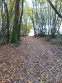
Go round a copse, keeping it on your right and the vineyards on your left. Continue along the path which enters the copse opposite and ignore the small paths on your right. Cross a log bridge and follow the path to the next log bridge.

(5) Cross the culvert and carry on, keeping to the right at all times. Follow the path to the road, then turn right onto the road and carry on to the next crossroads, at a place called Le Merle.

(6) Cross with care and take the small road opposite, which is slightly offset to the left. Walk alongside the hamlet and, at the end of the road, continue along the track for about 800 metres.

(7) Ignore a path on your left; continue straight ahead along the path which climbs very steeply. Follow it for about 400 m until you reach a small stream; cross it, either by wading or using the concrete posts on your left. Head straight ahead, cross the field and take the path into the woods and then between the fields, continuing until you reach the road.

(8) When you reach the road and the Moulin de Bellac, turn right onto a grassy path and follow it to the road (D141).

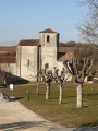
(9) Turn right. Walk past the cemetery, continue on to Nonac and head for the car park (S/E).

Waypoints

  1. S/E : mi 0 - alt. 443 ft - Salle des Fêtes car park
  2. 1 : mi 0.51 - alt. 456 ft - Junction
  3. 2 : mi 0.95 - alt. 364 ft - Path on the right
  4. 3 : mi 1.53 - alt. 397 ft - Road
  5. 4 : mi 2.14 - alt. 443 ft - Étang du Randeau crossroads
  6. 5 : mi 2.98 - alt. 499 ft - Crossroads
  7. 6 : mi 3.62 - alt. 377 ft - Le Merle
  8. 7 : mi 4.09 - alt. 302 ft - Crossroads
  9. 8 : mi 5.05 - alt. 302 ft - The Bellac Mill
  10. 9 : mi 5.32 - alt. 381 ft - D141 road
  11. S/E : mi 5.66 - alt. 443 ft - Salle des Fêtes car park

Notes

The route follows the path marked in yellow, but do not look for the markings as they are almost non-existent. There may be three or four markings along the entire route.

Reviews and comments

3.4 / 5
Based on 3 reviews

Reliability of the description
3.3 / 5
Ease of following the route
3.7 / 5
Route interest
3.3 / 5
josyetjo
josyetjo

Overall rating : 3.3 / 5

Date of your route : Mar 17, 2026
Reliability of the description : ★★★☆☆ Average
Ease of following the route : ★★★☆☆ Average
Route interest : ★★★★☆ Good
Very busy route : No

Please note that point 1 is now private; you must follow the road to point 3. Also, be careful at point 7 as it is difficult to cross due to water; do not attempt this during heavy rain.

Machine-translated

Lambert
Lambert

Overall rating : 5 / 5

Date of your route : Oct 02, 2023
Reliability of the description : ★★★★★ Very good
Ease of following the route : ★★★★★ Very good
Route interest : ★★★★★ Very good
Very busy route : Yes

Really, really lovely

Machine-translated

j-p-sicaud
j-p-sicaud

The grass has grown a lot this year; by the time I realised, he wasn’t in the tall grass. I’m sorry, but the people who post here can’t maintain the paths.

Machine-translated

Timothe43
Timothe43

Overall rating : 2 / 5

Date of your route : Aug 20, 2021
Reliability of the description : ★★☆☆☆ Disappointing
Ease of following the route : ★★★☆☆ Average
Route interest : ★☆☆☆☆ Very disappointing
Very busy route : No

A route to avoid for the time being, given its state of repair…
Route: not particularly interesting; please note that between waypoints 1 and 2, follow the path directly round the field to the right – you’ll rejoin the route on the right when crossing the stream, thus avoiding unnecessary detours through the field…
Condition of the route: not maintained; at present, you’ll be walking through tall grass for over a third of the route, which hides the path and the stream crossings… little shade along this route…
Points of interest: little of tourist interest; some vineyard scenery; few attractive villages and viewpoints
As a long-standing Visorandonneur, this route is the first one I would advise against…
The only highlight is the restaurant in Nonac, where the owner gives you a remarkably warm welcome…

Machine-translated

Other walks in the area

For more walks, use our search engine .

The GPS track and description are the property of this route's author. Please do not copy them without permission.