Country:
 City:
City:


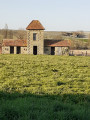
Park in the car park just below the village hall.
(S/E) Join the road and turn right. On the main road (D7), cross at the pedestrian crossing and turn left. Follow the road with care.
(1) Turn right at the first road, the D436, towards Mainfonds. Follow the road for about 150 metres and, immediately after crossing the small stream, leave the road as it turns right and continue straight on along a track. Follow the track between the fields to the hamlet of Le Luc. At the entrance to the hamlet, turn left, walk alongside the buildings and continue through the hamlet along the road.
Follow it for about 300 m.
(2) At the end of the hairpin bend to the left, turn right onto the stony track between two rows of trees. Follow this track, ignoring the path on the right, and head towards the pond’s embankment.
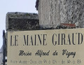
Cross the dam, continue along the path and join the “Manoir du Maine Giraud” road (the home of Alfred de Vigny, where he wrote several of his works).
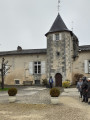
(3) Go round the manor house on the right (the gardens are sometimes open to visitors). The road bends to the right. Follow it between the buildings; immediately afterwards, turn left and carry on to the T-junction.
(4) Turn right and, after about 200 m, turn left at the first road, Route de la Cabane; pass through the hamlet of La Cabane and continue along the road for about 700 m.
(5) Turn left onto the second grassy track. Immediately after a large ash tree, head uphill towards the houses. Join the D7, cross it carefully, and cross the other road just beyond. Continue straight on for about a hundred metres along the road towards Puygrelier.
(6) Turn left onto the first white track. Follow this track, skirting the woodland on the left, and continue along the track which turns right just after the woodland. Carry on along the track as it winds around the fields until you reach the hamlet of Font Ladre, where you’ll join a road.
(7) Follow it to the crossroad and turn left. Ignore the small road on the left heading towards La Côte, pass through the hamlet of Brande and, further on, admire the Lussaud mansion on the left. Join the D436 crossroad.
(8) Turn right onto this departmental road and, after about 300 m, turn left onto the first track. Continue straight on along the narrow track that crosses the Bois du Puy André and pass close to the mast on the right.
(9) Walk to the foot of the water tower, turn left and follow the road. Pass through the hamlet of La Charbonnière and arrive at a T-junction.
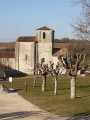
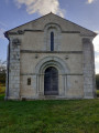
(10) Turn left and follow the road to the village of Champagne-Vigny. Carry on straight ahead, continue along Rue de Chatterton and turn right to pass in front of the church. Head for the car park at the village hall (S/E).

 Tourist office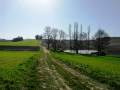

 Visorando Member
 Easy
Easy