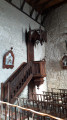
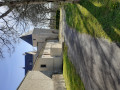
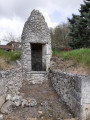
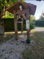
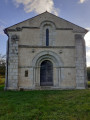
Beautiful scenery with Montmoreau Castle in the distance

Beautiful, unobstructed scenery with views of Montmoreau Castle.

Details

16751545
Creation:
Last update:
Last review:
  • Walking
    Activity: Walking
  • ↔
    Distance: 5.93 mi
  • ◔
    Average duration: 3h 15 
  • ▲
    Difficulty: Easy

  • ⚐
    Back to start: Yes
  • ↗
    Ascent: + 607 ft
  • ↘
    Descent: - 620 ft

  • ▲
    Highest point: 564 ft
  • ▼
    Lowest point: 272 ft
  • ⚐ Country: France
  • ⚐ City: Saint-Amant (16190)
  • ⚑
    Start/End: N 45.395213° / E 0.155871°
  • ❏
    IGN map(s): Ref. 1733E, 1733O
  • Hour-by-hour weather

Photos

Description of the walk

Park in the church car park.

(S/E) As you leave the car park, turn left and follow the main road uphill. Do not take the small road signposted ‘La Grange Lambert – Maison Neuve’. Follow the main road.
Just as the road bends to the left, take the small road opposite towards Chez Berthomé – La Chaise and carry on until you reach the masts.

(1) Turn right into the woods, immediately after the antenna on the right and opposite the one on the left. Follow the path downhill until you reach the road near the hamlet of Les Bernards.

(2) Turn left and, immediately afterwards, right onto the first road; go downhill, pass the end of the Chemin des Trois Vallées and continue along the dead-end road.
Carry on straight along the road until you reach the hamlet of Chez Braud.

(3) At the hamlet, go straight on along the narrow path which climbs steeply. Follow the path through the woods and keep as straight as possible for about 1 km.

(4) After an 85° bend to the right, about 20 metres further on, turn left onto a path; it’s not very wide but is clearly marked.
(If you forget to turn, you’ll end up on the return route – a very wide stony track – so turn back; you’ll only have covered about 350 m).
A little further on, keep to the right on the narrow path and continue to the D450 road.

(5) At the road, turn right and follow it for about 700 m.
Turn right onto the first path marked in yellow; at the entrance to the path there is a sign prohibiting 3T5 vehicles.
Enter the woods, follow this lovely stony track and continue straight ahead along the very long track.

(6) At the junction with a track coming from the right, continue straight ahead along the track. Pass through the hamlet of Chez Bertaud and continue along the road. Head downhill to the next hamlet, Le Maine du Prieur.

(7) Turn right just after passing the barn; walk right past it – it’s very well-maintained and full of flowers; it feels like you’re entering a garden, but there is a path. Just before you reach two large fir trees and the descent, follow the path to the hamlet of Puymoisson.

(8) The name of the hamlet is marked on an electricity pole. Continue along the road, going straight on until you reach the D143

(9) Cross the road carefully and take the path leading uphill opposite. Follow the path until you reach the road. There is a cross on the left and the schools.
Turn right and follow the road to the church car park (S/E).


Waypoints

  1. S/E : mi 0 - alt. 446 ft - Car park - Église Saint-Amant (Saint-Amant-de-Montmoreau)
  2. 1 : mi 0.45 - alt. 482 ft - Two signal bars
  3. 2 : mi 0.85 - alt. 338 ft - Les Bernards
  4. 3 : mi 1.2 - alt. 318 ft - Chez Braud
  5. 4 : mi 2.32 - alt. 541 ft - Turn right
  6. 5 : mi 3.03 - alt. 358 ft - D450 road
  7. 6 : mi 4.32 - alt. 564 ft - Crossroads in the woods
  8. 7 : mi 4.75 - alt. 482 ft - Le Maine du Prieur
  9. 8 : mi 4.94 - alt. 377 ft - Puymoisson
  10. 9 : mi 5.21 - alt. 305 ft - Road D143
  11. S/E : mi 5.93 - alt. 456 ft - Car park - Église Saint-Amant (Saint-Amant-de-Montmoreau)

Notes

It’s best to have a phone with the Visorando app so you can enjoy the peace and quiet of the woods, but it’s perfectly doable without the app.

Reviews and comments

4.6 / 5
Based on 3 reviews

Reliability of the description
4.3 / 5
Ease of following the route
4.7 / 5
Route interest
4.7 / 5
User 20426517

Overall rating : 4 / 5

Date of your route : Jul 30, 2025
Reliability of the description : ★★★☆☆ Average
Ease of following the route : ★★★★☆ Good
Route interest : ★★★★★ Very good
Very busy route : No

A magnificent hiking trail, at least once you're on the right track, which isn't easy without a GPS/GPX route. A very peaceful and beautiful trail. Highly recommended.

Machine-translated

kehan
kehan

Overall rating : 4.7 / 5

Date of your route : Mar 06, 2022
Reliability of the description : ★★★★★ Very good
Ease of following the route : ★★★★★ Very good
Route interest : ★★★★☆ Good
Very busy route : No

I can confirm it’s a lovely route, with the same downside as Marchal16 mentioned: that path through the forest – oh dear, oh dear, oh dear!! Logging operations and big tractors, but we stuck with it right to the end!!!

Machine-translated

Marchal16
Marchal16

Overall rating : 5 / 5

Date of your route : Feb 23, 2022
Reliability of the description : ★★★★★ Very good
Ease of following the route : ★★★★★ Very good
Route interest : ★★★★★ Very good
Very busy route : No

A lovely route with stunning views… and some steep climbs. The only – major – downside was that the path through the forest on the way there was virtually impassable (probably badly damaged by heavy vehicles, and very muddy). We had to take a shortcut to get back onto the return route, which we managed without any problems. We highly recommend it… but in summer or after a long spell of dry weather.

Machine-translated

Other walks in the area

For more walks, use our search engine .

The GPS track and description are the property of this route's author. Please do not copy them without permission.