


 Country:
 City:
City:


Red and white markings
(S) From Place des Halles in Nolay, take Rue Derrière l’Église, then turn left onto Rue Monge. At Place Carnot, turn right onto Rue Sadi Carnot towards Change (D111E).
(1) At the fork in the road on the outskirts of Nolay, take the stony track on the left. Cross a ford in a gully, then at the next fork, turn right along the edge of the woodland. Head straight ahead onto a grassy path, follow a pile of stone gathered from fields*, then come out onto a road and follow it southwards.
(2) At the crossroads, head up to the left along the grassy path between two piles of stone gathered from fields*. Cross the Santenay–Nolay greenway. At another crossroads, take a stony path to the right, then emerge at the top of a road. Head up to the left along another stony path
(3) At the Croix de Craie, head uphill to the left. Ignore a grassy path branching off to the left, then come out onto a road and follow it to the right for 100 metres.
(4) At the fork in the road, head up to the left along a grassy path (Sentier de la Chaume), following a hedge. After a stretch through woodland, you’ll come out onto a plateau.
(5) Ignore a path branching off to the right, then come out onto a road (Chemin du Plessis, signpost for the GR® 7 “Santenay 4 km”). Take this road to the right.
(6) At the Dolmen du Cul Blanc, head up to the left, then at the crossroads, continue uphill straight ahead along the road. At the Fork in the road, take the stony path on the left (GR® 7 signpost “Santenay-le-Haut 3.1 km”). At another fork in the road, turn right (signposted GR® 7 “Santenay-le-Haut 2.1 km”), then left and finally right.
(7) At the paragliding take-off points for Le Pylône and La Montagne, follow the cliff face to the right until you reach a pass. Head down to the left along the path.
(8) At the fork in the road, head down to the right along a steep, stony path (GR® 7 signpost “Santenay 1.5 km”). Walk alongside the vineyards, then come out onto a road and head down to the right.
At the fork in the road, head down to the left along the road, then immediately left onto Route de Saint-Jean.
At the cross, turn right onto Rue de la Crée.
(9) In Santenay-le-Haut, head downhill to the left, then cross the vineyard.
At the junction with the Route des Grands Crus, continue down the road opposite along Rue du Potet.
Ride past the Casino, then the care home.
(10) You’ll come out onto the Beaune–Santenay cycle route; follow it to the left.
Turn right onto the D113A, cross the Nevers–Lagny railway line, then cross a bridge over the Dheune.
Follow the Canal du Centre, then cross it on the left.
(11) Turn right onto the D974 towards Corchanu.
At the T-junction (crossroads), head left up into the hamlet until you reach a Fork in the road.
(12) Continue right along the Montée des Sources (signposted GR® 7 “Neolithic Camp 1.5 km”). Ignore a path on the right, then at the Fork in the road, continue up the slope straight ahead along a stony track.
(13) At the junction on the ridge, continue uphill along the second path on the right.
Enter the site of the Ancient Neolithic Camp, then pass the information board and head down to the right. Continue along the ridge until you emerge into a small valley.
(14) Turn left. Descend through the woods, go through a gate and come out onto a path.
Climb up to the right, pass a shelter, then turn left along the ridge. You’ll come out onto a road; take it straight ahead and head down to Chamilly. Pass the church and come out onto the Grande Rue.
(15) Walk down it to the left, cross the Ruisseau du Moulin Marinot and reach a junction (D109, cross). First turn left then right and take the road that climbs into the forest. At the Fork in the road, take the gravel track to the right, then at a junction, continue along the gravel track heading south-east. Reach a pass.
(16) Turn right onto the Chemin d’Aluze towards Bouzeron. Pass a picnic area and come out onto a road at the Moulin d’Aluze.
(17) Head down Rue du Moulin to the right.
(18) At the church square, turn left onto Rue de la Mairie, then left again onto Rue des Roches Pendantes. At the junction, head down Rue du Tartre to the right, then turn left onto Rue des Vignes de la Chaume for 100 metres.
(19) Head down the road on the right leading to the sewage treatment works, then continue along the stony track. You’ll come out onto a road; follow it to the right.
(20) Shortly afterwards, as you come out of a bend, head up to the left along the stony track. Ignore the paths branching off to the left and right. Pass over a hilltop, then head down a road through the vineyards and emerge onto the D978.
(21) Take this road to the left for 100 m, then head up to the right along a wide stony track. At the fork in the road near the Mecurey hunting lodge, head up to the left into the woods. At another fork in the road, continue straight ahead, then ignore the paths running at right angles and come out onto a road at the Calvaire des Gravelles.
(22) Continue straight on along the road for 80 m, then take the second stony track on the right. Pass the ruins of Montaigu Castle and reach a Fork in the road.
(23) Head down to the right through the vineyards. You’ll come out onto Rue du Clos Montaigu; follow it down to the left, passing a car park on your right (signposted ‘Randonnées’). You’ll come out onto Rue de la Croix Reuchou; turn left onto it.
(24) At the junction, head downhill to the right along Rue des Marronniers. At Place de Corcelles, first turn left then right onto Rue du Clos, then onto Rue de Suzeau. You’ll come out onto the D48; follow it to the left for 60 metres along Route de la Vallée to Mellecey (E).
 Visorando Member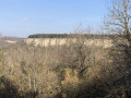
 Moderate
 Easy
Easy 
 Difficult
