


 Country:
 City:
City:


(S/E) Leave the church on your left and follow the road towards Baubigny for about 100 m before turning right onto Rue de l’Orme. Keep left immediately and turn right a little further on at the stone cross.
Keep to the left after the vault and take the one-way lane (Rue Bregnet) to cross the Route de Beaune a little further down.
(1) Cross carefully (poor visibility on the bend!) and follow the path straight ahead through the woods until you reach a three-way junction further on. Turn slightly to the right and continue along the central path.
Ignore a path on the right a short distance further on before reaching a Fork in the road in an open area.
(2) Turn left towards Puligny and head into the forest. Continue climbing along this stony track, going straight on at every junction. (Note that the side paths are often very overgrown and more or less visible.) The gradient will level off before the track leads, further on, to a clearing overlooking the vineyard on the right.
(3) Stay on the track along the edge of the woodland until you reach the forest again and soon come to a path on the left at the 460-metre mark. Turn left onto this winding dirt track and continue downhill towards the north. After a hairpin bend, ignore a path on the right and carry on straight ahead until you come across another path a little further down.
(4) Turn left, continuing downhill, then stay on the track which curves to the right a little further on, leaving a path that climbs slightly to the left. The slope becomes steeper until you reach a lane further down, near the first houses in Melin.
Turn left and follow this lane, which runs alongside the ruins of a castle before crossing the D973.
(5) Cross carefully and head opposite towards Orches, staying on the road until you come to a path on the left near the last houses. Turn left, then keep left shortly afterwards at a Fork in the road.
Follow this lane between vineyards and copses and, a little further on, join a cross-lane at a hunting shelter.
(6) Turn left, then immediately right onto the D111D. At the next bend, take thesecond path on the left and head into the woods (yellow markings).
The path climbs steadily before reaching, a little further on, the junction with the “Chemin de la Cité”, with the village of Baubigny in view.
(7) Turn left and continue climbing gently, still following the yellow markings. The path soon narrows, forcing you to walk in single file, more or less under cover.
Ignore a path branching off to the left before reaching a Y-junction.
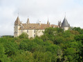
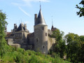
(8) Turn slightly to the left and begin to descend through the woods. Ignore the side paths before walking alongside the stone walls of the Domaine de La Rochepot and reaching another path near the entrance to the château (drawbridge).
Turn right and reach the D111D at the visitors’ car park.
(9) Turn left and follow this road to reach the church a little further down (S/E).

 Visorando Member

 Very difficult
 Difficult
