Circular route via Lavacherie

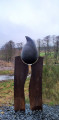
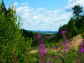
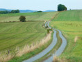
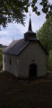
As a result, the walk is more rural than wooded, offering more panoramic views of this beautiful region. Whilst the natural scenery is lovely, don’t expect too many architectural or artistic highlights: there are a few works of art along the old country lane between Amberloup and Lavacherie, the Saint-Hubert Chapel in Bonnerue and the Church of Saint-Ouen in Tillet with its separate bell tower, but that’s about it.

Details

n°52299391
Creation:
Last update:
–
Last review:
–
  • Walking
    Activity: Walking
  • ↔
    Distance: 13.01 mi
  • ◔
    Average duration: 6h 45 
  • ▲
    Difficulty: Difficult

  • ⚐
    Back to start: Yes
  • ↗
    Ascent: + 866 ft
  • ↘
    Descent: - 846 ft

  • ▲
    Highest point: 1,634 ft
  • ▼
    Lowest point: 1,204 ft

Photos

Description of the walk

(5) The standard route continues straight on towards Tonny … but it seems that there is now (since 2025?) the option to turn right and follow the A7 walk, marked with Blue Rectangles, which crosses the Bois Cousin (private) to reach Bonnerue via the forest rather than via the cycle path (concrete) between Tonny (6) and Bonnerue (7).
Worth a try… feedback would be welcome if any ‘visorandonneur’ gives it a go!

(11) When we were there, the mapped path leading straight ahead was impassable. We had to take a detour by turning right onto the road and then taking the first path on the left. Its accessibility seems to vary with the seasons and/or from year to year. No big deal. To be checked.

Waypoints

  1. S/E : mi 0 - alt. 1,280 ft - Amberloup, Place de Sainte-Mère-Église
  2. 1 : mi 0.22 - alt. 1,253 ft - Fork in the road near the picnic area
  3. 2 : mi 0.58 - alt. 1,204 ft - Ourthe occidentale (rivière) - Affluent de l'Ourthe
  4. 3 : mi 1.65 - alt. 1,234 ft - N829
  5. 4 : mi 1.83 - alt. 1,260 ft - Lavacherie, former school
  6. 5 : mi 3.36 - alt. 1,539 ft - Espoir du Bois Cousin
  7. 6 : mi 4.27 - alt. 1,316 ft - Tonny
  8. 7 : mi 5.95 - alt. 1,424 ft - Bonnerue, Saint-Hubert Chapel
  9. 8 : mi 6.88 - alt. 1,506 ft - Picnic table
  10. 9 : mi 7.94 - alt. 1,381 ft - Jenneville - Ourthe occidentale (rivière) - Affluent de l'Ourthe
  11. 10 : mi 9.22 - alt. 1,512 ft - Froide Fontaine stream
  12. 11 : mi 9.66 - alt. 1,617 ft - N848
  13. 12 : mi 11.28 - alt. 1,371 ft - Tillet
  14. 13 : mi 11.34 - alt. 1,365 ft - Saint-Ouen Church and picnic table
  15. 14 : mi 11.6 - alt. 1,319 ft - Picnic table
  16. 15 : mi 11.87 - alt. 1,312 ft - Picnic tables
  17. 16 : mi 12.91 - alt. 1,276 ft - N826
  18. S/E : mi 13.01 - alt. 1,280 ft - Amberloup, Place de Sainte-Mère-Église

Notes

There are quite a few picnic tables along the route: see the list of waypoints.

Other walks in the area

For more walks, use our search engine .

The GPS track and description are the property of this route's author. Please do not copy them without permission.