Athienville Circuit

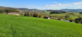
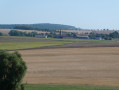
A walk around Athienville and the Ranzey Forest, with a view towards Hoéville.

Details

n°21198672
Creation:
Last update:
Last review:
  • Walking
    Activity: Walking
  • ↔
    Distance: 8.47 mi
  • ◔
    Average duration: 4h 20 
  • ▲
    Difficulty: Average

  • ⚐
    Back to start: Yes
  • ↗
    Ascent: + 551 ft
  • ↘
    Descent: - 558 ft

  • ▲
    Highest point: 1,024 ft
  • ▼
    Lowest point: 705 ft

Photos

Description of the walk

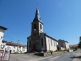
The walk starts at Athienville church, where there are several parking spaces available. Red Ring markings are present almost everywhere along this route.

(S/E) Head for the Grande Rue and follow it to the right.

(1) Turn right towards the Ferme de Ranzey.

(2) Once you reach the hamlet, continue straight ahead and then enter the Ranzey Forest.

(3) Turn left, then a little further on, turn right: be careful, as there are no signposts in some places. Leave the forest and you’ll soon reach a junction.

(4) Carry on to the left along the path beside the Basse des Vaux at the edge of the forest.

(5) Carry on straight ahead in the same direction, first through the woodland and then across fields.

(6) Turn left: ‘Red Ring’ signpost at the crossroads. Ignore the first path on the right.

(7) Follow the signposting, heading down the path on the right through the field to the dirt track below. Turn left, come out onto the access road to Ferme Saint-Jean and continue to the right until you reach the D72.

(8) Turn left and follow the departmental road with care for about 800 m.

(9) Turn right at the edge of the field; signposts are in place. Enter the Bois de Saussi and follow the path as it climbs steeply.

(10) Turn onto the path on the left and follow the signposts as you leave the woods. Continue along the edge of the field, turn left onto the path and join another, wider path.

(11) Follow it to the right until you reach the hamlet of Lincourt.

(12) Carry on straight ahead and rejoin the D72.

(13) Turn right and keep left at the junction.

(1) Go straight on to return to the church and the car park (S/E).

Waypoints

  1. S/E : mi 0 - alt. 758 ft - Athienville Church, car park
  2. 1 : mi 0.21 - alt. 761 ft - Junction on the circular loop
  3. 2 : mi 1.5 - alt. 722 ft - Ranzey Farm
  4. 3 : mi 2.5 - alt. 938 ft - Turn left at the fork
  5. 4 : mi 3.61 - alt. 1,024 ft - Junction, turn left
  6. 5 : mi 4.28 - alt. 951 ft - Junction, straight ahead
  7. 6 : mi 4.92 - alt. 922 ft - Turn left at the junction
  8. 7 : mi 5.25 - alt. 906 ft - Path on the right
  9. 8 : mi 5.86 - alt. 860 ft - D72
  10. 9 : mi 6.11 - alt. 807 ft - Leave the road, take the path on the right
  11. 10 : mi 6.56 - alt. 997 ft - Path on the left
  12. 11 : mi 7.18 - alt. 909 ft - T-junction, turn right
  13. 12 : mi 7.6 - alt. 866 ft - Lincourt
  14. 13 : mi 8.04 - alt. 761 ft - D72
  15. S/E : mi 8.47 - alt. 758 ft - Athienville Church, car park

Notes

No water points.

A picnic table in the centre of the village of Athienville.

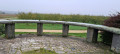
You can start this circular loop from the car park by the orientation table near point (4).

(9) You can shorten the circular route by continuing straight on along the D72 and turning right 500 metres further on towards the hamlet of Hincourt to rejoin the route at point (12).

Red Ring markings are present almost everywhere along this route. Thanks to the local branch of the FFRP.

Worth a visit

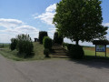
Orientation table near point (4): turn right.

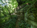
After point (4), a sign in the Basse des Vaux points to the Roche des Fées path. This is a circular path that can be added to the route or explored on a separate hike. There are some lovely rock formations in the woods.
Nearby: A few kilometres away, the Étang de Parroy and its water sports centre.

Reviews and comments

3.3 / 5
Based on 4 reviews

Reliability of the description
3 / 5
Ease of following the route
3.8 / 5
Route interest
3.3 / 5
User 10076719

Overall rating : 4.3 / 5

Date of your route : Apr 13, 2026
Reliability of the description : ★★★★☆ Good
Ease of following the route : ★★★★☆ Good
Route interest : ★★★★★ Very good
Very busy route : No

At times, there were no markings in certain places... but when I checked my route, there were no problems!!

Machine-translated

pclop
pclop

Overall rating : 3.7 / 5

Date of your route : Oct 20, 2024
Reliability of the description : ★★★★☆ Good
Ease of following the route : ★★★★☆ Good
Route interest : ★★★☆☆ Average
Very busy route : No

The path leading into Ranzey Wood after the farm of the same name is a bit tricky to find; it splits into two, and I found myself walking along another (less passable) path about ten metres away.

Machine-translated

Christecol
Christecol

Overall rating : 4 / 5

Date of your route : Nov 04, 2024
Reliability of the description : Not used / Not applicable
Ease of following the route : ★★★★☆ Good
Route interest : ★★★★☆ Good
Very busy route : No

I don’t understand Natfre’s review; personally, I had no trouble following the route and it seems the signposting has been updated a bit!
It’s a lovely walk along little-used paths, which is part of its charm...
I did this walk (with lovely scenery) in very misty weather, so there were no views, but I’d do it again in the spring.

Machine-translated

NATFRE
NATFRE
• Edited:

Overall rating : 1.7 / 5

Date of your route : May 19, 2023
Reliability of the description : ★☆☆☆☆ Very disappointing
Ease of following the route : ★★★☆☆ Average
Route interest : ★☆☆☆☆ Very disappointing
Very busy route : No

Back from this walk...
The route description in the forest is very complicated; you lose sight of the ⭕, or it’s sometimes hidden in the vegetation...
We did a bit of clearing… Point 4, along a pasture, isn’t often used and is therefore difficult to access. Point 5, ‘Les Fées’, is overgrown… At point 6, it’s best to take the first path on the right; at the second path, you cross a meadow that may or may not have been mown…Point 9 is inaccessible… nothing but scrub… we took the alternative route, but it involved a long stretch of tarmac… this walk is signposted – indeed, right in the centre of the village – but it’s absolutely not maintained… too bad for us…

Machine-translated

Other walks in the area

For more walks, use our search engine .

The GPS track and description are the property of this route's author. Please do not copy them without permission.