From Vernoux-sur-Boutonne to the Foncoubert wash house (short version)

A short walk across the plain between Vernoux-sur-Boutonne and Périgné. It offers the chance to discover the traditional architectural heritage of Vernoux-sur-Boutonne and the natural heritage, such as the Foncoubert wash house and fountain, and the landscapes of the plain.

Details

1129352
Creation:
Last update:
Last review:
  • Walking
    Activity: Walking
  • ↔
    Distance: 2.72 mi
  • ◔
    Average duration: 1h 15 
  • ▲
    Difficulty: Easy

  • ⚐
    Back to start: Yes
  • ↗
    Ascent: + 33 ft
  • ↘
    Descent: - 33 ft

  • ▲
    Highest point: 213 ft
  • ▼
    Lowest point: 167 ft

Photos

Description of the walk

(S/E) Join the D104 road. Turn right towards the village of Vernoux-sur-Boutonne. Head left across the junction with the Route de Périgné, where the war memorial is located. Continue for around fifty metres.

(1) Turn left into Rue des Tilleuls and follow it until it joins the D104, the road to Brioux-sur-Boutonne, near the western edge of the village. Turn left, follow the road carefully for about 50 metres, then turn right onto a track.
Follow it to Rue des Marais, going round the beautiful property on the right-hand side. Turn right and head towards the junction of Rue des Marais and the D104. Continue carefully to the left.

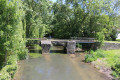
(2) Shortly after passing Rue de l’Epinée (on the left), turn right onto a track that crosses one of the branches of the Boutonne via a small bridge. Continue along a narrow alleyway, passing between two buildings, until you reach Rue de l’Abreuvoir. Turn left and follow the street until you reach the D104.

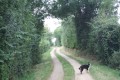
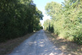
Turn left and immediately take the right-hand turn into Rue des Roctons. At the very start of the street, on the left-hand side, you’ll see the Church of the Holy Cross, which is the smallest church in the department. Shortly afterwards, the road gives way to a country lane near the last houses. The lane crosses the plain towards Périgné and eventually reaches the Foncoubert fountain and washhouse.

(3) Continue along the track, which climbs slightly, until it joins the D740 road. Turn right and follow the road carefully for about thirty metres.

(4) Turn right again onto a small road leading to the house in the hamlet of Saint Hubert. After passing the house, continue to the right along a track. Further on, cross a small road with care and carry on straight ahead until you reach the T-junction with the first track on the right.

(5) Turn right towards the south-west and continue until you come out onto the D104 road. Turn right towards the car park (S/E).

Waypoints

  1. S/E : mi 0 - alt. 180 ft - Car park at the town hall and the Salle des Fêtes
  2. 1 : mi 0.14 - alt. 177 ft - Crossroads - Boutonne (rivière)
  3. 2 : mi 0.43 - alt. 171 ft - Road–path junction
  4. 3 : mi 1.36 - alt. 177 ft - Fontcoubert’s fountain and wash house
  5. 4 : mi 1.56 - alt. 207 ft - Crossroads. Near the - Béronne (rivière)
  6. 5 : mi 2.26 - alt. 194 ft - T-junction
  7. S/E : mi 2.72 - alt. 180 ft - Car park at the town hall and the Salle des Fêtes

Notes

The car park is located at the Town Hall and Village Hall in Vernoux-sur-Boutonne.
Another option near Vilaine (just past the point (4)): a single car (or two at most) can be parked at the start of the road leading to the hamlet of Saint Hubert (two grassy areas provide space for one or two cars).

This walk across varied terrain requires suitable footwear.

This unmarked route presents no real difficulties. It follows sections that are signposted. Consequently, it is advisable to follow the instructions in this description and on the map, whilst also paying attention to the landscapes you pass through. Distance markers from the starting point, or even the GPS coordinates of waypoints (including the start), can also help hikers find their way.

Hike completed by the author on 14 February 2019

Worth a visit

Foncoubert (Foucombert) wash house and fountain
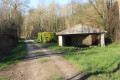
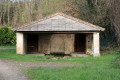
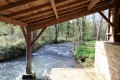
In the municipality of Périgné, 500 metres from the village of Vilaine, there is a wash house fed by a spring. On the other side of the path, a small spring feeds a stream; a pumping station has been installed at another spring near the wash house. The wash house has wooden and stone pillars, a central wooden beam, two doors and large stone slabs on the floor. Its roof is covered with tiles. A few years ago, this wash house was renovated.

In his book *Mythologie des Deux-Sèvres*, Guy Pillard recounts the history of the “Fontaines de Foncoubert”, which were once considered miraculous:
“Pilgrims would visit them particularly during the week leading up to Corpus Christi, for on that day the water from these fountains would turn to milk… and their supernatural powers were thereby enhanced. Until 1789, the parish priest of Périgné would come there on Corpus Christi to lead a procession. People drank this water, which was reputed to cure migraines and stomach aches. It was, moreover, beneficial to animals as well as to humans.
Shepherds, for example, who wished their ewes to be fertile, would lead them to drink from these fountains for a certain number of days; and if they wanted a black lamb, they had to immerse the ewes in the water.

Many superstitions surrounded these fountains at Foncoubert. Tradition has it that at night, by moonlight, travellers who lingered too long would once encounter groups of washerwomen dressed in white, beating funeral linen. Such an encounter was considered an omen of misfortune.”

Vernoux-sur-Boutonne
Hydraulic ram
Installed around 1890 on the River Boutonne, the hydraulic ram cannot fail to arouse your curiosity when in operation, due to its loud thuds. Now very rare, this pressure-pump system was invented by
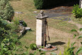
Joseph Montgolfier in 1796. The one in Vernoux was installed in 1890 opposite the mill. This ingenious system uses only the driving force of water. As the water enters air-filled chambers, the pressure builds up and the water is eventually forced through a penstock by the action of valves. It is these valves that you can hear. The force generated is used to carry the water to another reservoir 55 metres away and situated at a height of 8.70 metres.

Vilaine (near Périgné)
Less than five hundred metres from the route (point ) stands a Roman bridge spanning the main road from Niort to Ruffec. The restored bridge spans the River Béronne. Comprising two arches and abutments, it is in the tradition of medieval bridges such as those still to be seen in the Gâtine region (Gourgé) or in the Thouarsais region (Saint-Généroux). This bridge was restored as part of a work integration scheme for the long-term unemployed. The collapse of one of the arches had threatened to flood the houses downstream.

The Grézolle washhouse (not on the route)
The La Grézolle washhouse is situated opposite the Château de la Grézolle and at the bottom of the hamlet. It is also near the bridge over the River Belle. It has six wooden posts and two low stone walls. It has no door and the roof is tiled.

Périgné
Protohistoric and Gallo-Roman settlement.
A village on the dividing line between the Catholic region to the south-west and the Protestant region to the north-east; the church was burnt down during the Wars of Religion.
A dolmen destroyed at ‘Pierre-Levée’.
Remains of a Gallo-Roman temple at Mairé; excavations at Mazerolles: Roman villa, thermal baths, theatre.
Gallo-Roman and Merovingian cemetery at La Boucharderie.
Remains of the Château de la Guittonnière, 15th/16th century.
Foucombert Fountain.
Saint-Martin’s Church, 10th century, rebuilt in the 17th century; Romanesque nave and bell tower, capitals on the north portal.

Reviews and comments

4.7 / 5
Based on 2 reviews

Reliability of the description
5 / 5
Ease of following the route
5 / 5
Route interest
4 / 5
User 28749416

Overall rating : 4.7 / 5

Date of your route : Jun 11, 2026
Reliability of the description : ★★★★★ Very good
Ease of following the route : ★★★★★ Very good
Route interest : ★★★★☆ Good
Very busy route : No

At the start, in the village, make sure you follow the route description and the yellow markings carefully, as the route is tricky.
At the wash house, you can take a path on the right that climbs directly up to St Hubert (blue markings), thus avoiding the main road.

Machine-translated

lafamillelacour
lafamillelacour

Overall rating : 4.7 / 5

Date of your route : Sep 09, 2024
Reliability of the description : ★★★★★ Very good
Ease of following the route : ★★★★★ Very good
Route interest : ★★★★☆ Good
Very busy route : No

A really lovely route starting from the pretty little village of Vernoux. We didn’t see a soul; it’s really peaceful walking through the fields. A relaxing, easy and enjoyable route.

Machine-translated

Other walks in the area

For more walks, use our search engine .

The GPS track and description are the property of this route's author. Please do not copy them without permission.