Country:
 City:
City:


Park at the bottom of the hamlet of Mairé.
(S/E) Take a farm track heading east-north-east. It follows the Béronne valley before climbing up towards the plateau.
(1) At the crossroads, take a path on the right leading downhill. The walk then follows theGR®655and one of the routes to Santiago de Compostela. Carry on straight ahead to the Moulin de Génebrie, which you’ll reach after crossing the Béronne via a small stone bridge. When you reach the road, turn left to walk past the mill.
(2) Immediately afterwards, turn right onto an uphill path. Follow it straight on until you reach the plateau. At the junction, continue straight on along the path that veers slightly to the right.
(3) At the next junction, turn right (west) onto the tree-lined path that passes under a high-voltage power line. Continue straight on until you reach the D740 road. Cross it with great care and take the slightly downhill path opposite.
(4) At the first junction, turn right onto the almost flat path heading north-west. Shortly afterwards, ignore a path on the right which joins the D740 road some distance further on, and turn onto the path on the left which joins the Vernoux road.
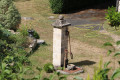
(5) Turn right towards the Y-junction with the Route de Périgné, where the war memorial is situated. Continue towards the village centre and take the street on the left. As you cross the Boutonne, you’ll see the water ram and the flour mill (see the section ‘During the walk or nearby’).
Continue along this circular route around the village centre until you reach Route de la Boutonne. Turn right and walk upstream along the Boutonne to Rue des Roctons.
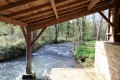
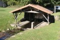
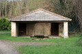
(6) Turn left onto this street, which, once past the last houses, becomes a farm track. Carry on straight ahead. The track passes close to the sewage treatment plant on the left. You’ll reach the River Béronne and the beautiful Foncoubert (Foucombert) fountain and washhouse.
(7) Continue along the same track and head uphill to join the D740 road. Walk along the road with caution, using the wide grass verge on the left-hand side (heading towards Vilaine).
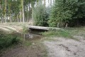
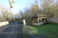
(8) Immediately after the Moulin de Vilaine, cross the D740 road with great care to take the grassy path that crosses the restored Roman bridge (see the ‘During the walk or nearby’ section).
After the bridge, the path is circular and passes through some gardens before returning to the D740. Turn right and walk alongside it for 20 metres (take care).
(10) Turn right onto the uphill Rue de Riplet. The street leads to the top of the neighbourhood. Then turn right onto the Chemin des Fermedières. The route passes a house where Joseph Pineau, president of the Deux-Sèvres Departmental Liberation Committee, once lived.
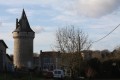
Immediately afterwards, turn right onto Rue du Château, which descends towards the Château de la Grézolle. At the first right-hand bend, take the small, steeply descending path opposite (on the left-hand side) which runs alongside the château grounds, turns to the right and follows the River Béronne. It then passes below the Château de la Grézolle (offering a fine view of this private estate) and emerges onto the road near the bridge spanning the River Béronne. Opposite is the Grézolle washhouse on the banks of the River Béronne.
(10) Turn left, cross the Béronne via the bridge and continue along the road until you reach the first path on the left, which you take to continue the walk. Shortly afterwards, turn left onto the tree-lined path on your right-hand side, heading north. It soon runs alongside a high-voltage power line, before turning sharply right to cross the Béronne via the Pont Robert.
A little further on, leave Rue de la Béronne behind and continue along Rue du Pont Robert. When you reach Impasse du Moulin, turn left and then immediately right into Rue des Feux Fanets. At the end of Rue des Feux Fanets, the route returns to the car park (S/E).

 Visorando Member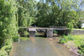

 Moderate