From Vilaine to the Pont de la Berge

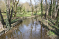
A pleasant little walk along both banks of the Béronne between Vernoux-sur-Boutonne and Vilaine (de Périgné). Beautiful scenery and some lovely discoveries, such as the wash house at Foncoubert (Foucambert according to other sources), fine examples of traditional architecture and a delightful natural environment.

Details

1754578
Creation:
Last update:
Last review:
  • Walking
    Activity: Walking
  • ↔
    Distance: 5.04 mi
  • ◔
    Average duration: 2h 20 
  • ▲
    Difficulty: Easy

  • ⚐
    Back to start: Yes
  • ↗
    Ascent: + 36 ft
  • ↘
    Descent: - 36 ft

  • ▲
    Highest point: 217 ft
  • ▼
    Lowest point: 154 ft

Photos

Description of the walk

(S/E) From the car park by the Town Hall and the Village Hall, head towards the road and follow it to the right towards the village. Pass the monument on your right and continue to the junction with Rue des Tilleuls.

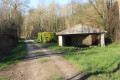
(1) Continue to the right on the D104, walking alongside one of the branches of the River Boutonne on your left. Take thesecond right onto Rue des Roctons. Carry on straight ahead along the path that follows on from it after the last houses. Pass a sewage treatment works on your left and carry on straight ahead north-north-east. You’ll reach the Foncoubert washhouse (see the ‘During the walk’ section).

(2) Follow the path, which climbs slightly, to join the D740. Follow (with care) the road to the left (using the grassy verge on the left-hand side). At the Moulin de Vilaine, cross the road with care (no pedestrian crossing).

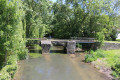
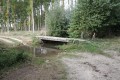
(3) Continue along the road and, after a few dozen metres, turn right onto the path which crosses a pretty Roman bridge. The path then leads back to the road after going round a house and its garden. Walk alongside the road until you reach the pedestrian crossing.

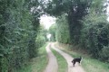
Then cross the road and follow the Chemin de Théré straight ahead, slightly to the left. Go straight on for about 150 metres and turn right onto the Chemin des Minaies. Follow this road, ignoring the side lanes, and leave Vilaine. Ignore a path branching off to the right and you’ll soon reach a junction.

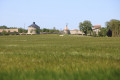
(4) Take the path on the left. At the next junction, turn right (south-west). Ignore a path branching off to the left (marker 56). After passing through the hamlet of La Grande Baillie, join a small road and follow it to the left (note a fortified farm with a dovecote some distance away on the right).

(5) At the crossroads, turn left. You’ll immediately join the D104; follow it to the left. Cross a stream at the hamlet of Badane and immediately take a path on the right at the edge of the woods. The path runs more or less alongside the course of the Béronne. Continue until it joins a small road.

(6) Then turn left and follow the road carefully towards the hamlet of La Fosse-à-Genets. Ignore a turn-off on the right and, at the next junction, turn slightly left. Join the D104 at the hamlet known as Le Pont de la Berge and follow it to the right (taking care). Immediately ignore the road to Cholet on the right and carry on straight ahead until you reach a square dovecote on the left-hand side, at the entrance to a beautiful estate.

(7) Turn left onto Impasse de la Fontaine, which runs round the estate. At the end, follow Rue du Marais to the right. At the end, turn left to follow the D104. Pass Rue de l’Epinée on your left and immediately turn right onto a footbridge over the Boutonne. Continue along the narrow lane that follows it. At the end, carry on along a small street. At the next junction, turn left into Rue des Tilleuls.

(1) At the T-junction, turn right, passing the war memorial on your left, and head towards the car park (S/E).

Waypoints

  1. S/E : mi 0 - alt. 180 ft - Car park at the Town Hall and the Village Hall
  2. 1 : mi 0.14 - alt. 177 ft - Junction of the D104 and Rue des Tilleuls
  3. 2 : mi 1.04 - alt. 174 ft - Foncoubert (Foucambert) wash house
  4. 3 : mi 1.37 - alt. 180 ft - Vilaine Mill. Roman bridge over the - Béronne (rivière)
  5. 4 : mi 2.06 - alt. 180 ft - Junction
  6. 5 : mi 3.33 - alt. 174 ft - Road junctions
  7. 6 : mi 3.93 - alt. 154 ft - Crossroads (path and road)
  8. 7 : mi 4.65 - alt. 167 ft - Junction of the D104 and Impasse de la Fontaine - Boutonne (rivière)
  9. S/E : mi 5.04 - alt. 180 ft - Car park at the Town Hall and the Village Hall

Notes

The car park is located at the Town Hall and Village Hall in Vernoux-sur-Boutonne (a large open area to the east of the village).

This walk across varied terrain requires suitable footwear.

This walk is only partially signposted. Consequently, it is advisable to follow the directions in the description and on the map, whilst also paying close attention to the landscape. The waypoints (with their GPS coordinates and the distance from the starting point) serve as aids for walkers exploring the route for the first time.

Hike completed by the author on 12 May 2019 and 8 June 2019

Worth a visit

Vernoux-sur-Boutonne
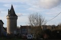
Vernoux-sur-Boutonne is a small French village, situated in the Deux-Sèvres department and the Nouvelle-Aquitaine region (formerly the Poitou-Charentes region). Its inhabitants are known as the Vernouxais and the Vernouxaises.
The commune covers an area of 8.1 km² and had a population of 222 according to the latest census, conducted in 2007. With a population density of 27.3 inhabitants per km², Vernoux-sur-Boutonne has seen a marked increase of 27.6 per cent in its population compared with 1999.
Surrounded by the communes of Séligné, Brioux-sur-Boutonne and Secondigné-sur-Belle, Vernoux-sur-Boutonne is situated 3 km south-west of Périgné, the nearest large town.
Situated at an altitude of 53 metres, the River Boutonne is the main watercourse flowing through the commune of Vernoux-sur-Boutonne.
Source: Town Hall Yearbook (excerpts)

Foncambert Washhouse
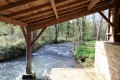
The Foncambert washhouse (Fontcoubert on the map) is situated on a small path leading to the village of Vernoux-sur-Boutonne after Vilaine, on the road to Brioux. It is fed by a stream, a tributary of the Béronne. It has wooden and stone pillars, a central wooden beam, two doors and large stone slabs on the floor. Its roof is covered with tiles. A few years ago, this washhouse was renovated. There is a legend about its water.

The legend of the fairy washerwomen:
‘Many wash houses are bathing spots for fairies. As they do not wish to be seen by humans, they bathe at night. In days gone by, women had to be careful not to arrive too early in the morning to wash their laundry, for if they caught the fairies, they risked being chased away with slaps or beaters. Tradition also has it that if you hear the clacking of washbeaters at night, coming from the washhouses, you must on no account go to investigate, for it is the fairy washerwomen beating a sheer curtain intended for someone who will very soon join them in the afterlife. Anyone who is too curious and goes to surprise them might well be told that the sheer curtain is meant for them.”

Source: Dracis79 – The Washhouses of Deux-Sèvres and *Tales and Legends of the Mellois Region* by the Tourist Office

Reviews and comments

4.7 / 5
Based on 2 reviews

Reliability of the description
4.5 / 5
Ease of following the route
4.5 / 5
Route interest
5 / 5
chabot sandrine
chabot sandrine

Overall rating : 4.3 / 5

Date of your route : Feb 20, 2024
Reliability of the description : ★★★★☆ Good
Ease of following the route : ★★★★☆ Good
Route interest : ★★★★★ Very good
Very busy route : No

We’re a walking club and everyone said it was a lovely walk

Machine-translated

larochenet
larochenet

Overall rating : 5 / 5

Date of your route : Nov 24, 2021
Reliability of the description : ★★★★★ Very good
Ease of following the route : ★★★★★ Very good
Route interest : ★★★★★ Very good
Very busy route : No

A lovely little walk: perfect for this time of year in November. Beautiful colours and some wonderful discoveries: the (very) little church in Vernoux, the wash houses, the little Roman bridge at Vilaine, and the charming stone-built village houses. I loved every bit of it. On the way back, I pottered through the village’s streets and alleyways. Well worth a visit.

Machine-translated

Other walks in the area

For more walks, use our search engine .

The GPS track and description are the property of this route's author. Please do not copy them without permission.