Between Barbaise and Raillicourt

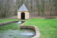
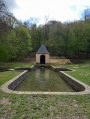
A walk for those who wish to stroll through the countryside when it’s not too hot (there aren’t many woods). The village of Barbaise has installed a number of truly welcome features, all with a touch of humour: an exhibition of paintings from different periods in the washhouse, a trail featuring moral lessons from fables accompanied by sculptures around the village, and a flower-filled pond alluding to Brussels’ Manneken-Pis.

Details

12699112
Creation:
Last update:
Last review:
  • Walking
    Activity: Walking
  • ↔
    Distance: 5.20 mi
  • ◔
    Average duration: 2h 40 
  • ▲
    Difficulty: Easy

  • ⚐
    Back to start: Yes
  • ↗
    Ascent: + 272 ft
  • ↘
    Descent: - 243 ft

  • ▲
    Highest point: 830 ft
  • ▼
    Lowest point: 623 ft
  • ⚐ Country: France
  • ⚐ City: Barbaise (08430)
  • ⚑
    Start/End: N 49.665671° / E 4.57925°
  • ❏
    IGN map(s): Ref. 2909SB, 2910SB
  • Hour-by-hour weather

Photos

Description of the walk

Parking is available near the church.

(S/E) Walk round the church, go down Rue Haut, then turn right towards the town hall. With your back to the town hall, turn right onto the main street and, at the end of it, turn left. The washhouse, which houses an exhibition of various paintings from different periods, is situated about ten metres further on, on the right.

(1) Turn left into Rue du Ruisseau de Pétréant, walk alongside the landscaped pond, then follow the street to the castle, which has been converted into a farm.

(2) Take the path on the left opposite the château and join the small road leading to Raillicourt. Follow this road to the right, pass under a power line and arrive at the crossroads at the entrance to Raillicourt.

(3) Turn right to cross the village via Rue du Haut du Remblay, then Rue de l’Église, until you reach the church.

(4). Turn left back onto Rue du Haut du Remblay, turn right into Rue de Metz, then left into Rue de Saint-Michel to return to the crossroads at the entrance to Raillicourt.

(3) Continue to the right along Rue de Touligny until you reach the junction near the hamlet of Le Pré Milot.

(5) Turn left towards Hocmont. Pass under the power line again and follow the small road along the Fond de la Ruelle aux Boquillons.

(6) At the junction with a grassy track, turn left onto it towards Barbaise.
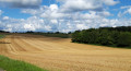
Continue the walk through meadows and cultivated fields, descending from the 260-metre mark to an altitude of 225 metres.

(7) Turn left onto Rue Haut and follow it back to the starting point in the village (S/E).

Waypoints

  1. S/E : mi 0 - alt. 686 ft - Église Sainte-Anne (Barbaise)
  2. 1 : mi 0.25 - alt. 650 ft - Washing house
  3. 2 : mi 0.61 - alt. 646 ft - Château de Barbaise
  4. 3 : mi 1.39 - alt. 663 ft - Crossroads at the entrance to Raillicourt
  5. 4 : mi 1.61 - alt. 623 ft - Église Saint-Martin (Raillicourt)
  6. 5 : mi 2.37 - alt. 630 ft - Touligny-Hocmont crossroads
  7. 6 : mi 3.73 - alt. 830 ft - Crossroads towards Barbaise
  8. 7 : mi 4.84 - alt. 715 ft - Rue du Haut
  9. S/E : mi 5.2 - alt. 686 ft - Église Sainte-Anne (Barbaise)

Worth a visit

- Visit the exhibition on display in the Barbaise washhouse. An unexpected treat.
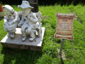
- If you wish, you can look for all the sculptures associated with the moral lessons from La Fontaine’s fables; they are located in various parts of the village. There is a mistake in the clues: the answer is given near the washhouse.
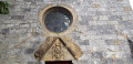
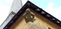
- The exterior of Raillicourt Church is well worth a look (gargoyle, windows dating from 1565, etc.).

Reviews and comments

4.2 / 5
Based on 3 reviews

Reliability of the description
4.7 / 5
Ease of following the route
4.7 / 5
Route interest
3.3 / 5
Rethel
Rethel

Overall rating : 3.7 / 5

Date of your route : Jul 30, 2023
Reliability of the description : ★★★★☆ Good
Ease of following the route : ★★★★☆ Good
Route interest : ★★★☆☆ Average
Very busy route : Yes

At number 6, it says ‘at the junction with a grassy path’. This path is gravelled, not grassy.
In any case, it’s an easy walk.
It can be done even after a few days of rain.

Machine-translated

Parapente08
Parapente08

Overall rating : 4.3 / 5

Date of your route : Feb 27, 2023
Reliability of the description : ★★★★★ Very good
Ease of following the route : ★★★★★ Very good
Route interest : ★★★☆☆ Average
Very busy route : No

A lovely walk, beautiful views, well-maintained paths, though the route is a bit monotonous.

Machine-translated

olive
olive

Overall rating : 4.7 / 5

Date of your route : Jul 06, 2022
Reliability of the description : ★★★★★ Very good
Ease of following the route : ★★★★★ Very good
Route interest : ★★★★☆ Good
Very busy route : No

Well explained (this one)...
a lovely walk to explore the Ardennes countryside

Machine-translated

Other walks in the area

For more walks, use our search engine .

The GPS track and description are the property of this route's author. Please do not copy them without permission.