The “Terre aux Roches” route in Fagnon

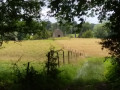
Magnificent view over the village of Fagnon and the surrounding countryside.

Details

3111521
Creation:
Last update:
Last review:
  • Walking
    Activity: Walking
  • ↔
    Distance: 2.28 mi
  • ◔
    Average duration: 1h 20 
  • ▲
    Difficulty: Easy

  • ⚐
    Back to start: Yes
  • ↗
    Ascent: + 318 ft
  • ↘
    Descent: - 318 ft

  • ▲
    Highest point: 883 ft
  • ▼
    Lowest point: 564 ft
  • ⚐ Country: France
  • ⚐ City: Fagnon (08090)
  • ⚑
    Start/End: N 49.735453° / E 4.636209°
  • ❏
    IGN map(s): Ref. 2909SB
  • Hour-by-hour weather

Description of the walk

Park at Place de la Mairie.

(S/E) With your back to the town hall, turn right to cross the bridge over the Ruisseau des Rejets, cross the RD34 and take the alley opposite.

(1) At the top, turn left into Rue Haute, then 50 metres further on, take Chemin de la Louvière on the right. Continue along this path until you reach the RD34; follow it to the right for about twenty metres, then turn right onto Chemin de la Vallée Robin, which joins the road further up.

(2) Immediately turn right onto a path between two fields. At the end, turn right down to the bottom of the field, then turn left between the two small copses. Walk for about 600 metres to the fence: the path no longer exists, but there is a right of way.

(3) From here, you have a magnificent view of the village. Walk down alongside the fence (right of way) then turn right to join the road (Rue des Sept Fontaines).

(4) Head back down to the right towards the village. At the wash house, turn right onto Rue Perpère, then take the first street on the right.

(1) Turn left to cross the bridge again and reach the town hall car park (S/E).

Waypoints

  1. S/E : mi 0 - alt. 564 ft - Town hall car park
  2. 1 : mi 0.07 - alt. 577 ft - Rue Haute
  3. 2 : mi 0.7 - alt. 823 ft - RD34
  4. 3 : mi 1.33 - alt. 761 ft - View of the village
  5. 4 : mi 1.62 - alt. 666 ft - Rue des Sept Fontaines
  6. S/E : mi 2.28 - alt. 564 ft - Town hall car park

Worth a visit

Reviews and comments

4 / 5
Based on 3 reviews

Reliability of the description
4 / 5
Ease of following the route
3.3 / 5
Route interest
4.7 / 5
User 28316517

Overall rating : 5 / 5

Date of your route : Jan 26, 2026
Reliability of the description : ★★★★★ Very good
Ease of following the route : ★★★★★ Very good
Route interest : ★★★★★ Very good
Very busy route : No

Beautiful view of the surrounding hills. Easy hike.
Off-trail route not easy to find on the way down, but you can still manage it.

Machine-translated

Parapente08
Parapente08

Overall rating : 3.3 / 5

Date of your route : Jan 30, 2023
Reliability of the description : ★★★☆☆ Average
Ease of following the route : ★★☆☆☆ Disappointing
Route interest : ★★★★★ Very good
Very busy route : No

Hello, the off-track section isn’t straightforward. Between point 2 and point 3 there’s a right-hand bend; the co-ordinates should be specified, or it should be made clear not to take the grassy path. But above all, the next left-hand bend between the two small copses is absolutely not obvious – there’s no sign of frequent use – and this point really does warrant GPS co-ordinates.
Just a quick note: your routes are mostly very good. For the coordinates, I use a Garmin GPS and also GPS-compatible IGN maps, and I find that on the GPS I use kilometre coordinates and degrees.
Thank you for all your hard work.
I’ll be sending you a circular route for the PRIX LES MEZIERES WARCQ MEZIERES route soon, passing by a small chapel. The path is very muddy at the moment (gaiters are essential).

P.S. I’m writing to Fagnon Town Hall.

Machine-translated

Humbeline
Humbeline

Hello,
There is indeed a problem on this section. Historically, a path ran across this plot, but the farmer was ploughing up the path. The mayor at the time decided to sell the path to this farmer, despite opposition from many villagers. The path was nevertheless sold on the condition that a right of way for pedestrians be maintained and that passage not be obstructed; despite this, the farmer continues to plough over this right of way, sometimes forcing walkers to turn back. I would advise you, as I have done before, to ring the town hall or send an email (mairie.fagnon@wanadoo.fr) to report this inconvenience

Machine-translated

DUBERRY
DUBERRY

Overall rating : 3.7 / 5

Date of your route : Jan 08, 2021
Reliability of the description : ★★★★☆ Good
Ease of following the route : ★★★☆☆ Average
Route interest : ★★★★☆ Good
Very busy route : No

As regards points 2 to 4, the rights of way are rarely respected; we walked through a ploughed field...

Machine-translated

Other walks in the area

For more walks, use our search engine .

The GPS track and description are the property of this route's author. Please do not copy them without permission.