


AJan08

 Visorando Member
 Premium user
 Sign up:
Published route(s)
 Murtin circular loop
 4.18 mi
 +318 ft
 -315 ft
 2h 10
2h 10
 Easy
Easy
 Departure from Murtin-et-Bogny (Ardennes)
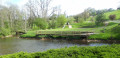
A route offering varied landscapes (mill and reservoir, rock folds, woods, meadows) with a view of the Saint-Quentin de Rimogne mine headframe and the hamlet of Bogny with its picnic area.
Between Barbaise and Raillicourt
 5.20 mi
+272 ft
-243 ft
2h 40
Easy
Departure from Barbaise (Ardennes)
5.20 mi
+272 ft
-243 ft
2h 40
Easy
Departure from Barbaise (Ardennes)
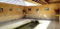
A walk for those who wish to stroll through the countryside when it’s not too hot (there aren’t many woods). The village of Barbaise has installed a number of truly welcome features, all with a touch of humour: an exhibition of paintings from different periods in the washhouse, a trail featuring moral lessons from fables accompanied by sculptures around the village, and a flower-filled pond alluding to Brussels’ Manneken-Pis.
The Ganguille dolmen and the villages of Bolmont and Hardoncelle
 4.98 mi
+554 ft
-554 ft
2h 45
Easy
Departure from Saint-Marcel (Ardennes) (Ardennes)
4.98 mi
+554 ft
-554 ft
2h 45
Easy
Departure from Saint-Marcel (Ardennes) (Ardennes)
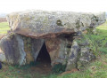
A walk offering 360° panoramic views and taking you from one valley to another. As well as the Dolmen de la Ganguille, don’t miss the viewpoint over the Audry Valley and Hardoncelle Castle.