Baâlons, Omont, Chagny – villages on the Pre-Ardennes ridges

From a rare Baroque church in the countryside at Baâlons, to the timber-clad or slate-roofed houses of Chagny, via the ruins of Omont Castle and its sculpture gardens.

Details

2184315
Creation:
Last update:
Last review:
  • Walking
    Activity: Walking
  • ↔
    Distance: 11.17 mi
  • ◔
    Average duration: 5h 50 
  • ▲
    Difficulty: Moderate

  • ⚐
    Back to start: Yes
  • ↗
    Ascent: + 830 ft
  • ↘
    Descent: - 833 ft

  • ▲
    Highest point: 968 ft
  • ▼
    Lowest point: 604 ft
  • ⚐ Country: France
  • ⚐ City: Baâlons (08430)
  • ⚑
    Start/End: N 49.593958° / E 4.669756°
  • ❏
    IGN map(s): Ref. 2910SB
  • Hour-by-hour weather

Description of the walk

Start in front of the Baroque church in Baâlons.

(S/E) Opposite the church, turn right, heading due east, onto the road which quickly leaves the village and runs through pastures. Head slightly into the woods.

(1) Turn left onto the first straight track, heading due north. Cross a forest track and continue down the steep path which joins the forest track.

(2) Follow it to the right. It leads to the Pont de la Folie. Carry on to the D28 and follow it to the right.

(3) At the first track on the right, head into the woods. Cross the Pont de la Bauquerie, then the Pont de la Grangette. The track then runs alongside meadows until it reaches the D33.

(4) Turn right and follow the road to the entrance to Omont, at the junction with the D33, which you must not take.

(5) Turn right onto the small road leading up to the church and Omont Town Hall.
Take the time to read the various information boards explaining the history of the castle, a strategic stronghold for many centuries which was destroyed by Henry IV.
Walk past the cemetery until you reach the D33, then follow it to the right for 100 metres.

(6) Turn left onto the path between two meadows. Stop at the sculpture garden, the Champavoy (two other gardens by the same sculptors are located in Omont, 500 metres and 1,250 metres away respectively). The path continues through a wood, then enters a field.

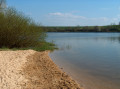
(7) Immediately turn left downwards, through the copse, to join a path which descends more steeply in places. It overlooks the Étangs de la Vivaubières (private property). You’ll reach the bottom of the descent at the end of the second pond (Étang des Vivaubières).

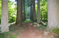
(8) Turn right onto a wide, poorly marked and muddy path. After about ten metres, cross the stream and continue along this path for about a hundred metres. It then becomes a lovely path where you can find wild asparagus on either side in spring. 500 metres further on, stay alert and do not be led astray by the path that continues straight ahead.

(9) Turn left (a large beech tree marked number 22 is situated just before the junction). Continue along the path, which leads out onto the meadows of Chagny.

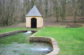
(10) Turn left onto a path that takes you to Chagny, passing a first wash house on the way. Reach the D33 road, follow it to the left and cross over the Bairon stream.

(11) Then take the first road on the right, which passes by a second wash house. Walk up to the church. Follow a path to the left along the edge of the Buttigny woods. Admire the view over Chagny and the three community-owned wind turbines, one of which was funded by children and the others by local residents and local authorities, mostly from the Ardennes. Pass by a pylon and continue uphill.

(12) Turn right onto a wide path that descends into the Bois de Buttigny until you reach a forest track.

(13) Turn left, then follow the path alongside a pond and carry on until you reach the edge of the woods.

(14) At the edge of the woods, head up a path on the right, through the fields, which leads back to Baâlons. At the top of the hill, rejoin the path you took on the way out, follow it to the left and return to Baâlons church (S/E).


Waypoints

  1. S/E : mi 0 - alt. 778 ft - Baâlons Church
  2. 1 : mi 0.88 - alt. 869 ft - Turn left into the forest
  3. 2 : mi 1.2 - alt. 732 ft - Turn right onto the forest track.
  4. 3 : mi 2.04 - alt. 669 ft - Turn right to enter the woods
  5. 4 : mi 4.03 - alt. 732 ft - Turn right towards Omont.
  6. 5 : mi 4.65 - alt. 758 ft - Directions: head towards Omont Church.
  7. 6 : mi 5.58 - alt. 889 ft - Near Champavoy, the sculpture garden.
  8. 7 : mi 5.8 - alt. 869 ft - 50 metres off the marked trail.
  9. 8 : mi 7.11 - alt. 604 ft - Vivaubières Pond
  10. 9 : mi 7.4 - alt. 653 ft - Beech tree No. 22, on the left.
  11. 10 : mi 7.78 - alt. 709 ft - Descent towards Chagny.
  12. 11 : mi 8.48 - alt. 617 ft - Road on the right
  13. 12 : mi 9.23 - alt. 745 ft - Descent through the woods.
  14. 13 : mi 9.55 - alt. 630 ft - On the left, at the forest track.
  15. 14 : mi 10.7 - alt. 705 ft - Exit from the woods.
  16. S/E : mi 11.17 - alt. 778 ft - Baâlons Church

Notes

There are no shops along this walk.
Nearest shops: Le Chesne, 13 km from Baâlons (restaurants, cafés, mini-market, bakeries, petrol stations).
Picnic shelter, just before the (6) at Omont.

Worth a visit

Baâlons: Romanesque church with a tympanum depicting Saint Remi.
Omont: Information boards on the history of the Château d’Omont, which was a key defensive stronghold for France until Henry IV had it completely dismantled.
Omont: 3 sculpture gardens. Champavoy along the route, Mon Jardin 500 metres away and the pond 1,250 metres away
More information on ‘Mon Jardin’
Chagny: architecture typical of the Pre-Ardennes ridges, wash houses.
Lake Bairon, 12 km away: swimming, sailing, fishing, camping, restaurant, café.

Reviews and comments

4 / 5
Based on 2 reviews

Reliability of the description
4.5 / 5
Ease of following the route
4 / 5
Route interest
3.5 / 5
Rémy1511
Rémy1511

Overall rating : 4.7 / 5

Date of your route : Aug 23, 2026
Reliability of the description : ★★★★★ Very good
Ease of following the route : ★★★★☆ Good
Route interest : ★★★★★ Very good
Very busy route : No

Very good

Machine-translated

Didierisaso
Didierisaso

Overall rating : 3.3 / 5

Date of your route : Mar 15, 2020
Reliability of the description : ★★★★☆ Good
Ease of following the route : ★★★★☆ Good
Route interest : ★★☆☆☆ Disappointing

It might not have been the right time of year, but it was just walking for the sake of walking – no fun at all, with no signposts; the paths were just muddy ruts. We got bored – sorry.

Machine-translated

Other walks in the area

For more walks, use our search engine .

The GPS track and description are the property of this route's author. Please do not copy them without permission.